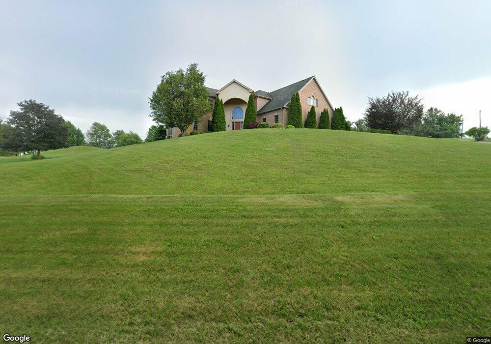
750 Rydell Dr Dallastown, PA 17313
Estimated Value: $592,000 - $739,475
4
Beds
3
Baths
4,495
Sq Ft
$147/Sq Ft
Est. Value
About This Home
This home is located at 750 Rydell Dr, Dallastown, PA 17313 and is currently estimated at $662,869, approximately $147 per square foot. 750 Rydell Dr is a home located in York County with nearby schools including Dallastown Elementary School, Dallastown Area Middle School, and Dallastown Area High School.
Ownership History
Date
Name
Owned For
Owner Type
Purchase Details
Closed on
Apr 12, 2001
Sold by
Seitz Scott A
Bought by
Seitz Scott A and Seitz Jennifer E
Current Estimated Value
Home Financials for this Owner
Home Financials are based on the most recent Mortgage that was taken out on this home.
Original Mortgage
$252,262
Interest Rate
6.97%
Create a Home Valuation Report for This Property
The Home Valuation Report is an in-depth analysis detailing your home's value as well as a comparison with similar homes in the area
Home Values in the Area
Average Home Value in this Area
Purchase History
| Date | Buyer | Sale Price | Title Company |
|---|---|---|---|
| Seitz Scott A | -- | -- |
Source: Public Records
Mortgage History
| Date | Status | Borrower | Loan Amount |
|---|---|---|---|
| Closed | Seitz Scott A | $252,262 |
Source: Public Records
Tax History Compared to Growth
Tax History
| Year | Tax Paid | Tax Assessment Tax Assessment Total Assessment is a certain percentage of the fair market value that is determined by local assessors to be the total taxable value of land and additions on the property. | Land | Improvement |
|---|---|---|---|---|
| 2025 | $13,200 | $384,550 | $80,630 | $303,920 |
| 2024 | $13,008 | $384,550 | $80,630 | $303,920 |
| 2023 | $13,008 | $384,550 | $80,630 | $303,920 |
| 2022 | $12,582 | $384,550 | $80,630 | $303,920 |
| 2021 | $11,986 | $384,550 | $80,630 | $303,920 |
| 2020 | $11,986 | $384,550 | $80,630 | $303,920 |
| 2019 | $11,948 | $384,550 | $80,630 | $303,920 |
| 2018 | $11,867 | $384,550 | $80,630 | $303,920 |
| 2017 | $11,394 | $384,550 | $80,630 | $303,920 |
| 2016 | $0 | $384,550 | $80,630 | $303,920 |
| 2015 | -- | $384,550 | $80,630 | $303,920 |
| 2014 | -- | $384,550 | $80,630 | $303,920 |
Source: Public Records
Map
Nearby Homes
- 260 Country Ridge Dr
- 156 Country Ridge Dr
- 126 Country Ridge Dr
- 131 Country Ridge Dr
- 600 S Duke St
- 840 Country Club Rd
- 64 S Pleasant Ave
- 420 Greenway Dr
- 786 Arbor Dr
- 126 Linden Ave
- 400 Carriage Ln Unit 400
- 338 Atlantic Ave
- 136 Teila Dr
- 503 W Broadway
- 321 Atlantic Ave
- 357 Country Club Rd Unit 26
- 137 Furlong Way
- 197 S Main St
- 424 Dartha Dr
- 300 N Franklin St
- 755 Rydell Dr
- 720 Rydell Dr
- 725 Mockingbird Dr
- 790 Rydell Dr
- 745 Mockingbird Dr
- 705 Rydell Dr
- 755 Mockingbird Dr
- 705 Mockingbird Dr
- 435 S Park St
- 445 S Park St
- 700 Rydell Dr
- 503 S Park St
- 720 Mockingbird Dr
- 425 S Park St
- 709 Sherry Dawn Dr
- 485 S Park St
- 14 Sherry Dawn Dr
- 13 Sherry Dawn Dr
- 375 S Park St
- 13 & 14 Sherry Dawn Dr