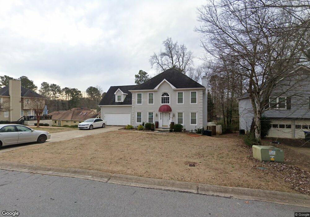
750 Simmons Mine Cir Sugar Hill, GA 30518
Estimated Value: $374,000 - $397,497
4
Beds
3
Baths
1,882
Sq Ft
$205/Sq Ft
Est. Value
About This Home
This home is located at 750 Simmons Mine Cir, Sugar Hill, GA 30518 and is currently estimated at $386,124, approximately $205 per square foot. 750 Simmons Mine Cir is a home located in Gwinnett County with nearby schools including Sugar Hill Elementary School, Lanier Middle School, and Lanier High School.
Ownership History
Date
Name
Owned For
Owner Type
Purchase Details
Closed on
Oct 27, 2006
Sold by
Secretary Of Hud
Bought by
Ketkeo Viengxay Rick K and Ketkeo Viengxay
Current Estimated Value
Home Financials for this Owner
Home Financials are based on the most recent Mortgage that was taken out on this home.
Original Mortgage
$139,750
Outstanding Balance
$11,906
Interest Rate
6.31%
Mortgage Type
New Conventional
Estimated Equity
$374,218
Purchase Details
Closed on
Jun 7, 2005
Sold by
Washington Mutual Bk Fa
Bought by
Secretary Of Hud
Purchase Details
Closed on
Oct 12, 2001
Sold by
Bailey Steven C and Bailey Lenora M
Bought by
Taylor Alvin
Home Financials for this Owner
Home Financials are based on the most recent Mortgage that was taken out on this home.
Original Mortgage
$154,771
Interest Rate
6.74%
Mortgage Type
FHA
Create a Home Valuation Report for This Property
The Home Valuation Report is an in-depth analysis detailing your home's value as well as a comparison with similar homes in the area
Home Values in the Area
Average Home Value in this Area
Purchase History
| Date | Buyer | Sale Price | Title Company |
|---|---|---|---|
| Ketkeo Viengxay Rick K | $147,150 | -- | |
| Secretary Of Hud | -- | -- | |
| Washington Mutual Bk Fa | $193,655 | -- | |
| Taylor Alvin | $157,200 | -- |
Source: Public Records
Mortgage History
| Date | Status | Borrower | Loan Amount |
|---|---|---|---|
| Open | Ketkeo Viengxay Rick K | $139,750 | |
| Previous Owner | Taylor Alvin | $154,771 |
Source: Public Records
Tax History Compared to Growth
Tax History
| Year | Tax Paid | Tax Assessment Tax Assessment Total Assessment is a certain percentage of the fair market value that is determined by local assessors to be the total taxable value of land and additions on the property. | Land | Improvement |
|---|---|---|---|---|
| 2025 | $508 | $154,960 | $34,000 | $120,960 |
| 2024 | $3,703 | $151,880 | $28,000 | $123,880 |
| 2023 | $3,703 | $142,360 | $28,000 | $114,360 |
| 2022 | $3,273 | $130,320 | $22,000 | $108,320 |
| 2021 | $2,660 | $97,440 | $16,000 | $81,440 |
| 2020 | $3,083 | $97,440 | $16,000 | $81,440 |
| 2019 | $2,753 | $86,960 | $16,000 | $70,960 |
| 2018 | $2,565 | $79,080 | $12,000 | $67,080 |
| 2016 | $2,242 | $66,360 | $12,000 | $54,360 |
| 2015 | $1,972 | $55,240 | $7,600 | $47,640 |
| 2014 | $1,982 | $55,240 | $7,600 | $47,640 |
Source: Public Records
Map
Nearby Homes
- 4867 Hunters Grove Way
- 4679 Gold Dust Trail Unit 1
- 512 Level Creek Rd
- 5000 Sugar Creek Dr
- 0 (4989 ?) Hidden Branch Dr
- 5028 Hidden Branch Dr
- 5008/4998 Hidden Branch Dr
- 5008 Hidden Branch Dr
- 504 Level Creek Rd
- 502 Level Creek Rd
- 614 Hickory Nobb
- Schubert Plan at Park Ridge at Sugar Hill
- Mendelssohn Plan at Park Ridge at Sugar Hill
- 5445 Maltdie Ct
- 5059 Hidden Branch Dr
- 5156 Allison Way
- 5152 Park Vale Dr
- 4920 Markim Forest Ln
- 5109 Dogwood Hills Dr
- 434 Level Creek Rd
- 760 Simmons Mine Cir
- 760 Simmons Mine Cir
- 680 Simmons Mine Cir Unit 2
- 700 Simmons Mine Cir
- 4853 Gold Nugget Way Unit 2
- 660 Simmons Mine Cir
- 770 Simmons Mine Cir
- 660 Simmons Mine Cir 0
- 660 Simmons Mine Circle 0
- 751 Simmons Mine Cir
- 4863 Gold Nugget Way
- 0 Simmons Mine Cir 0
- 761 Simmons Mine Cir
- 650 Simmons Mine Cir Unit 2
- 741 Simmons Mine Cir
- 731 Simmons Mine Cir
- 4951 Gold Mine Dr Unit 2
- 640 Simmons Mine Cir
- 781 Simmons Mine Cir
- 0 Simmons Mine Cir Unit 8433853