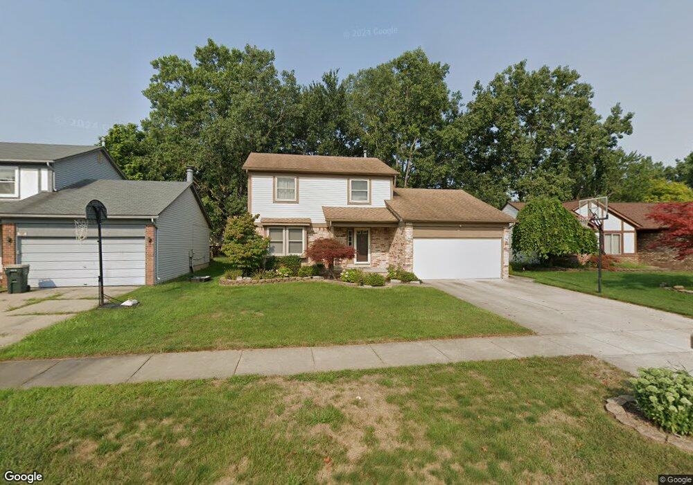
750 Sutten Dr Canton, MI 48188
Estimated Value: $365,239 - $432,000
3
Beds
3
Baths
1,616
Sq Ft
$247/Sq Ft
Est. Value
About This Home
This home is located at 750 Sutten Dr, Canton, MI 48188 and is currently estimated at $399,810, approximately $247 per square foot. 750 Sutten Dr is a home located in Wayne County with nearby schools including Canton High School, Salem High School, and Plymouth High School.
Ownership History
Date
Name
Owned For
Owner Type
Purchase Details
Closed on
Jun 10, 2010
Sold by
Wunderlich Rick E and Wunderlich Christine E
Bought by
Kopp Kenneth M
Current Estimated Value
Purchase Details
Closed on
Oct 21, 1994
Sold by
Mikulski Michael W
Bought by
Raymer Scott D and Raymer Lori
Home Financials for this Owner
Home Financials are based on the most recent Mortgage that was taken out on this home.
Original Mortgage
$127,300
Interest Rate
6%
Mortgage Type
New Conventional
Create a Home Valuation Report for This Property
The Home Valuation Report is an in-depth analysis detailing your home's value as well as a comparison with similar homes in the area
Home Values in the Area
Average Home Value in this Area
Purchase History
| Date | Buyer | Sale Price | Title Company |
|---|---|---|---|
| Kopp Kenneth M | $163,000 | Title Direct Agency Llc | |
| Raymer Scott D | $134,000 | -- |
Source: Public Records
Mortgage History
| Date | Status | Borrower | Loan Amount |
|---|---|---|---|
| Previous Owner | Raymer Scott D | $127,300 |
Source: Public Records
Tax History Compared to Growth
Tax History
| Year | Tax Paid | Tax Assessment Tax Assessment Total Assessment is a certain percentage of the fair market value that is determined by local assessors to be the total taxable value of land and additions on the property. | Land | Improvement |
|---|---|---|---|---|
| 2025 | $1,725 | $178,700 | $0 | $0 |
| 2024 | $1,725 | $155,800 | $0 | $0 |
| 2023 | $1,645 | $148,900 | $0 | $0 |
| 2022 | $1,567 | $128,800 | $0 | $0 |
| 2021 | $2,011 | $124,700 | $0 | $0 |
| 2020 | $3,485 | $117,800 | $0 | $0 |
| 2019 | $3,423 | $115,080 | $0 | $0 |
| 2018 | $1,398 | $111,790 | $0 | $0 |
| 2017 | $3,521 | $109,300 | $0 | $0 |
| 2016 | $3,115 | $110,500 | $0 | $0 |
| 2015 | $7,682 | $96,390 | $0 | $0 |
| 2013 | $7,442 | $77,610 | $0 | $0 |
| 2010 | -- | $85,470 | $36,765 | $48,705 |
Source: Public Records
Map
Nearby Homes
- 41567 SiMcOe Dr
- 41191 Southwind Dr
- 42437 Majestic Ct
- 41109 Southwind Dr
- 42272 Beechwood Ct
- 42384 Beechwood Ct
- 678 Kings Way
- 41878 Ravenwood St
- 41928 Old Bridge Rd
- 572 Shana St
- 41481 Cumberland Dr
- 41441 Cumberland Dr
- 42075 Gloria Dr
- 631 Tyler Ln
- 1693 Woodbridge Ct
- 829 Glenulline Dr
- 550 Concord Dr Unit 75
- 42473 Lilley Pointe Dr Unit 39
- 42481 Lilley Pointe Dr Unit 33
- 42540 Lilley Pointe Dr
- 740 Sutten Dr
- 760 Sutten Dr
- 757 Sorel Dr
- 730 Sutten Dr
- 747 Sorel Dr
- 767 Sorel Dr
- 737 Sorel Dr
- 41546 SiMcOe Dr
- 720 Sutten Dr
- 771 Stonehenge Dr
- 727 Sorel Dr
- 41579 SiMcOe Dr
- 41532 SiMcOe Dr
- 41591 SiMcOe Dr
- 710 Sutten Dr
- 763 Stonehenge Dr
- 41555 SiMcOe Dr Unit Bldg-Unit
- 41555 SiMcOe Dr
- 715 Sorel Dr
- 41599 SiMcOe Dr