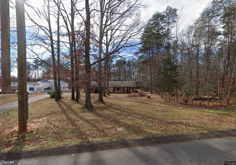
7500 Gold Dale Rd Locust Grove, VA 22508
Estimated Value: $370,460 - $424,000
3
Beds
2
Baths
1,967
Sq Ft
$201/Sq Ft
Est. Value
About This Home
This home is located at 7500 Gold Dale Rd, Locust Grove, VA 22508 and is currently estimated at $395,365, approximately $200 per square foot. 7500 Gold Dale Rd is a home located in Orange County with nearby schools including Locust Grove Elementary School, Locust Grove Primary School, and Locust Grove Middle School.
Ownership History
Date
Name
Owned For
Owner Type
Purchase Details
Closed on
May 27, 2005
Sold by
Wyskoczka William
Bought by
Bell Karen
Current Estimated Value
Home Financials for this Owner
Home Financials are based on the most recent Mortgage that was taken out on this home.
Original Mortgage
$266,611
Outstanding Balance
$139,009
Interest Rate
5.94%
Mortgage Type
New Conventional
Estimated Equity
$256,356
Create a Home Valuation Report for This Property
The Home Valuation Report is an in-depth analysis detailing your home's value as well as a comparison with similar homes in the area
Home Values in the Area
Average Home Value in this Area
Purchase History
| Date | Buyer | Sale Price | Title Company |
|---|---|---|---|
| Bell Karen | $261,000 | Heeritage Title & Settlement |
Source: Public Records
Mortgage History
| Date | Status | Borrower | Loan Amount |
|---|---|---|---|
| Open | Bell Karen | $266,611 |
Source: Public Records
Tax History Compared to Growth
Tax History
| Year | Tax Paid | Tax Assessment Tax Assessment Total Assessment is a certain percentage of the fair market value that is determined by local assessors to be the total taxable value of land and additions on the property. | Land | Improvement |
|---|---|---|---|---|
| 2025 | $1,909 | $251,600 | $50,100 | $201,500 |
| 2024 | $1,909 | $251,600 | $50,100 | $201,500 |
| 2023 | $1,909 | $251,600 | $50,100 | $201,500 |
| 2022 | $1,909 | $251,600 | $50,100 | $201,500 |
| 2021 | $1,832 | $254,500 | $50,100 | $204,400 |
| 2020 | $1,832 | $254,500 | $50,100 | $204,400 |
| 2019 | $1,549 | $192,700 | $45,100 | $147,600 |
| 2018 | $1,549 | $192,700 | $45,100 | $147,600 |
| 2017 | $1,549 | $192,700 | $45,100 | $147,600 |
| 2016 | $1,549 | $192,700 | $45,100 | $147,600 |
| 2015 | $1,508 | $209,400 | $66,100 | $143,300 |
| 2014 | $1,508 | $209,400 | $66,100 | $143,300 |
Source: Public Records
Map
Nearby Homes
- 0 Constitution Hwy Unit VAOR2012262
- 32314 Deep Meadow Ln
- 32236 Deep Meadow Ln
- 0 Zoar Rd Unit VAOR2010406
- 0 Zoar Rd
- 0 Zoar Rd Unit VAOR2010396
- 0 Zoar Rd Unit VAOR2010404
- 104 Butler Cir
- 111 Butler Cir
- 112 Butler Cir
- 109 Aspen Ct
- 31078 Old Office Rd
- 13037 Orange Plank Rd
- 203 Battlefield Rd
- 537 Monticello Cir
- 31380 Paynes Farm Dr
- 108 Confederate Cir
- 518 Monticello Cir
- 2600 Lakeview Pkwy
- 118 Confederate Cir
- 7518 Gold Dale Rd
- 7491 Gold Dale Rd
- 7485 Gold Dale Rd
- 7472 Gold Dale Rd
- 32422 White Oak Dr
- 32420 White Oak Dr
- 7456 Gold Dale Rd
- 32393 White Oak Dr
- 7537 Gold Dale Rd
- 8032 Meadowland Dr
- 7555 Gold Dale Rd
- 7426 Gold Dale Rd
- 8065 Meadowland Dr
- 8045 Meadowland Dr
- 32459 Jacob Ln
- 7417 Gold Dale Rd
- 7581 Gold Dale Rd
- 8039 Meadowland Dr
- 8089 Meadowland Dr
- 32502 Jacob Ln