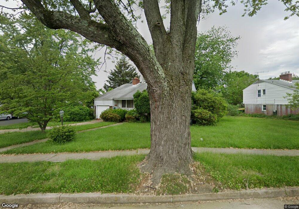
7500 Lisburne Rd Pikesville, MD 21208
Estimated Value: $539,000 - $577,000
--
Bed
3
Baths
2,177
Sq Ft
$256/Sq Ft
Est. Value
About This Home
This home is located at 7500 Lisburne Rd, Pikesville, MD 21208 and is currently estimated at $557,161, approximately $255 per square foot. 7500 Lisburne Rd is a home located in Baltimore County with nearby schools including Wellwood International Elementary, Pikesville Middle School, and Pikesville High School.
Ownership History
Date
Name
Owned For
Owner Type
Purchase Details
Closed on
Sep 24, 2022
Sold by
Andrew Segal
Bought by
Segal Andrew H
Current Estimated Value
Home Financials for this Owner
Home Financials are based on the most recent Mortgage that was taken out on this home.
Original Mortgage
$361,600
Outstanding Balance
$341,446
Interest Rate
3.92%
Mortgage Type
New Conventional
Estimated Equity
$215,715
Purchase Details
Closed on
Nov 4, 1970
Sold by
Zeskind Morris W
Bought by
Segal Robert E and Segal Lynda D
Create a Home Valuation Report for This Property
The Home Valuation Report is an in-depth analysis detailing your home's value as well as a comparison with similar homes in the area
Home Values in the Area
Average Home Value in this Area
Purchase History
| Date | Buyer | Sale Price | Title Company |
|---|---|---|---|
| Segal Andrew H | -- | -- | |
| Segal Robert E | $29,000 | -- |
Source: Public Records
Mortgage History
| Date | Status | Borrower | Loan Amount |
|---|---|---|---|
| Open | Segal Andrew H | $361,600 |
Source: Public Records
Tax History Compared to Growth
Tax History
| Year | Tax Paid | Tax Assessment Tax Assessment Total Assessment is a certain percentage of the fair market value that is determined by local assessors to be the total taxable value of land and additions on the property. | Land | Improvement |
|---|---|---|---|---|
| 2025 | $5,023 | $434,900 | $96,800 | $338,100 |
| 2024 | $5,023 | $386,533 | $0 | $0 |
| 2023 | $2,402 | $338,167 | $0 | $0 |
| 2022 | $3,507 | $289,800 | $84,200 | $205,600 |
| 2021 | $4,425 | $289,800 | $84,200 | $205,600 |
| 2020 | $4,425 | $289,800 | $84,200 | $205,600 |
| 2019 | $4,346 | $304,100 | $84,200 | $219,900 |
| 2018 | $4,118 | $299,933 | $0 | $0 |
| 2017 | $3,507 | $295,767 | $0 | $0 |
| 2016 | $2,853 | $291,600 | $0 | $0 |
| 2015 | $2,853 | $291,600 | $0 | $0 |
| 2014 | $2,853 | $291,600 | $0 | $0 |
Source: Public Records
Map
Nearby Homes
- 3211 Hatton Rd
- 3213 Hatton Rd
- 3221 Shelburne Rd
- 3302 Northbrook Rd
- 2906 Oakton Ct
- 7612 Carla Rd
- 3306 Labyrinth Rd
- 7618 Carla Rd
- 3206 Clarks Ln
- 3313 Claran Rd
- 3312 Bonnie Rd
- 2907 Lightfoot Dr
- 6808 Timberlane Rd
- 3031 Fallstaff Rd Unit 605C
- 7035 Wallis Ave
- 3000 Stone Cliff Dr Unit 307
- 3000 Stone Cliff Dr Unit 205
- 7111 Park Heights Ave Unit 103
- 7111 Park Heights Ave Unit 305
- 3207 Midfield Rd
- 7502 Lisburne Rd
- 3102 Northbrook Rd
- 7504 Lisburne Rd
- 3103 Northbrook Rd
- 3101 Northbrook Rd
- 3104 Northbrook Rd
- 3105 Northbrook Rd
- 3009 Northbrook Rd
- 3103 Hatton Rd
- 7506 Lisburne Rd
- 3107 Northbrook Rd
- 3007 Northbrook Rd
- 3106 Northbrook Rd
- 3105 Hatton Rd
- 3100 Marnat Rd
- 3102 Marnat Rd
- 3028 Marnat Rd
- 3005 Northbrook Rd
- 3104 Marnat Rd
- 3107 Hatton Rd