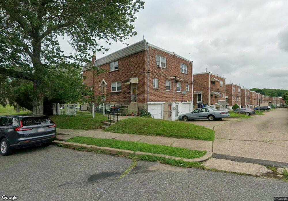
7501 Brous Ave Philadelphia, PA 19152
Mayfair NeighborhoodEstimated Value: $364,193 - $400,000
4
Beds
1
Bath
1,518
Sq Ft
$255/Sq Ft
Est. Value
About This Home
This home is located at 7501 Brous Ave, Philadelphia, PA 19152 and is currently estimated at $386,798, approximately $254 per square foot. 7501 Brous Ave is a home with nearby schools including Lincoln High School, Northeast Community Propel Academy, and St. Matthew School.
Ownership History
Date
Name
Owned For
Owner Type
Purchase Details
Closed on
Feb 2, 2022
Sold by
Rednor Shirley B
Bought by
Rednor Ronald Philip
Current Estimated Value
Purchase Details
Closed on
Jan 5, 2022
Sold by
Rednor Shirley B
Bought by
Rednor Ronald Philip
Purchase Details
Closed on
Nov 8, 2021
Sold by
Rednor Shirley B
Bought by
Rednor Ronald Philip
Purchase Details
Closed on
Nov 29, 1951
Bought by
Rednor Albert L and Rednor Shirley B
Create a Home Valuation Report for This Property
The Home Valuation Report is an in-depth analysis detailing your home's value as well as a comparison with similar homes in the area
Home Values in the Area
Average Home Value in this Area
Purchase History
| Date | Buyer | Sale Price | Title Company |
|---|---|---|---|
| Rednor Ronald Philip | $275,739 | Freedman Gary B | |
| Rednor Ronald Philip | -- | Freedman Gary B | |
| Rednor Ronald Philip | $275,739 | Freedman Gary B | |
| Rednor Albert L | $15,700 | -- |
Source: Public Records
Tax History Compared to Growth
Tax History
| Year | Tax Paid | Tax Assessment Tax Assessment Total Assessment is a certain percentage of the fair market value that is determined by local assessors to be the total taxable value of land and additions on the property. | Land | Improvement |
|---|---|---|---|---|
| 2025 | $4,454 | $397,900 | $79,580 | $318,320 |
| 2024 | $4,454 | $397,900 | $79,580 | $318,320 |
| 2023 | $4,454 | $318,200 | $63,640 | $254,560 |
| 2022 | $2,977 | $273,200 | $63,640 | $209,560 |
| 2021 | $3,607 | $0 | $0 | $0 |
| 2020 | $3,607 | $0 | $0 | $0 |
| 2019 | $3,284 | $0 | $0 | $0 |
| 2018 | $2,556 | $0 | $0 | $0 |
| 2017 | $2,556 | $0 | $0 | $0 |
| 2016 | $2,136 | $0 | $0 | $0 |
| 2015 | $17,842 | $0 | $0 | $0 |
| 2014 | -- | $182,600 | $54,281 | $128,319 |
| 2012 | -- | $24,128 | $6,185 | $17,943 |
Source: Public Records
Map
Nearby Homes
- 7416 Revere St
- 7418 Revere St
- 3036 Nesper St
- 3011 Teesdale St
- 3114 Nesper St
- 3034 Teesdale St
- 7233 Barnard Ave
- 3118 Cottman Ave
- 2547 Shelmire Ave
- 3219 Teesdale St
- 3222 Guilford St
- 3227 Cottman Ave
- 7521 Calvert St
- 7525 Calvert St
- 7703 Brous Ave
- 3243 Teesdale St
- 3136 Wellington St
- 7246 Calvert St
- 7249 Rupert St
- 7121 Brous Ave
- 7503 Brous Ave
- 7505 Brous Ave
- 7507 Brous Ave
- 7429 Brous Ave
- 7509 Brous Ave
- 7427 Brous Ave
- 7511 Brous Ave
- 7500 Battersby St
- 2910 Nesper St
- 7513 Brous Ave
- 2912 Nesper St
- 7425 Brous Ave
- 7502 Battersby St
- 7444 Brous Ave
- 7504 Battersby St
- 7423 Brous Ave
- 7432 Battersby St
- 7515 Brous Ave
- 7434 Brous Ave
- 7506 Battersby St