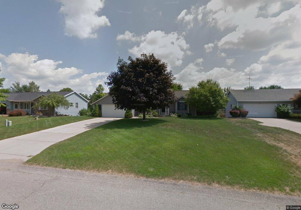
7502 Woodside Dr Hudsonville, MI 49426
Estimated Value: $353,762 - $380,000
2
Beds
2
Baths
1,208
Sq Ft
$307/Sq Ft
Est. Value
About This Home
This home is located at 7502 Woodside Dr, Hudsonville, MI 49426 and is currently estimated at $371,191, approximately $307 per square foot. 7502 Woodside Dr is a home located in Ottawa County with nearby schools including Bauer Elementary School, Baldwin Street Middle School, and Hudsonville Freshman Campus.
Ownership History
Date
Name
Owned For
Owner Type
Purchase Details
Closed on
May 8, 2020
Sold by
Anderson Isaac C and Anderson Lauren D
Bought by
Isaac & Lauren Anderson Trust
Current Estimated Value
Purchase Details
Closed on
Jun 14, 2019
Sold by
Smith Ronald G and Smith Pamela J
Bought by
Anderson Isaac and Anderson Lauren
Home Financials for this Owner
Home Financials are based on the most recent Mortgage that was taken out on this home.
Original Mortgage
$176,000
Outstanding Balance
$154,747
Interest Rate
4.1%
Mortgage Type
New Conventional
Estimated Equity
$216,444
Create a Home Valuation Report for This Property
The Home Valuation Report is an in-depth analysis detailing your home's value as well as a comparison with similar homes in the area
Home Values in the Area
Average Home Value in this Area
Purchase History
| Date | Buyer | Sale Price | Title Company |
|---|---|---|---|
| Isaac & Lauren Anderson Trust | -- | None Available | |
| Anderson Isaac | $220,000 | Chicago Title Of Mi Inc |
Source: Public Records
Mortgage History
| Date | Status | Borrower | Loan Amount |
|---|---|---|---|
| Open | Anderson Isaac | $176,000 |
Source: Public Records
Tax History Compared to Growth
Tax History
| Year | Tax Paid | Tax Assessment Tax Assessment Total Assessment is a certain percentage of the fair market value that is determined by local assessors to be the total taxable value of land and additions on the property. | Land | Improvement |
|---|---|---|---|---|
| 2025 | $2,913 | $138,100 | $0 | $0 |
| 2024 | $2,521 | $124,700 | $0 | $0 |
| 2023 | $2,407 | $114,200 | $0 | $0 |
| 2022 | $2,646 | $102,000 | $0 | $0 |
| 2021 | $2,570 | $96,900 | $0 | $0 |
| 2020 | $2,544 | $91,000 | $0 | $0 |
| 2019 | $1,957 | $85,500 | $0 | $0 |
| 2018 | $1,824 | $77,500 | $0 | $0 |
| 2017 | $1,791 | $76,600 | $0 | $0 |
| 2016 | $1,780 | $72,200 | $0 | $0 |
| 2015 | $1,699 | $70,500 | $0 | $0 |
| 2014 | $1,699 | $66,700 | $0 | $0 |
Source: Public Records
Map
Nearby Homes
- 4087 Baldwin St
- 0 Baldwin St
- 4663 Hidden Ridge Dr Unit lot 38
- 7114 Tory Dr
- 4672 Lexem Dr
- 7918 Westside Dr
- 4717 Lexem Dr Unit Lot 41
- 4699 Lexem Dr
- 6863 Bridgeport Dr
- 6950 Meadowcreek Dr
- 7068 Jasper Dr
- 3646 Lenters Dr
- 4106 Blair St
- 4372 Shady Oak Ct
- 3528 Tearose Dr
- 3546 Eagles Roost Trail Unit 3
- 4768 Bauer Rd
- 7954 Bald Eagle Pass Unit 130
- 7318 Alycia Dr
- 6584 Moss Lake Dr
- 7488 Woodside Dr
- 7516 Woodside Dr
- 7499 Pheasant Run Dr
- 7513 Pheasant Run Dr
- 7474 Woodside Dr
- 7528 Woodside Dr
- 7485 Pheasant Run Dr
- 4443 Sleepy Hollow Dr
- 7529 Pheasant Run Dr
- 7519 Woodside Dr
- 7460 Woodside Dr
- 7469 Pheasant Run Dr
- 7471 Woodside Dr
- 7538 Woodside Dr
- 7543 Pheasant Run Dr
- 4459 Sleepy Hollow Dr
- 7537 Woodside Dr
- 7446 Woodside Dr
- 7455 Pheasant Run Dr
- 7500 Pheasant Run Dr