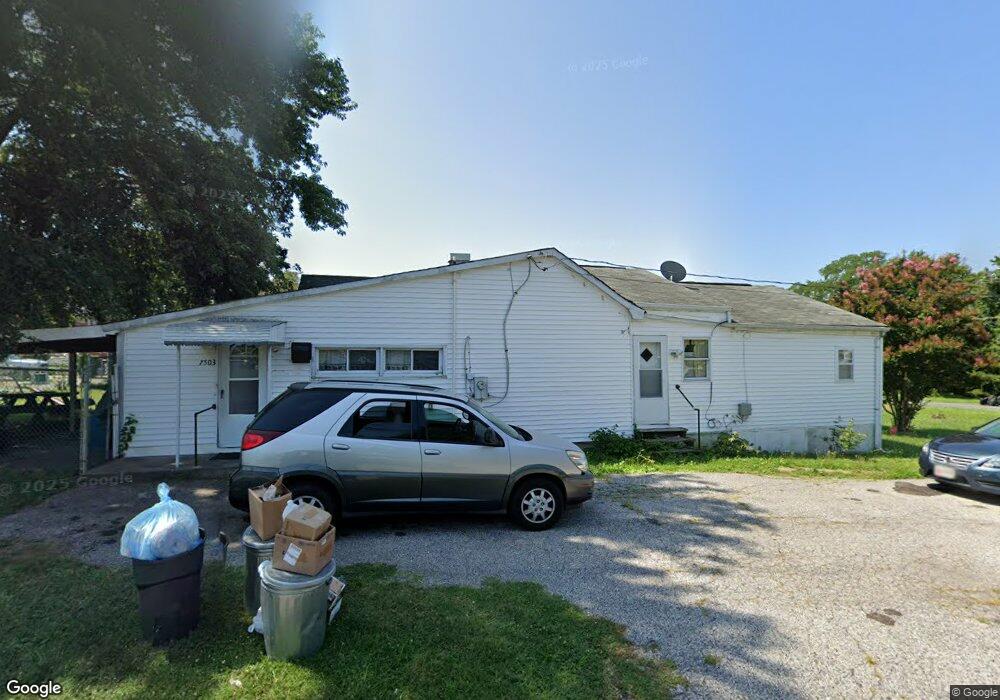
7503 Battle Grove Cir Baltimore, MD 21222
Estimated Value: $215,000 - $387,000
--
Bed
1
Bath
1,349
Sq Ft
$213/Sq Ft
Est. Value
About This Home
This home is located at 7503 Battle Grove Cir, Baltimore, MD 21222 and is currently estimated at $287,172, approximately $212 per square foot. 7503 Battle Grove Cir is a home located in Baltimore County with nearby schools including Battle Grove Elementary, Sparrows Point Middle School, and Sparrows Point High School.
Ownership History
Date
Name
Owned For
Owner Type
Purchase Details
Closed on
Sep 28, 2021
Sold by
Davis Brian E and Wilson Sharon
Bought by
Marston Michael W B and Marston Katherine B
Current Estimated Value
Home Financials for this Owner
Home Financials are based on the most recent Mortgage that was taken out on this home.
Original Mortgage
$176,641
Outstanding Balance
$161,267
Interest Rate
2.88%
Mortgage Type
FHA
Estimated Equity
$125,905
Purchase Details
Closed on
Jun 4, 2007
Sold by
Dusich Ada M
Bought by
Davis Christene
Purchase Details
Closed on
Apr 17, 2007
Sold by
Dusich Ada M
Bought by
Davis Christene
Purchase Details
Closed on
Sep 23, 1959
Sold by
Nelson Concrete Stone Co
Bought by
Dusich Paul
Create a Home Valuation Report for This Property
The Home Valuation Report is an in-depth analysis detailing your home's value as well as a comparison with similar homes in the area
Home Values in the Area
Average Home Value in this Area
Purchase History
| Date | Buyer | Sale Price | Title Company |
|---|---|---|---|
| Marston Michael W B | $179,900 | R & P Settlement Group Llc | |
| Davis Christene | -- | -- | |
| Davis Christene | -- | -- | |
| Dusich Paul | $2,500 | -- |
Source: Public Records
Mortgage History
| Date | Status | Borrower | Loan Amount |
|---|---|---|---|
| Open | Marston Michael W B | $176,641 | |
| Closed | Marston Michael W B | $176,641 |
Source: Public Records
Tax History Compared to Growth
Tax History
| Year | Tax Paid | Tax Assessment Tax Assessment Total Assessment is a certain percentage of the fair market value that is determined by local assessors to be the total taxable value of land and additions on the property. | Land | Improvement |
|---|---|---|---|---|
| 2025 | $2,565 | $152,800 | -- | -- |
| 2024 | $2,565 | $140,500 | $0 | $0 |
| 2023 | $1,212 | $128,200 | $74,900 | $53,300 |
| 2022 | $2,168 | $124,933 | $0 | $0 |
| 2021 | $4,057 | $121,667 | $0 | $0 |
| 2020 | $1,435 | $118,400 | $74,900 | $43,500 |
| 2019 | $1,435 | $118,400 | $74,900 | $43,500 |
| 2018 | $1,435 | $118,400 | $74,900 | $43,500 |
| 2017 | $1,889 | $118,400 | $0 | $0 |
| 2016 | -- | $118,400 | $0 | $0 |
| 2015 | $557 | $118,400 | $0 | $0 |
| 2014 | $557 | $119,200 | $0 | $0 |
Source: Public Records
Map
Nearby Homes
- 7431 Saint Patricia Ct
- 4015 Saint Augustine Ln
- 8216 Beach Dr
- 7842 Saint Boniface Ln
- 1605 Evergreen Dr
- 7849 Saint Claire Ln
- 7817 Saint Claire Ln
- 7706 Village Park Dr
- 8325 Bear Creek Dr
- 7607 Town View Dr
- 7723 Town View Dr
- 7865 Saint Bridget Ln
- 7656 Old Battle Grove Rd
- 7808 Deboy Ave
- 1704 Melbourne Rd
- 4 Bayside Dr
- 1711 Woodland Dr
- 5 Seabright Ave
- 4 Midway Ave
- 8169 Park Haven Rd
- 7503 Old Battle Grove Rd
- 7501 Old Battle Grove Rd
- 7428 Saint Patricia Ct
- 7426 Saint Patricia Ct
- 7507 Old Battle Grove Rd
- 7424 Saint Patricia Ct
- 7422 Saint Patricia Ct
- 7420 Saint Patricia Ct
- 7502 Old Battle Grove Rd
- 7800 Saint Patricia Ln
- 7418 Saint Patricia Ct
- 7416 Saint Patricia Ct
- 7414 Saint Patricia Ct
- 7802 Saint Patricia Ln
- 7412 Saint Patricia Ct
- 7804 Saint Patricia Ln
- 7410 Saint Patricia Ct
- 7806 Saint Patricia Ln
- 7408 Saint Patricia Ct
- 7511 Old Battle Grove Rd