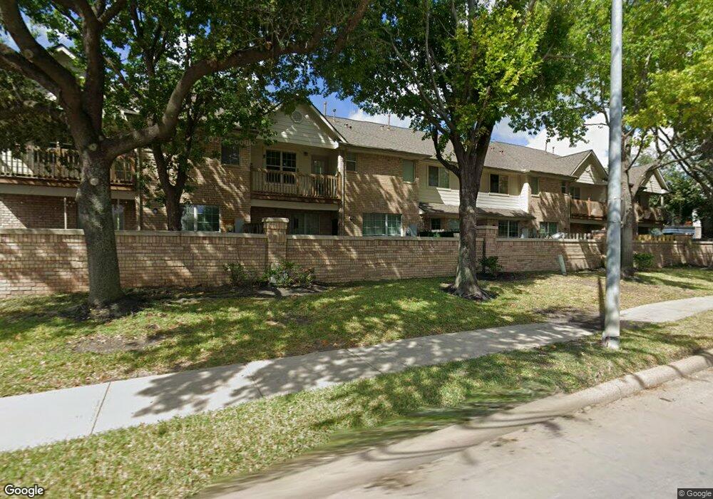
7506 N Linpar Ct Houston, TX 77040
Fairbanks-Northwest Crossing NeighborhoodEstimated Value: $262,000 - $273,000
3
Beds
3
Baths
2,263
Sq Ft
$118/Sq Ft
Est. Value
About This Home
This home is located at 7506 N Linpar Ct, Houston, TX 77040 and is currently estimated at $267,664, approximately $118 per square foot. 7506 N Linpar Ct is a home located in Harris County with nearby schools including Holbrook Elementary School, Dean Middle School, and Cypress Ridge High School.
Ownership History
Date
Name
Owned For
Owner Type
Purchase Details
Closed on
Apr 11, 2014
Sold by
Browne Susan F
Bought by
Holt James A and Holt Michele T
Current Estimated Value
Home Financials for this Owner
Home Financials are based on the most recent Mortgage that was taken out on this home.
Original Mortgage
$166,012
Outstanding Balance
$126,532
Interest Rate
4.41%
Mortgage Type
New Conventional
Estimated Equity
$141,132
Purchase Details
Closed on
Feb 24, 2011
Sold by
Sicola Tom S and Sicola Laurita
Bought by
Browne Peter J
Home Financials for this Owner
Home Financials are based on the most recent Mortgage that was taken out on this home.
Original Mortgage
$115,000
Interest Rate
4.7%
Mortgage Type
New Conventional
Purchase Details
Closed on
Jun 26, 2003
Sold by
Ballater Ltd
Bought by
Sicola Tom S and Sicola Laurita
Create a Home Valuation Report for This Property
The Home Valuation Report is an in-depth analysis detailing your home's value as well as a comparison with similar homes in the area
Home Values in the Area
Average Home Value in this Area
Purchase History
| Date | Buyer | Sale Price | Title Company |
|---|---|---|---|
| Holt James A | -- | Fort Bend Title Llc | |
| Browne Peter J | -- | Stewart Title Houston Div | |
| Sicola Tom S | -- | Alamo Title Company |
Source: Public Records
Mortgage History
| Date | Status | Borrower | Loan Amount |
|---|---|---|---|
| Open | Holt James A | $166,012 | |
| Previous Owner | Browne Peter J | $115,000 |
Source: Public Records
Tax History Compared to Growth
Tax History
| Year | Tax Paid | Tax Assessment Tax Assessment Total Assessment is a certain percentage of the fair market value that is determined by local assessors to be the total taxable value of land and additions on the property. | Land | Improvement |
|---|---|---|---|---|
| 2025 | $536 | $276,697 | $51,536 | $225,161 |
| 2024 | $536 | $276,697 | $51,536 | $225,161 |
| 2023 | $536 | $285,084 | $51,536 | $233,548 |
| 2022 | $6,015 | $255,353 | $36,812 | $218,541 |
| 2021 | $5,717 | $221,226 | $36,812 | $184,414 |
| 2020 | $5,597 | $210,225 | $32,899 | $177,326 |
| 2019 | $5,587 | $201,596 | $32,899 | $168,697 |
| 2018 | $2,070 | $210,931 | $32,899 | $178,032 |
| 2017 | $5,842 | $210,931 | $32,899 | $178,032 |
| 2016 | $5,426 | $195,940 | $27,415 | $168,525 |
| 2015 | $1,570 | $187,066 | $27,415 | $159,651 |
| 2014 | $1,570 | $164,891 | $22,846 | $142,045 |
Source: Public Records
Map
Nearby Homes
- 6406 E Linpar Ct
- 7438 Hollister Spring
- 7414 Hollister Spring
- 6310 Wilshire Fern
- 7120 Cole Creek Dr
- 7115 Drowsy Pine Dr
- 5814 Langfield Rd Unit 5814
- 6011 Knotty Wood Dr
- 5834 Shurmard Dr
- 5822 Shurmard Dr
- 6946 Cole Creek Dr
- 6926 Pine Grove Dr
- 6918 Pine Grove Dr
- 5703 Pampero Ln
- 8020 Oakwood Forest Dr
- 5710 Pampero Ln
- 8007 E Oakwood Ct
- 6809 Troya Ln
- 8615 Black Tern Ln
- 7259 Shady Arbor Ln
- 7510 N Linpar Ct
- 7514 N Linpar Ct
- 7518 N Linpar Ct
- 6450 E Linpar Ct
- 6446 E Linpar Ct
- 7507 N Linpar Ct
- 7503 N Linpar Ct
- 6442 E Linpar Ct
- 7522 N Linpar Ct
- 7511 N Linpar Ct
- 7515 N Linpar Ct
- 6438 E Linpar Ct
- 7519 N Linpar Ct
- 7526 N Linpar Ct
- 6434 E Linpar Ct
- 7523 N Linpar Ct
- 7530 N Linpar Ct
- 7527 N Linpar Ct
- 7534 N Linpar Ct
- 7531 N Linpar Ct