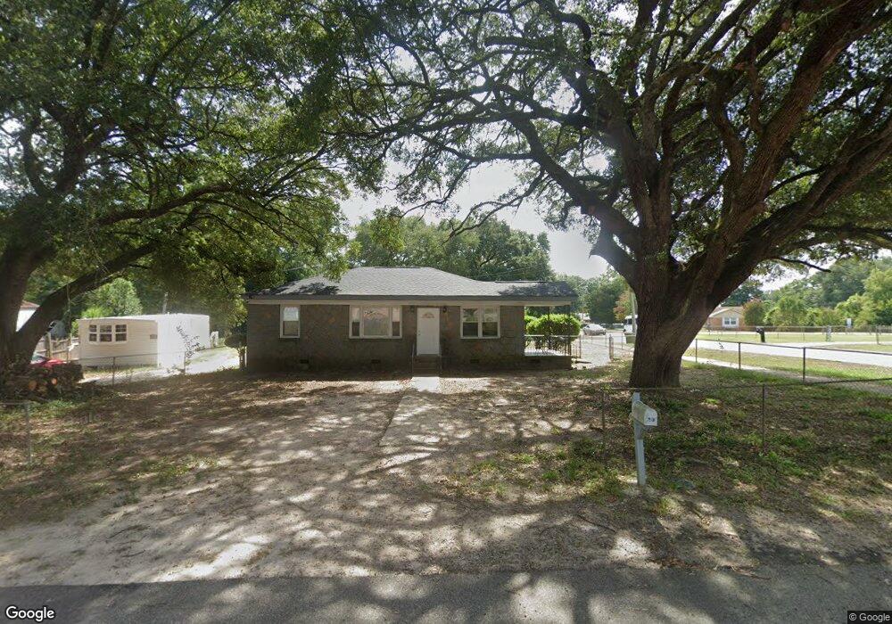
7508 Tyson St Columbia, SC 29209
Southeast Columbia NeighborhoodEstimated Value: $147,000 - $248,000
3
Beds
2
Baths
2,500
Sq Ft
$71/Sq Ft
Est. Value
About This Home
This home is located at 7508 Tyson St, Columbia, SC 29209 and is currently estimated at $178,380, approximately $71 per square foot. 7508 Tyson St is a home located in Richland County with nearby schools including Mill Creek Elementary School, Hopkins Middle School, and Lower Richland High School.
Ownership History
Date
Name
Owned For
Owner Type
Purchase Details
Closed on
Mar 25, 2021
Sold by
Mooney Altana E and Mooney Robert P
Bought by
Montoya Carlos Laneth Rivera and Alvarenga Lizbeth Izaquirre
Current Estimated Value
Purchase Details
Closed on
Feb 14, 2017
Sold by
Mooney Robert Patrick and Mooney Artana
Bought by
Mooney Robert Patrick and Mooney Artana Cassidy
Purchase Details
Closed on
Aug 31, 2005
Sold by
White Cindy and White Cindy C
Bought by
Mooney Robert Patrick and Mooney Artana
Home Financials for this Owner
Home Financials are based on the most recent Mortgage that was taken out on this home.
Original Mortgage
$75,000
Interest Rate
5.64%
Mortgage Type
Fannie Mae Freddie Mac
Purchase Details
Closed on
Feb 6, 2004
Sold by
Nix William Boyd and Lyons Michelle Marie
Bought by
White Cindy
Create a Home Valuation Report for This Property
The Home Valuation Report is an in-depth analysis detailing your home's value as well as a comparison with similar homes in the area
Home Values in the Area
Average Home Value in this Area
Purchase History
| Date | Buyer | Sale Price | Title Company |
|---|---|---|---|
| Montoya Carlos Laneth Rivera | $94,000 | None Available | |
| Montoya Carlos Laneth River | $94,000 | None Listed On Document | |
| Mooney Robert Patrick | -- | None Available | |
| Mooney Robert Patrick | $75,000 | -- | |
| White Cindy | $61,000 | -- | |
| Nix Laura Elizabeth | -- | -- |
Source: Public Records
Mortgage History
| Date | Status | Borrower | Loan Amount |
|---|---|---|---|
| Previous Owner | Mooney Robert Patrick | $75,000 |
Source: Public Records
Tax History Compared to Growth
Tax History
| Year | Tax Paid | Tax Assessment Tax Assessment Total Assessment is a certain percentage of the fair market value that is determined by local assessors to be the total taxable value of land and additions on the property. | Land | Improvement |
|---|---|---|---|---|
| 2024 | $4,283 | $108,100 | $0 | $0 |
| 2023 | $4,283 | $3,760 | $0 | $0 |
| 2022 | $3,916 | $94,000 | $10,100 | $83,900 |
| 2021 | $3,387 | $4,660 | $0 | $0 |
| 2020 | $3,399 | $4,660 | $0 | $0 |
| 2019 | $3,260 | $4,660 | $0 | $0 |
| 2018 | $2,858 | $4,060 | $0 | $0 |
| 2017 | $2,321 | $2,980 | $0 | $0 |
| 2016 | $2,296 | $2,980 | $0 | $0 |
| 2015 | $2,276 | $2,980 | $0 | $0 |
| 2014 | $2,249 | $49,600 | $0 | $0 |
| 2013 | -- | $2,980 | $0 | $0 |
Source: Public Records
Map
Nearby Homes
- 7428 Fairmont Rd
- 155 Colonial Commons Ln
- 1527 Burnside Ave
- 349 Eastfair Dr
- 267 Blue Savannah St
- 263 Blue Savannah St
- 7600 Leitner Rd
- 115 Colonial Commons Ln
- 113 Colonial Commons Ln
- 7245 Venus Rd
- 106 Colonial Commons Ln
- 101 Colonial Commons Ln
- 2 Routhland Ct
- 175 Nestle Ct
- 7712 Burdell Dr
- 525 Eastfair Dr
- 7819 Charles Towne Dr
- 168 Ashewood Commons Dr
- 7229 Holloway Rd
- 1925 Beckley Dr
- 7512 Tyson St
- 1702 Hazelwood Rd
- 7507 Tyson St
- 7516 Tyson St
- 1630 Hazelwood Rd
- 1615 Hazelwood Rd
- 1603 Hazelwood Rd
- 1720 Hazelwood Rd
- 1623 Hazelwood Rd
- 7520 Tyson St
- 1622 Hazelwood Rd
- 7619 Patricia Dr
- 1604 Deborah Dr
- 1616 Deborah Dr
- 1631 Hazelwood Rd
- 1730 Hazelwood Rd
- 7522 Tyson St
- 1624 Deborah Dr
- 1612 Hazelwood Rd
- 7524 Tyson St