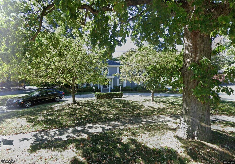
751 Covington Rd Bloomfield Hills, MI 48301
Estimated Value: $1,461,000 - $1,796,000
4
Beds
6
Baths
4,439
Sq Ft
$365/Sq Ft
Est. Value
About This Home
This home is located at 751 Covington Rd, Bloomfield Hills, MI 48301 and is currently estimated at $1,621,674, approximately $365 per square foot. 751 Covington Rd is a home located in Oakland County with nearby schools including Quarton Elementary, Derby Middle School, and Ernest W. Seaholm High School.
Ownership History
Date
Name
Owned For
Owner Type
Purchase Details
Closed on
May 22, 2015
Sold by
Anderson Paul R
Bought by
Anderson Paul R and Anderson Susan H
Current Estimated Value
Purchase Details
Closed on
Aug 26, 2013
Sold by
Anderson Mary R
Bought by
Anderson Paul R
Create a Home Valuation Report for This Property
The Home Valuation Report is an in-depth analysis detailing your home's value as well as a comparison with similar homes in the area
Home Values in the Area
Average Home Value in this Area
Purchase History
| Date | Buyer | Sale Price | Title Company |
|---|---|---|---|
| Anderson Paul R | -- | First American Title Ins Co | |
| Anderson Paul R | -- | None Available |
Source: Public Records
Tax History Compared to Growth
Tax History
| Year | Tax Paid | Tax Assessment Tax Assessment Total Assessment is a certain percentage of the fair market value that is determined by local assessors to be the total taxable value of land and additions on the property. | Land | Improvement |
|---|---|---|---|---|
| 2024 | $8,498 | $629,250 | $0 | $0 |
| 2023 | $8,155 | $552,320 | $0 | $0 |
| 2022 | $14,379 | $512,360 | $0 | $0 |
| 2021 | $14,498 | $508,600 | $0 | $0 |
| 2020 | $7,834 | $505,290 | $0 | $0 |
| 2019 | $14,454 | $500,000 | $0 | $0 |
| 2018 | $14,300 | $462,340 | $0 | $0 |
| 2017 | $14,300 | $437,620 | $0 | $0 |
| 2016 | $14,382 | $426,770 | $0 | $0 |
| 2015 | -- | $411,650 | $0 | $0 |
| 2014 | -- | $397,710 | $0 | $0 |
| 2011 | -- | $302,400 | $0 | $0 |
Source: Public Records
Map
Nearby Homes
- 2579 Amberly Rd
- 1019 N Cranbrook Rd
- 956 Westwood Dr
- 1882 Melbourne St
- 345 Kimberly St
- 1120 Lyonhurst St
- 1260 Lyonhurst St
- 1834 Fairview St
- 120 Westchester Way
- 100 Overhill Rd
- 397 S Cranbrook Rd
- 3320 Morningview Terrace
- 586 Fairfax St
- 394 S Glenhurst Dr
- 1348 Charrington Rd
- 421 S Williamsbury Rd
- 375 Dunston Rd
- 1287 Charrington Rd
- 270 Martell Dr
- 1056 Pilgrim Ave
- 2584 Amberly Rd
- 801 Covington Rd
- 2515 Amberly Rd
- 2535 Amberly Rd
- 2612 Amberly Rd
- 2601 Indian Mound S
- 841 Covington Rd
- 732 Covington Rd
- 800 Covington Rd
- 2633 Indian Mound S
- 2514 Endsleigh Dr
- 2534 Endsleigh Dr
- 2611 Amberly Rd
- 678 Covington Rd
- 876 Covington Rd
- 2556 Endsleigh Dr
- 2640 Amberly Rd
- 2600 Indian Mound S
- 2629 Amberly Rd
- 650 Covington Rd