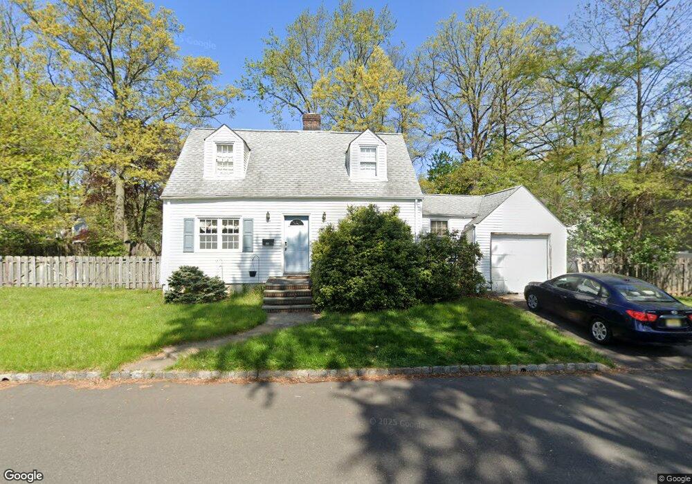
751 Cranford Ave Westfield, NJ 07090
Estimated Value: $767,000 - $1,097,000
--
Bed
--
Bath
1,898
Sq Ft
$506/Sq Ft
Est. Value
About This Home
This home is located at 751 Cranford Ave, Westfield, NJ 07090 and is currently estimated at $959,973, approximately $505 per square foot. 751 Cranford Ave is a home located in Union County with nearby schools including Washington Elementary School, Edison Intermediate School, and Westfield Senior High School.
Ownership History
Date
Name
Owned For
Owner Type
Purchase Details
Closed on
Feb 1, 1999
Sold by
Lisooey David A and Lisooey Dolores B
Bought by
Lisooey David A and Lisooey Dolores B
Current Estimated Value
Home Financials for this Owner
Home Financials are based on the most recent Mortgage that was taken out on this home.
Original Mortgage
$180,900
Interest Rate
6.75%
Mortgage Type
Stand Alone First
Purchase Details
Closed on
Apr 27, 1995
Sold by
Lisooey David A and Lisooey Dolores B
Bought by
Lisooey David A and Lisooey Dolores B
Create a Home Valuation Report for This Property
The Home Valuation Report is an in-depth analysis detailing your home's value as well as a comparison with similar homes in the area
Home Values in the Area
Average Home Value in this Area
Purchase History
| Date | Buyer | Sale Price | Title Company |
|---|---|---|---|
| Lisooey David A | -- | Stewart Title Guaranty Compa | |
| Lisooey David A | -- | -- |
Source: Public Records
Mortgage History
| Date | Status | Borrower | Loan Amount |
|---|---|---|---|
| Closed | Lisooey David A | $180,900 |
Source: Public Records
Tax History Compared to Growth
Tax History
| Year | Tax Paid | Tax Assessment Tax Assessment Total Assessment is a certain percentage of the fair market value that is determined by local assessors to be the total taxable value of land and additions on the property. | Land | Improvement |
|---|---|---|---|---|
| 2025 | $13,821 | $613,700 | $461,000 | $152,700 |
| 2024 | $13,538 | $613,700 | $461,000 | $152,700 |
| 2023 | $13,538 | $613,700 | $461,000 | $152,700 |
| 2022 | $13,256 | $613,700 | $461,000 | $152,700 |
| 2021 | $13,274 | $613,700 | $461,000 | $152,700 |
| 2020 | $13,244 | $613,700 | $461,000 | $152,700 |
| 2019 | $13,195 | $613,700 | $461,000 | $152,700 |
| 2018 | $15,080 | $162,200 | $86,900 | $75,300 |
| 2017 | $14,997 | $162,200 | $86,900 | $75,300 |
| 2016 | $14,645 | $162,200 | $86,900 | $75,300 |
| 2015 | $14,353 | $162,200 | $86,900 | $75,300 |
| 2014 | $13,879 | $162,200 | $86,900 | $75,300 |
Source: Public Records
Map
Nearby Homes
- 529 Benson Place
- 519 3rd Ave
- 613 Maple Ct Unit 613
- 500 Maple Ct Unit 500
- 484 4th Ave Unit 9
- 401 Brookside Place
- 629 Tremont Ave
- 8 Cedar St
- 305 Cedar St
- 131 Wells St
- 820 E Broad St
- 243 2nd Ave
- 112 Linden Ave
- 415 Myrtle Ave
- 416 Center St
- 65 4th Ave
- 501 Center St
- 1012 Columbus Ave
- 443 Pine Ave
- 112 Windsor Ave
- 619 Benson Place
- 714 Stevens Ave
- 761 Cranford Ave
- 720 Stevens Ave
- 639 Benson Place
- 632 Benson Place
- 726 Stevens Ave
- 760 Cranford Ave
- 771 Cranford Ave
- 624 Benson Place
- 605 Benson Place
- 711 Stevens Ave
- 711 4th Ave
- 620 Benson Place
- 721 Stevens Ave
- 813 4th Ave
- 740 Stevens Ave
- 770 Cranford Ave
- 713 4th Ave
- 616 Benson Place