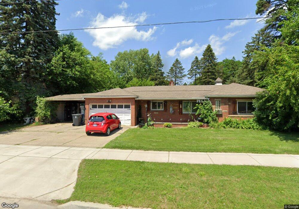
751 E Atherton Rd Flint, MI 48507
Circle Neighborhood NeighborhoodEstimated Value: $115,000 - $145,000
3
Beds
2
Baths
1,817
Sq Ft
$73/Sq Ft
Est. Value
About This Home
This home is located at 751 E Atherton Rd, Flint, MI 48507 and is currently estimated at $132,095, approximately $72 per square foot. 751 E Atherton Rd is a home located in Genesee County with nearby schools including Freeman Elementary School, Flint Southwestern Classical Academy, and Burton Glen Charter Academy.
Ownership History
Date
Name
Owned For
Owner Type
Purchase Details
Closed on
Apr 15, 2009
Sold by
Craig Henry L and Craig Teresa K
Bought by
Federal Home Loan Mortgage Corp
Current Estimated Value
Purchase Details
Closed on
Jan 5, 2001
Sold by
Craig Chad D
Bought by
Craig Chad D and Craig Henry L
Purchase Details
Closed on
May 14, 1999
Sold by
Craig Henry L and Craig Teresa K
Bought by
Craig Chad D
Create a Home Valuation Report for This Property
The Home Valuation Report is an in-depth analysis detailing your home's value as well as a comparison with similar homes in the area
Home Values in the Area
Average Home Value in this Area
Purchase History
| Date | Buyer | Sale Price | Title Company |
|---|---|---|---|
| Federal Home Loan Mortgage Corp | $71,831 | None Available | |
| Craig Chad D | -- | -- | |
| Craig Chad D | -- | Sargents Abstract & Title Co |
Source: Public Records
Tax History
| Year | Tax Paid | Tax Assessment Tax Assessment Total Assessment is a certain percentage of the fair market value that is determined by local assessors to be the total taxable value of land and additions on the property. | Land | Improvement |
|---|---|---|---|---|
| 2025 | $1,626 | $66,200 | $0 | $0 |
| 2024 | $1,450 | $59,300 | $0 | $0 |
| 2023 | $1,412 | $47,000 | $0 | $0 |
| 2022 | $0 | $39,800 | $0 | $0 |
| 2021 | $1,482 | $35,400 | $0 | $0 |
| 2020 | $1,314 | $29,500 | $0 | $0 |
| 2019 | $1,267 | $23,800 | $0 | $0 |
| 2018 | $1,315 | $24,100 | $0 | $0 |
| 2017 | $1,273 | $0 | $0 | $0 |
| 2016 | $1,234 | $0 | $0 | $0 |
| 2015 | -- | $0 | $0 | $0 |
| 2014 | -- | $0 | $0 | $0 |
| 2012 | -- | $27,100 | $0 | $0 |
Source: Public Records
Map
Nearby Homes
- 630 Buckingham Ave
- 621 Burroughs Ave
- 720 Algonquin Ave
- 3505 Comanche Ave
- 4126 Circle Dr
- 617 McKeighan Ave
- 420 Burroughs Ave
- 4127 Custer Ave
- 4424 Cheyenne Ave
- 530 McKeighan Ave
- 1030 McKeighan Ave
- 366 E Atherton Rd
- 3056 Shaw St
- 3110 Menominee Ave
- 352 Buckingham Ave
- 326 Burroughs Ave
- 2910 Shawnee Ave
- 3009 Menominee Ave
- 3193 Myrton St
- 3914 Red Arrow Rd
- 3708 Dearborn Ave
- 701 E Atherton Rd
- 3702 Dearborn Ave
- 3715 Dearborn Ave
- 3707 Dearborn Ave
- 3707 Dearborn St
- 3630 Dearborn Ave
- 3701 Ogema Ave
- 3701 Dearborn Ave
- 3626 Dearborn Ave
- 712 E Atherton Rd
- 708 E Atherton Rd
- 716 E Atherton Rd
- 3629 Dearborn Ave
- 726 E Atherton Rd
- 702 E Atherton Rd
- 637 E Atherton Rd
- 3622 Dearborn Ave
- 802 E Atherton Rd
- 3714 Comanche Ave
Your Personal Tour Guide
Ask me questions while you tour the home.