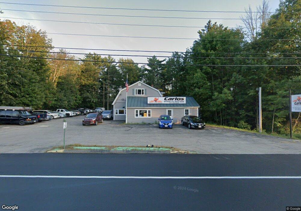
751 Narragansett Trail Buxton, ME 04093
Estimated Value: $575,000 - $816,285
--
Bed
--
Bath
3,500
Sq Ft
$199/Sq Ft
Est. Value
About This Home
This home is located at 751 Narragansett Trail, Buxton, ME 04093 and is currently estimated at $695,643, approximately $198 per square foot. 751 Narragansett Trail is a home located in York County with nearby schools including Bonny Eagle High School.
Ownership History
Date
Name
Owned For
Owner Type
Purchase Details
Closed on
Nov 24, 2021
Sold by
Ccm Re Holdings Inc
Bought by
Carlos Auto Dos Llc
Current Estimated Value
Home Financials for this Owner
Home Financials are based on the most recent Mortgage that was taken out on this home.
Original Mortgage
$375,000
Outstanding Balance
$344,624
Interest Rate
3.05%
Mortgage Type
Commercial
Estimated Equity
$351,019
Purchase Details
Closed on
Apr 21, 2015
Sold by
Wayne S Joy Ret
Bought by
Ccm Real Estate Holdings
Create a Home Valuation Report for This Property
The Home Valuation Report is an in-depth analysis detailing your home's value as well as a comparison with similar homes in the area
Home Values in the Area
Average Home Value in this Area
Purchase History
| Date | Buyer | Sale Price | Title Company |
|---|---|---|---|
| Carlos Auto Dos Llc | -- | None Available | |
| Carlos Auto Dos Llc | -- | None Available | |
| Ccm Real Estate Holdings | -- | -- |
Source: Public Records
Mortgage History
| Date | Status | Borrower | Loan Amount |
|---|---|---|---|
| Open | Carlos Auto Dos Llc | $375,000 | |
| Closed | Carlos Auto Dos Llc | $375,000 |
Source: Public Records
Tax History Compared to Growth
Tax History
| Year | Tax Paid | Tax Assessment Tax Assessment Total Assessment is a certain percentage of the fair market value that is determined by local assessors to be the total taxable value of land and additions on the property. | Land | Improvement |
|---|---|---|---|---|
| 2024 | $5,582 | $507,900 | $184,400 | $323,500 |
| 2023 | $5,297 | $507,900 | $184,400 | $323,500 |
| 2022 | $5,160 | $503,900 | $184,400 | $319,500 |
| 2021 | $4,889 | $338,111 | $112,300 | $225,811 |
| 2020 | $4,930 | $338,111 | $112,300 | $225,811 |
| 2019 | $4,499 | $303,600 | $112,300 | $191,300 |
| 2018 | $4,293 | $303,600 | $112,300 | $191,300 |
| 2017 | $4,129 | $303,600 | $112,300 | $191,300 |
| 2016 | $3,962 | $303,600 | $112,300 | $191,300 |
| 2015 | $3,932 | $303,600 | $112,300 | $191,300 |
| 2014 | $3,856 | $303,600 | $112,300 | $191,300 |
| 2013 | -- | $303,600 | $112,300 | $191,300 |
Source: Public Records
Map
Nearby Homes
- Lot #13 Johnson Farm Rd
- 38 Johnson Farm Rd
- 1255 Long Plains Rd
- 1228 Long Plains Rd
- 11 Albert Cir
- 90 Green Acres Dr
- 380 Portland Rd
- 9 Bonita Way
- 28 E Wind Dr
- 121 Rankin Rd
- 430 Narragansett Trail
- 00 Deering Dr
- 7 Mathew Way
- 13 Mathew Way
- 10 Mathew Way
- 48 Tickle Way
- 14 David Dr
- 939 River Rd
- 222 Main St
- 29 Eaton Dr
- 757 Narragansett Trail
- 760 Narragansett Trail
- 739 Narragansett Trail
- 761 Narragansett Trail
- 1393 Long Plains Rd
- 771 Narragansett Trail
- 1411 Long Plains Rd
- 780 Narragansett Trail
- 728 Narragansett Trail
- 1419 Long Plains Rd
- 90 Berry Rd
- 723 Narragansett Trail
- 16 Pierce Dr
- 1369 Long Plains Rd
- 1380 Long Plains Rd
- 1420 Long Plains Rd
- 1355 Long Plains Rd
- 70 Berry Rd
- 40 Berry Rd
- 1360 Long Plains Rd