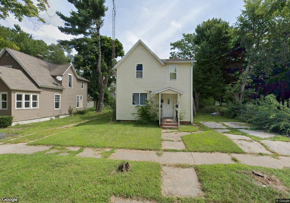
751 Pearl St Benton Harbor, MI 49022
Estimated Value: $98,000 - $176,000
--
Bed
3
Baths
2,380
Sq Ft
$57/Sq Ft
Est. Value
About This Home
This home is located at 751 Pearl St, Benton Harbor, MI 49022 and is currently estimated at $134,653, approximately $56 per square foot. 751 Pearl St is a home located in Berrien County with nearby schools including Fair Plain Middle School, Benton Harbor High School, and Benton Harbor Charter School Academy.
Ownership History
Date
Name
Owned For
Owner Type
Purchase Details
Closed on
Jun 17, 2024
Sold by
Burrell Jermaini L
Bought by
Berrien County Treasurer
Current Estimated Value
Purchase Details
Closed on
Jun 13, 2023
Sold by
Collins Charmaine
Bought by
Berrien County Treasurer
Purchase Details
Closed on
Oct 1, 2020
Sold by
Wallace Jerlyne L
Bought by
Collins Charmaine
Purchase Details
Closed on
Oct 25, 1982
Purchase Details
Closed on
Sep 22, 1973
Create a Home Valuation Report for This Property
The Home Valuation Report is an in-depth analysis detailing your home's value as well as a comparison with similar homes in the area
Home Values in the Area
Average Home Value in this Area
Purchase History
| Date | Buyer | Sale Price | Title Company |
|---|---|---|---|
| Berrien County Treasurer | -- | -- | |
| Berrien County Treasurer | -- | -- | |
| Collins Charmaine | $17,000 | First American Title | |
| Collins Charmaine | $17,000 | First American Title | |
| -- | $13,000 | -- | |
| -- | $13,000 | -- |
Source: Public Records
Tax History Compared to Growth
Tax History
| Year | Tax Paid | Tax Assessment Tax Assessment Total Assessment is a certain percentage of the fair market value that is determined by local assessors to be the total taxable value of land and additions on the property. | Land | Improvement |
|---|---|---|---|---|
| 2025 | $1,634 | $48,400 | $0 | $0 |
| 2024 | $1,429 | $42,000 | $0 | $0 |
| 2023 | $1,143 | $29,700 | $0 | $0 |
| 2022 | $1,297 | $21,600 | $0 | $0 |
| 2021 | $1,806 | $20,800 | $700 | $20,100 |
| 2020 | $922 | $20,800 | $0 | $0 |
| 2019 | $1,588 | $18,400 | $0 | $0 |
| 2018 | $1,577 | $18,400 | $0 | $0 |
| 2017 | $1,560 | $19,100 | $0 | $0 |
| 2016 | $852 | $19,300 | $0 | $0 |
| 2015 | $850 | $18,600 | $0 | $0 |
| 2014 | $805 | $22,500 | $0 | $0 |
Source: Public Records
Map
Nearby Homes
- 833 Pearl St
- 1045 Broadway
- 349 E Empire Ave
- 730 Superior St
- 972 Pearl St
- 872 Mcalister Ave
- 171 E Empire Ave
- 614 Pavone St
- 131 Clay St
- 161 Kline Ave
- 979 Lavette Ave
- 941 Colfax Ave
- 694 Colfax Ave
- 960 Jennings Ave
- 1097 Pearl St
- 361 E May St
- 416 E Britain Ave
- 576 Colfax Ave
- 378 Pipestone St
- 391 Pipestone St