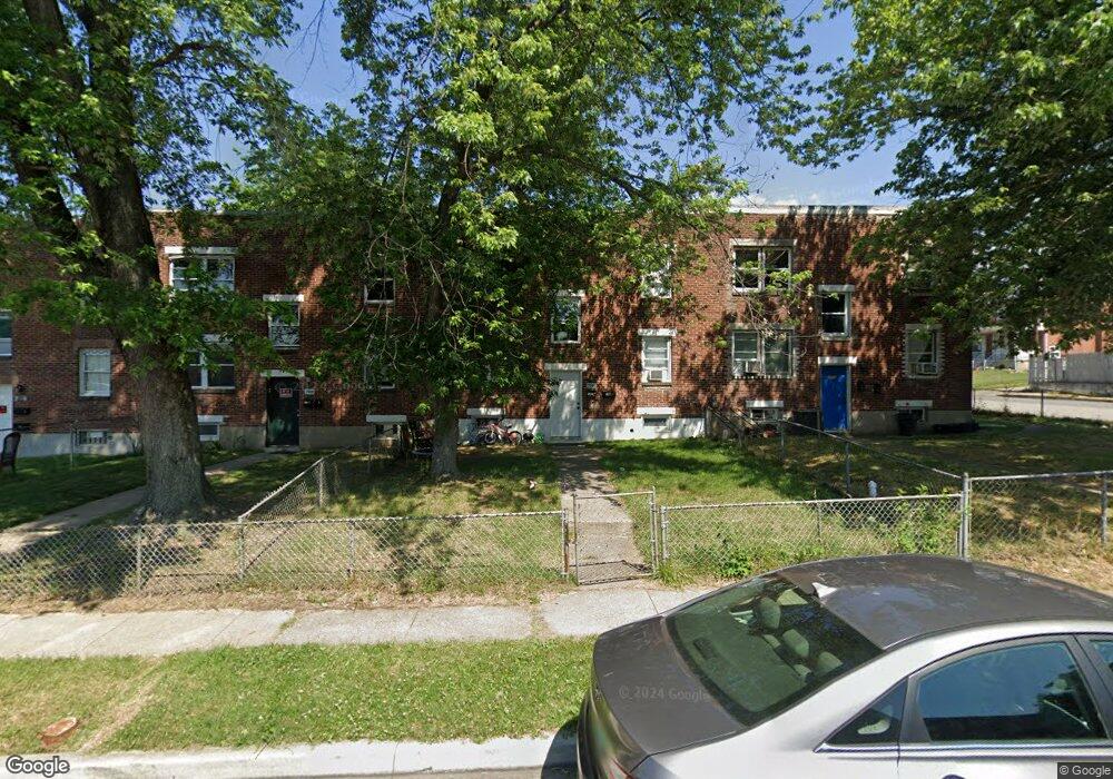
7510 Lange St Baltimore, MD 21224
Estimated Value: $185,000 - $218,000
--
Bed
2
Baths
1,500
Sq Ft
$136/Sq Ft
Est. Value
About This Home
This home is located at 7510 Lange St, Baltimore, MD 21224 and is currently estimated at $204,714, approximately $136 per square foot. 7510 Lange St is a home located in Baltimore County with nearby schools including Berkshire Elementary School, Holabird Middle School, and Dundalk High School.
Ownership History
Date
Name
Owned For
Owner Type
Purchase Details
Closed on
Mar 19, 2018
Sold by
Miller Robert Michael
Bought by
Sanusi Abdullah
Current Estimated Value
Home Financials for this Owner
Home Financials are based on the most recent Mortgage that was taken out on this home.
Original Mortgage
$82,500
Outstanding Balance
$70,595
Interest Rate
4.32%
Mortgage Type
Credit Line Revolving
Estimated Equity
$134,119
Purchase Details
Closed on
Feb 17, 2010
Sold by
Gray Haven Acquisition Llc
Bought by
Miller Robert Michael
Create a Home Valuation Report for This Property
The Home Valuation Report is an in-depth analysis detailing your home's value as well as a comparison with similar homes in the area
Home Values in the Area
Average Home Value in this Area
Purchase History
| Date | Buyer | Sale Price | Title Company |
|---|---|---|---|
| Sanusi Abdullah | $110,000 | Goldstar Title Co | |
| Miller Robert Michael | $108,000 | -- |
Source: Public Records
Mortgage History
| Date | Status | Borrower | Loan Amount |
|---|---|---|---|
| Open | Sanusi Abdullah | $82,500 |
Source: Public Records
Tax History Compared to Growth
Tax History
| Year | Tax Paid | Tax Assessment Tax Assessment Total Assessment is a certain percentage of the fair market value that is determined by local assessors to be the total taxable value of land and additions on the property. | Land | Improvement |
|---|---|---|---|---|
| 2025 | $2,548 | $153,867 | -- | -- |
| 2024 | $2,548 | $138,433 | $0 | $0 |
| 2023 | $2,383 | $123,000 | $30,000 | $93,000 |
| 2022 | $2,359 | $118,867 | $0 | $0 |
| 2021 | $1,118 | $114,733 | $0 | $0 |
| 2020 | $3,126 | $110,600 | $30,000 | $80,600 |
| 2019 | $1,294 | $106,767 | $0 | $0 |
| 2018 | $2,269 | $102,933 | $0 | $0 |
| 2017 | $2,256 | $99,100 | $0 | $0 |
| 2016 | $1,485 | $88,600 | $0 | $0 |
| 2015 | $1,485 | $78,100 | $0 | $0 |
| 2014 | $1,485 | $67,600 | $0 | $0 |
Source: Public Records
Map
Nearby Homes
- 7521 Lange St
- 988 Dalton Ave
- 7455 Manchester Rd
- 7420 Poplar Ave
- 7412 Poplar Ave
- 7412 Belmont Ave
- 1237 Willow Rd
- 1205 N Point Rd
- 7623 Spruce Rd
- 800 Northpoint Rd
- 739 Aldworth Rd
- 1260 Willow Rd
- 1229 N Point Rd
- 7520 Avondale Ave
- 1346 Willow Rd
- 2606 Plainfield Rd
- 0 Hillshire Rd
- 2608 Ambler Rd
- 7315 Stratton Way
- 217 S Woodwell Rd
- 7508 Lange St
- 7512 Lange St
- 7506 Lange St
- 7506 Lange St Unit 2
- 1021 Dalton Ave
- 7504 Lange St
- 1019 Dalton Ave
- 7502 Lange St
- 1017 Dalton Ave
- 7516 Lange St
- 1015 Dalton Ave
- 7509 Lange St
- 7507 Lange St
- 1013 Dalton Ave
- 7500 Lange St
- 7511 Lange St
- 7511 Lange St Unit 1
- 7511 Lange St Unit 2
- 7505 Lange St
- 7513 Lange St