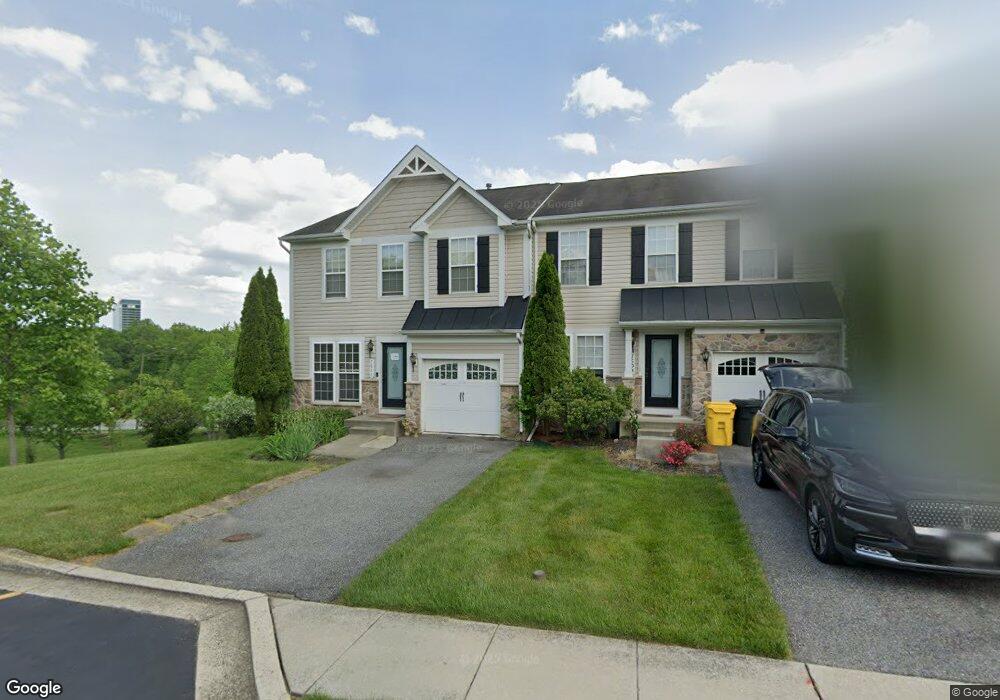
7511 Langport Ct Hanover, MD 21076
Estimated Value: $461,863 - $496,000
--
Bed
3
Baths
1,745
Sq Ft
$278/Sq Ft
Est. Value
About This Home
This home is located at 7511 Langport Ct, Hanover, MD 21076 and is currently estimated at $485,716, approximately $278 per square foot. 7511 Langport Ct is a home located in Anne Arundel County with nearby schools including Hebron-Harman Elementary School, MacArthur Middle School, and Meade High School.
Ownership History
Date
Name
Owned For
Owner Type
Purchase Details
Closed on
Oct 6, 2008
Sold by
Wright Guy A
Bought by
Wright Guy A
Current Estimated Value
Purchase Details
Closed on
Aug 6, 2008
Sold by
Wright Guy A
Bought by
Wright Guy A
Purchase Details
Closed on
Oct 26, 2007
Sold by
Cc&Dorchester Llc
Bought by
Wright Guy A and Brown Daphne
Home Financials for this Owner
Home Financials are based on the most recent Mortgage that was taken out on this home.
Original Mortgage
$375,806
Interest Rate
6.59%
Mortgage Type
Purchase Money Mortgage
Purchase Details
Closed on
Sep 21, 2007
Sold by
Cc&Dorchester Llc
Bought by
Wright Guy A and Brown Daphne
Home Financials for this Owner
Home Financials are based on the most recent Mortgage that was taken out on this home.
Original Mortgage
$375,806
Interest Rate
6.59%
Mortgage Type
Purchase Money Mortgage
Create a Home Valuation Report for This Property
The Home Valuation Report is an in-depth analysis detailing your home's value as well as a comparison with similar homes in the area
Home Values in the Area
Average Home Value in this Area
Purchase History
| Date | Buyer | Sale Price | Title Company |
|---|---|---|---|
| Wright Guy A | -- | -- | |
| Wright Guy A | -- | -- | |
| Wright Guy A | $395,586 | -- | |
| Wright Guy A | $395,586 | -- |
Source: Public Records
Mortgage History
| Date | Status | Borrower | Loan Amount |
|---|---|---|---|
| Previous Owner | Wright Guy A | $375,806 | |
| Previous Owner | Wright Guy A | $375,806 |
Source: Public Records
Tax History Compared to Growth
Tax History
| Year | Tax Paid | Tax Assessment Tax Assessment Total Assessment is a certain percentage of the fair market value that is determined by local assessors to be the total taxable value of land and additions on the property. | Land | Improvement |
|---|---|---|---|---|
| 2025 | $5,665 | $392,500 | $140,000 | $252,500 |
| 2024 | $5,665 | $378,167 | $0 | $0 |
| 2023 | $5,597 | $363,833 | $0 | $0 |
| 2022 | $3,652 | $349,500 | $140,000 | $209,500 |
| 2021 | $10,518 | $347,067 | $0 | $0 |
| 2020 | $5,130 | $344,633 | $0 | $0 |
| 2019 | $9,992 | $342,200 | $130,000 | $212,200 |
| 2018 | $3,439 | $339,167 | $0 | $0 |
| 2017 | $4,799 | $336,133 | $0 | $0 |
| 2016 | -- | $333,100 | $0 | $0 |
| 2015 | -- | $330,500 | $0 | $0 |
| 2014 | -- | $327,900 | $0 | $0 |
Source: Public Records
Map
Nearby Homes
- 7591 Taunton Ct
- 1544 Rutland Way
- 7296 Dorchester Woods Ln
- 7147 Wedmore Ct
- 7266 Dorchester Woods Ln
- 7490 Race Rd
- 7310 Wisteria Point Dr
- 7151 Wright Rd
- 7143 Wright Rd
- Parcel 325 Wright Rd
- Parcel 265 Wright Rd
- Parcel 271 Wright Rd
- 7111 River Birch Dr
- Parcel 316-7147 Wright Rd
- 7432 Race Rd
- 7611 Elmcrest Rd
- 7135 Wright Rd
- 7328 Wisteria Point Dr
- 7417 Copper Lake Dr
- 7131 Wright Rd
- 7509 Langport Ct
- 7505 Langport Ct
- 7507 Langport Ct
- 7501 Langport Ct
- 7512 Langport Ct
- 7510 Langport Ct
- 7508 Langport Ct
- 1601 Durham Way
- 7506 Langport Ct
- 7504 Langport Ct
- 7502 Langport Ct
- 1603 Durham Way
- 1605 Durham Way
- 1607 Durham Way
- 1609 Durham Way
- 1701 Hayle Dr
- 1600 Durham Way
- 1703 Hayle Dr
- 1705 Hayle Dr
- 1602 Durham Way