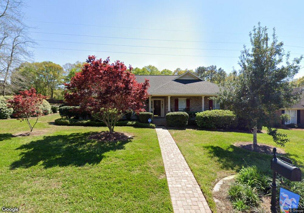
7511 Quency Dr Mobile, AL 36695
Sheldon NeighborhoodEstimated Value: $271,359 - $325,000
4
Beds
2
Baths
2,216
Sq Ft
$132/Sq Ft
Est. Value
About This Home
This home is located at 7511 Quency Dr, Mobile, AL 36695 and is currently estimated at $293,590, approximately $132 per square foot. 7511 Quency Dr is a home located in Mobile County with nearby schools including ER Dickson Elementary School, Burns Middle School, and WP Davidson High School.
Ownership History
Date
Name
Owned For
Owner Type
Purchase Details
Closed on
Nov 29, 1999
Sold by
Hancock David E and Hancock Brenda F
Bought by
Clanton Dewayne E and Clanton Jacinda A
Current Estimated Value
Purchase Details
Closed on
Sep 26, 1997
Sold by
Jones Eifion S and Keim Julie Keim
Bought by
Hancock David E and Hancock Brenda F
Home Financials for this Owner
Home Financials are based on the most recent Mortgage that was taken out on this home.
Original Mortgage
$106,000
Interest Rate
7.46%
Create a Home Valuation Report for This Property
The Home Valuation Report is an in-depth analysis detailing your home's value as well as a comparison with similar homes in the area
Home Values in the Area
Average Home Value in this Area
Purchase History
| Date | Buyer | Sale Price | Title Company |
|---|---|---|---|
| Clanton Dewayne E | -- | -- | |
| Hancock David E | -- | -- |
Source: Public Records
Mortgage History
| Date | Status | Borrower | Loan Amount |
|---|---|---|---|
| Previous Owner | Hancock David E | $106,000 |
Source: Public Records
Tax History
| Year | Tax Paid | Tax Assessment Tax Assessment Total Assessment is a certain percentage of the fair market value that is determined by local assessors to be the total taxable value of land and additions on the property. | Land | Improvement |
|---|---|---|---|---|
| 2025 | $893 | $22,000 | $3,500 | $18,500 |
| 2024 | $893 | $21,640 | $3,500 | $18,140 |
| 2023 | $878 | $21,240 | $3,500 | $17,740 |
| 2022 | $698 | $17,590 | $3,500 | $14,090 |
| 2021 | $660 | $16,690 | $3,500 | $13,190 |
| 2020 | $657 | $16,620 | $3,500 | $13,120 |
| 2019 | $653 | $16,510 | $3,500 | $13,010 |
| 2018 | $628 | $15,920 | $0 | $0 |
| 2017 | $621 | $15,760 | $0 | $0 |
| 2016 | -- | $16,440 | $0 | $0 |
| 2013 | -- | $16,240 | $0 | $0 |
Source: Public Records
Map
Nearby Homes
- 1337 Carson Rd W
- 1291 Carson Rd W
- 1265 Hanover Ct
- 1542 Stone Hedge Dr W
- 7693 Pembroke Cir
- 1171 Newbury Ln E
- 7271 Carson Rd S
- 1361 Dellwyn Ct
- 1484 Pebble Creek Dr
- 1645 Ashmoor Dr E
- 1130 Jonathan Ct
- 1735 Ashmoor Dr W
- 1263 Smithfield Rd E
- 7485 Creekwood Dr
- 1000 Choctaw Bluff Rd
- 7180 Charlanda Blvd
- 8621 Grelot Rd
- 7671 Creekwood Dr
- 7190 Bradshaw Ct
- 836 Willow Bridge Dr W
- 7521 Quency Dr
- 7491 Quency Dr
- 7510 Quency Dr
- 7500 Quency Dr
- 7520 Quency Dr
- 7531 Quency Dr
- 7510 Brockton Ct
- 7520 Brockton Ct
- 7541 Quency Dr
- 7490 Quency Dr
- 7481 Carson Rd S
- 7500 Brockton Ct
- 1355 Carson Rd W
- 1340 Carson Rd E
- 1349 Carson Rd W
- 7530 Brockton Ct
- 7551 Quency Dr
- 7471 Carson Rd S
- 7470 Brockton Ln N
- 1325 Carson Rd W