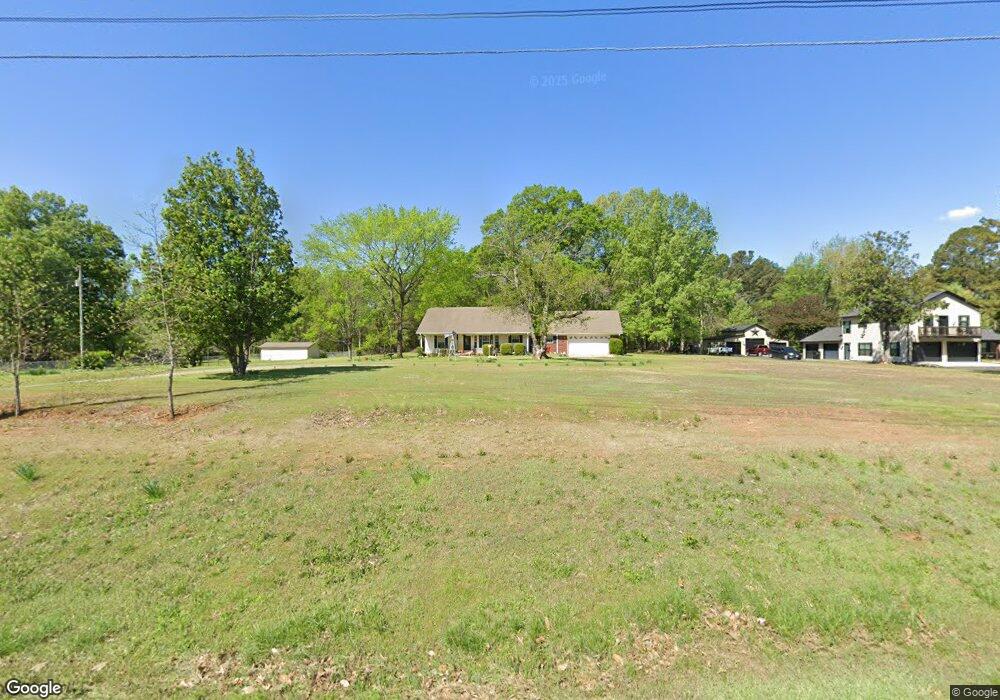
7512 Highway 89 S Lonoke, AR 72086
Estimated Value: $209,000 - $255,213
--
Bed
2
Baths
1,777
Sq Ft
$132/Sq Ft
Est. Value
About This Home
This home is located at 7512 Highway 89 S, Lonoke, AR 72086 and is currently estimated at $234,553, approximately $131 per square foot. 7512 Highway 89 S is a home located in Lonoke County with nearby schools including Southside Elementary School, Cabot Junior High South, and Cabot Middle School South.
Ownership History
Date
Name
Owned For
Owner Type
Purchase Details
Closed on
Jun 28, 2022
Sold by
Dozier Jerry D and Dozier Norman
Bought by
Dozier Jerry D and Dozier Gary L
Current Estimated Value
Purchase Details
Closed on
Jun 12, 1998
Bought by
Dozier
Purchase Details
Closed on
Aug 29, 1997
Bought by
Fields
Purchase Details
Closed on
Jun 19, 1997
Bought by
Taylor and Taylor Wife
Purchase Details
Closed on
Jun 16, 1997
Bought by
Taylor and Taylor Wife
Purchase Details
Closed on
Dec 2, 1977
Bought by
Pearson
Create a Home Valuation Report for This Property
The Home Valuation Report is an in-depth analysis detailing your home's value as well as a comparison with similar homes in the area
Home Values in the Area
Average Home Value in this Area
Purchase History
| Date | Buyer | Sale Price | Title Company |
|---|---|---|---|
| Dozier Jerry D | -- | None Listed On Document | |
| Dozier | $125,000 | -- | |
| Dozier | $125,000 | -- | |
| Fields | $2,000 | -- | |
| Taylor | $26,000 | -- | |
| Taylor | $26,000 | -- | |
| Pearson | -- | -- |
Source: Public Records
Tax History Compared to Growth
Tax History
| Year | Tax Paid | Tax Assessment Tax Assessment Total Assessment is a certain percentage of the fair market value that is determined by local assessors to be the total taxable value of land and additions on the property. | Land | Improvement |
|---|---|---|---|---|
| 2025 | $725 | $33,430 | $6,000 | $27,430 |
| 2024 | $725 | $33,430 | $6,000 | $27,430 |
| 2023 | $725 | $33,430 | $6,000 | $27,430 |
| 2022 | $775 | $33,430 | $6,000 | $27,430 |
| 2021 | $775 | $33,430 | $6,000 | $27,430 |
| 2020 | $775 | $30,840 | $6,000 | $24,840 |
| 2019 | $775 | $30,840 | $6,000 | $24,840 |
| 2018 | $800 | $30,840 | $6,000 | $24,840 |
| 2017 | $979 | $30,840 | $6,000 | $24,840 |
| 2016 | $800 | $30,840 | $6,000 | $24,840 |
| 2015 | $800 | $30,320 | $6,000 | $24,320 |
| 2014 | $800 | $30,320 | $6,000 | $24,320 |
Source: Public Records
Map
Nearby Homes
- 20 Tower Hill Ln
- 1D Forbus Rd
- 115 Staggs Ln
- 15 Opie Ct
- 000 Bratton Rd
- 000 Opie Dr
- 206 Sunset Country Ln
- 75 Charlene Dr
- 165 Sunset Country Ln
- 20 Williamsburg Dr
- 284 Sunnyvale Ln
- 4755 A- Ar Hwy 89 S
- 4755 Arkansas 89
- 160 Williamsburg Cove
- 000 Poppy Ln
- 3709 Sandhill Rd
- 136 Chickory Ln
- 0 Daniel Glover Rd
- 1064 Oliver Ln
- 485 Pearl Stone Dr
- 7544 Highway 89 S
- 7510 Highway 89 S
- 7510 Highway 89 S
- 10 Tower Loop
- 84 Tower Loop
- 7385 Highway 89 S
- 277 Sandhill Rd
- Lot 1 Sandhill Rd Unit 1
- Lot 1 Sandhill Rd
- 122 Tower Loop
- 8422 Hwy 89 S
- 8422 S Hwy 89 Hwy
- 000 Sandhill Rd
- 7762 Highway 89 S
- 7718 Highway 89 S
- 7730 Highway 89 S
- 7315 Highway 89 S
- 7315 Arkansas 89
- 7510 Arkansas 89
- 7285 Highway 89 S