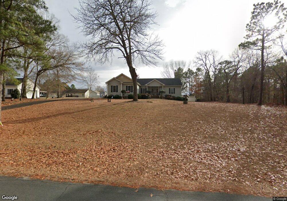
7515 Mourning Dove Dr Sanford, NC 27332
Estimated Value: $305,000 - $330,958
3
Beds
2
Baths
1,648
Sq Ft
$193/Sq Ft
Est. Value
About This Home
This home is located at 7515 Mourning Dove Dr, Sanford, NC 27332 and is currently estimated at $317,490, approximately $192 per square foot. 7515 Mourning Dove Dr is a home located in Lee County with nearby schools including Greenwood Elementary School, Sanlee Middle School, and Southern Lee High School.
Ownership History
Date
Name
Owned For
Owner Type
Purchase Details
Closed on
Mar 12, 2007
Sold by
Tuscarora Builders Inc
Bought by
Ford Margaret
Current Estimated Value
Home Financials for this Owner
Home Financials are based on the most recent Mortgage that was taken out on this home.
Original Mortgage
$140,000
Outstanding Balance
$84,415
Interest Rate
6.19%
Mortgage Type
New Conventional
Estimated Equity
$233,075
Create a Home Valuation Report for This Property
The Home Valuation Report is an in-depth analysis detailing your home's value as well as a comparison with similar homes in the area
Home Values in the Area
Average Home Value in this Area
Purchase History
| Date | Buyer | Sale Price | Title Company |
|---|---|---|---|
| Ford Margaret | $194,000 | None Available |
Source: Public Records
Mortgage History
| Date | Status | Borrower | Loan Amount |
|---|---|---|---|
| Open | Ford Margaret | $140,000 |
Source: Public Records
Tax History Compared to Growth
Tax History
| Year | Tax Paid | Tax Assessment Tax Assessment Total Assessment is a certain percentage of the fair market value that is determined by local assessors to be the total taxable value of land and additions on the property. | Land | Improvement |
|---|---|---|---|---|
| 2025 | $2,346 | $300,000 | $27,500 | $272,500 |
| 2024 | $2,346 | $300,000 | $27,500 | $272,500 |
| 2023 | $2,325 | $300,000 | $27,500 | $272,500 |
| 2022 | $1,743 | $193,700 | $27,500 | $166,200 |
| 2021 | $1,789 | $193,700 | $27,500 | $166,200 |
| 2020 | $1,795 | $193,700 | $27,500 | $166,200 |
| 2019 | $1,795 | $193,700 | $27,500 | $166,200 |
| 2018 | $1,843 | $194,800 | $31,000 | $163,800 |
| 2017 | $1,781 | $194,800 | $31,000 | $163,800 |
| 2016 | $1,817 | $194,800 | $31,000 | $163,800 |
| 2014 | $1,621 | $194,800 | $31,000 | $163,800 |
Source: Public Records
Map
Nearby Homes
- 258 Eakes Rd
- 7205 Kingfisher Rd
- 193 Jp Ln
- 716 Wildlife Rd
- 0 Cedar Lane Rd Unit 100537674
- 0 Cedar Lane Rd Unit 10111842
- 0 Cedar Lane Rd Unit 10064976
- 701 Blakely Rd
- 0 Sugar Maple Rd Unit 100509660
- 0 Lark Ln Unit 746934
- 6567 Old Jefferson Davis Hwy
- Lot 17 Hollywood Rd
- 0 Key Rd Jj Ln Unit 741077
- 1058 Sanders Rd
- 555 Key Rd
- 0 Saintsbury Place Unit 749650
- 0 Saintsbury Place Unit 10119218
- 3419 Chris Cole Rd
- 0 Ravens Nest Ln Unit 10115362
- 0 Lee Loop
- 7517 Mourning Dove Dr
- 468 Eakes Rd
- 470 Eakes Rd
- 7512 Mourning Dove Dr
- 390 Eakes Rd
- 7520 Mourning Dove Dr
- 7508 Mourning Dove Dr
- 472 Eakes Rd
- 7505 Mourning Dove Dr
- 7509 Mourning Dove Dr
- 384 Eakes Rd
- 0 Martin Cir & Warbler Rd
- TBD Martin Cir
- 6413 Martin Cir
- 474 Eakes Rd
- 7525 Mourning Dove Dr
- 5902 Quail Ridge Dr
- 6412 Martin Cir
- 5830 Quail Ridge Dr
- 6409 Martin Cir