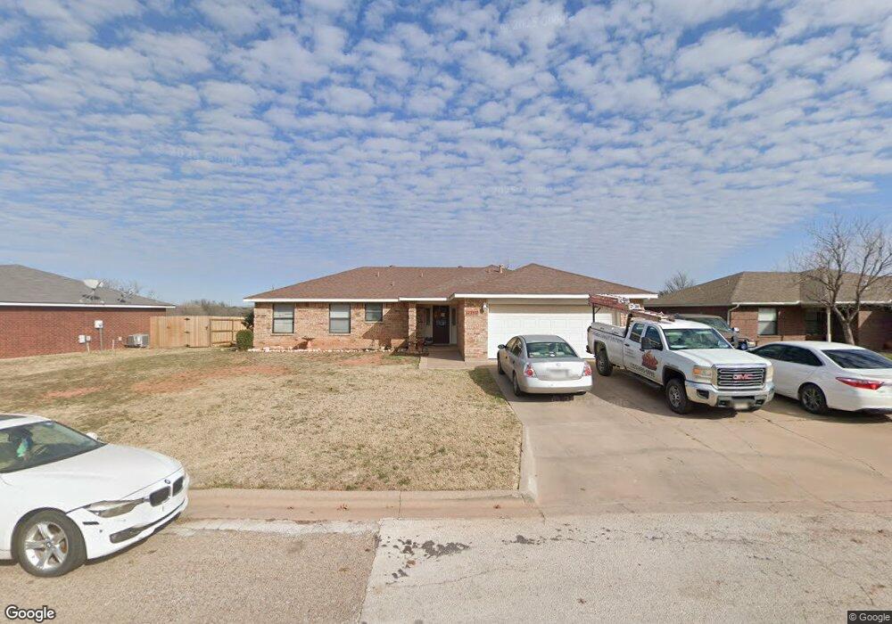
7517 Thompson Pkwy Abilene, TX 79606
Far Southside NeighborhoodEstimated Value: $206,000 - $246,000
4
Beds
2
Baths
1,544
Sq Ft
$150/Sq Ft
Est. Value
About This Home
This home is located at 7517 Thompson Pkwy, Abilene, TX 79606 and is currently estimated at $231,159, approximately $149 per square foot. 7517 Thompson Pkwy is a home located in Taylor County with nearby schools including Wylie West Early Childhood Center, Wylie West Intermediate School, and Wylie West Elementary School.
Ownership History
Date
Name
Owned For
Owner Type
Purchase Details
Closed on
Jul 28, 2021
Sold by
Lail Barbara Ann
Bought by
Lail James Floyd
Current Estimated Value
Purchase Details
Closed on
Aug 12, 2015
Sold by
Leiva Edison A and Leiva Lidia J
Bought by
Lail Barbara A
Home Financials for this Owner
Home Financials are based on the most recent Mortgage that was taken out on this home.
Original Mortgage
$139,918
Outstanding Balance
$111,300
Interest Rate
4.37%
Mortgage Type
FHA
Estimated Equity
$119,859
Create a Home Valuation Report for This Property
The Home Valuation Report is an in-depth analysis detailing your home's value as well as a comparison with similar homes in the area
Home Values in the Area
Average Home Value in this Area
Purchase History
| Date | Buyer | Sale Price | Title Company |
|---|---|---|---|
| Lail James Floyd | -- | None Available | |
| Lail Barbara A | -- | Attorney |
Source: Public Records
Mortgage History
| Date | Status | Borrower | Loan Amount |
|---|---|---|---|
| Open | Lail Barbara A | $139,918 |
Source: Public Records
Tax History Compared to Growth
Tax History
| Year | Tax Paid | Tax Assessment Tax Assessment Total Assessment is a certain percentage of the fair market value that is determined by local assessors to be the total taxable value of land and additions on the property. | Land | Improvement |
|---|---|---|---|---|
| 2025 | $3,058 | $225,385 | $26,672 | $198,713 |
| 2023 | $3,058 | $220,104 | $17,337 | $202,767 |
| 2022 | $4,490 | $190,288 | $17,337 | $172,951 |
| 2021 | $4,237 | $164,489 | $17,337 | $147,152 |
| 2020 | $4,096 | $156,418 | $15,725 | $140,693 |
| 2019 | $4,093 | $151,946 | $14,515 | $137,431 |
| 2018 | $3,722 | $148,680 | $14,515 | $134,165 |
| 2017 | $3,551 | $147,254 | $14,515 | $132,739 |
| 2016 | $3,400 | $140,985 | $14,515 | $126,470 |
| 2015 | $3,072 | $138,373 | $14,515 | $123,858 |
| 2014 | $3,072 | $136,772 | $0 | $0 |
Source: Public Records
Map
Nearby Homes
- 7710 John Carroll Dr
- 7501 White Blvd
- 3809 Mark Ct
- 7801 Old Forrest Hill Rd
- 4634 Beall Blvd
- 4833 Meadow Dr
- 5001 Buffalo Gap Rd
- 7967 Bonnie Cir
- 8073 Bonnie Cir
- 6642 Buffalo Gap Rd
- 5002 Meadow Dr
- 4034 Forrest Hill Rd
- 3676 Yamini Dr
- 6890 Buffalo Gap Rd
- 6781 Hillside Ct
- 6947 Forrest Meadows Dr
- 6856 Buffao Gap Rd
- 8 Contour Dr
- 6717 Hillside Ct
- TBD Phoenix Dr
- 7525 Thompson Pkwy
- 7509 Thompson Pkwy
- 7533 Thompson Pkwy
- 7542 Ruby Esther Cir
- 7501 Thompson Pkwy
- 4409 Cole Dr
- 7541 Thompson Pkwy
- 7550 Ruby Esther Cir
- 7541 Ruby Esther Cir
- 7526 Patricia Ln
- 7534 Patricia Ln
- 7518 Patricia Ln
- 4417 Cole Dr
- 7549 Ruby Esther Cir
- 4402 Cole Dr
- 7510 Patricia Ln
- 7558 Ruby Esther Cir
- 7542 Patricia Ln
- 7502 Patricia Ln
- 7557 Ruby Esther Cir