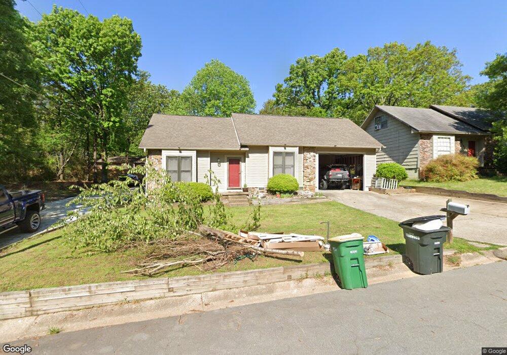
7519 Club Ln Sherwood, AR 72120
Estimated Value: $229,345 - $251,000
3
Beds
2
Baths
2,108
Sq Ft
$114/Sq Ft
Est. Value
About This Home
This home is located at 7519 Club Ln, Sherwood, AR 72120 and is currently estimated at $240,086, approximately $113 per square foot. 7519 Club Ln is a home located in Pulaski County with nearby schools including Sherwood Elementary School, Sylvan Hills Middle School, and Sylvan Hills High School.
Ownership History
Date
Name
Owned For
Owner Type
Purchase Details
Closed on
Sep 13, 2016
Sold by
Mabry Patricia and Mabry Thomas E
Bought by
Berber Everardo
Current Estimated Value
Home Financials for this Owner
Home Financials are based on the most recent Mortgage that was taken out on this home.
Original Mortgage
$154,057
Outstanding Balance
$123,134
Interest Rate
3.45%
Mortgage Type
FHA
Estimated Equity
$116,952
Purchase Details
Closed on
Aug 25, 1998
Sold by
Mabry Patricia and Fries Patricia
Bought by
Mabry Patricia and Mabry Thomas E
Create a Home Valuation Report for This Property
The Home Valuation Report is an in-depth analysis detailing your home's value as well as a comparison with similar homes in the area
Home Values in the Area
Average Home Value in this Area
Purchase History
| Date | Buyer | Sale Price | Title Company |
|---|---|---|---|
| Berber Everardo | $156,900 | American Abstract & Title Co | |
| Mabry Patricia | -- | -- |
Source: Public Records
Mortgage History
| Date | Status | Borrower | Loan Amount |
|---|---|---|---|
| Open | Berber Everardo | $154,057 |
Source: Public Records
Tax History Compared to Growth
Tax History
| Year | Tax Paid | Tax Assessment Tax Assessment Total Assessment is a certain percentage of the fair market value that is determined by local assessors to be the total taxable value of land and additions on the property. | Land | Improvement |
|---|---|---|---|---|
| 2025 | $1,820 | $34,931 | $2,800 | $32,131 |
| 2024 | $1,657 | $34,931 | $2,800 | $32,131 |
| 2023 | $1,657 | $34,931 | $2,800 | $32,131 |
| 2022 | $1,716 | $34,931 | $2,800 | $32,131 |
| 2021 | $1,519 | $26,510 | $3,700 | $22,810 |
| 2020 | $1,512 | $26,510 | $3,700 | $22,810 |
| 2019 | $1,512 | $26,510 | $3,700 | $22,810 |
| 2018 | $1,512 | $26,510 | $3,700 | $22,810 |
| 2017 | $1,494 | $26,510 | $3,700 | $22,810 |
| 2016 | $1,387 | $24,460 | $4,000 | $20,460 |
| 2015 | $1,243 | $24,460 | $4,000 | $20,460 |
| 2014 | $1,243 | $24,460 | $4,000 | $20,460 |
Source: Public Records
Map
Nearby Homes
- +/- 8.16 Acres Windchime Ave
- 1301 Stafford Rd
- 11 Daniel Dr
- 1300 Stafford Rd
- 619 Newcastle Dr
- 609 Newcastle Dr
- 626 Newcastle Dr
- 610 Newcastle Dr
- 618 & 620 Newcastle Dr
- 622 Newcastle Dr
- 615 & 617 Brierly Dr
- 1800 Palomino Dr
- 615 Brierly Dr
- 1415 Stafford Rd
- 1419 Stafford Rd
- 1423 Stafford Rd
- 1501 Stafford Rd
- 1406 Coolhurst Ave
- +/- 21.56 Acres Stafford Rd
- 8000 Pinto Trail
- 7523 Club Ln
- 7603 Club Ln
- 316 Alanbrook Ave
- 7520 Club Ln
- 314 Alanbrook Ave
- 7524 Club Ln
- 318 Alanbrook Ave
- 7607 Club Ln
- 1600 Club Ln E
- 312 Alanbrook Ave
- 320 Alanbrook Ave
- 1604 Club Ln E
- 7611 Club Ln
- 310 Alanbrook Ave
- 1608 Club Ln E
- 322 Alanbrook Ave
- 1601 Club Ln E
- 317 Alanbrook Ave
- 7615 Club Ln
- 315 Alanbrook Ave