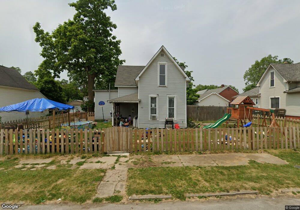
752 Gentry St Frankfort, IN 46041
Estimated Value: $99,000 - $106,000
3
Beds
1
Bath
1,660
Sq Ft
$61/Sq Ft
Est. Value
About This Home
This home is located at 752 Gentry St, Frankfort, IN 46041 and is currently estimated at $101,841, approximately $61 per square foot. 752 Gentry St is a home located in Clinton County with nearby schools including Frankfort Senior High School and Frankfort Covenant Academy.
Ownership History
Date
Name
Owned For
Owner Type
Purchase Details
Closed on
Dec 16, 2022
Sold by
Coonrod Amber
Bought by
Tapia Ruby and Quinonez Julio
Current Estimated Value
Purchase Details
Closed on
Apr 25, 2017
Sold by
Birge William L and Birge Donna
Bought by
Coonrod Amber
Purchase Details
Closed on
Dec 13, 2010
Sold by
Conner Michael W and Conner Barbara
Bought by
Coonrod Amber
Home Financials for this Owner
Home Financials are based on the most recent Mortgage that was taken out on this home.
Original Mortgage
$41,690
Interest Rate
7%
Mortgage Type
Adjustable Rate Mortgage/ARM
Create a Home Valuation Report for This Property
The Home Valuation Report is an in-depth analysis detailing your home's value as well as a comparison with similar homes in the area
Home Values in the Area
Average Home Value in this Area
Purchase History
| Date | Buyer | Sale Price | Title Company |
|---|---|---|---|
| Tapia Ruby | -- | -- | |
| Coonrod Amber | -- | None Available | |
| Coonrod Amber | -- | None Available |
Source: Public Records
Mortgage History
| Date | Status | Borrower | Loan Amount |
|---|---|---|---|
| Previous Owner | Coonrod Amber | $41,690 |
Source: Public Records
Tax History Compared to Growth
Tax History
| Year | Tax Paid | Tax Assessment Tax Assessment Total Assessment is a certain percentage of the fair market value that is determined by local assessors to be the total taxable value of land and additions on the property. | Land | Improvement |
|---|---|---|---|---|
| 2024 | $1,141 | $99,900 | $11,600 | $88,300 |
| 2023 | $961 | $86,800 | $11,600 | $75,200 |
| 2022 | $583 | $71,900 | $11,600 | $60,300 |
| 2021 | $348 | $44,700 | $11,600 | $33,100 |
| 2020 | $1,037 | $44,700 | $11,600 | $33,100 |
| 2019 | $344 | $44,800 | $11,600 | $33,200 |
| 2018 | $342 | $44,800 | $11,600 | $33,200 |
| 2017 | $458 | $57,900 | $11,200 | $46,700 |
| 2016 | $423 | $55,900 | $11,200 | $44,700 |
| 2014 | $282 | $55,200 | $11,200 | $44,000 |
Source: Public Records
Map
Nearby Homes
- 450 W Green St
- 557 W Green St
- 10 E Green St
- 1059 N Main St
- 902 Rossville Ave
- 250 252 W Washington St
- 250 , 252 W Washington St
- 756 Delphi Ave
- 907 Rowe St
- 952 Given St
- 506 W Walnut St
- 1159 W Mcclurg St
- 751 Woodland Ct
- 1209 E Wabash St
- 359 S 2nd St
- 255 N East St
- 1300 Myrtle Ave
- 458 S Jackson St
- 1401 W Morrison St
- 652 S Jackson St