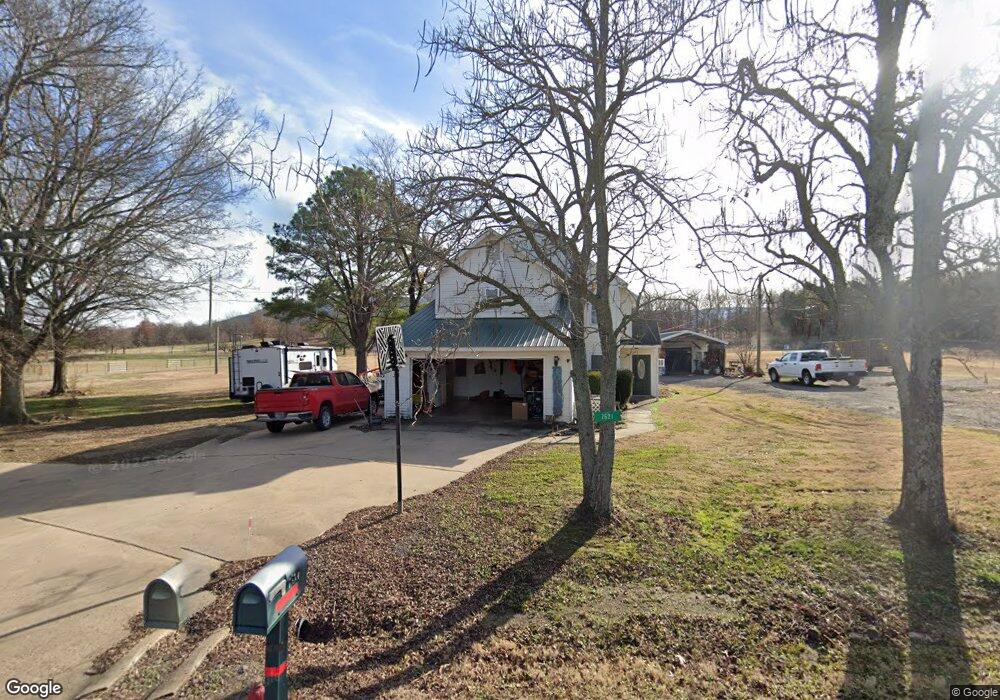
7521 W Highway 252 Hackett, AR 72937
Estimated Value: $209,463 - $298,000
Studio
2
Baths
1,684
Sq Ft
$147/Sq Ft
Est. Value
About This Home
This home is located at 7521 W Highway 252, Hackett, AR 72937 and is currently estimated at $248,116, approximately $147 per square foot. 7521 W Highway 252 is a home located in Sebastian County with nearby schools including Hackett Elementary School and Hackett High School.
Ownership History
Date
Name
Owned For
Owner Type
Purchase Details
Closed on
Dec 1, 2006
Sold by
Stem Janna L
Bought by
Branson Michael and Branson Amy
Current Estimated Value
Home Financials for this Owner
Home Financials are based on the most recent Mortgage that was taken out on this home.
Original Mortgage
$114,950
Outstanding Balance
$68,251
Interest Rate
6.37%
Mortgage Type
Purchase Money Mortgage
Estimated Equity
$179,865
Purchase Details
Closed on
Feb 8, 2002
Bought by
Cooper
Purchase Details
Closed on
Jan 4, 1996
Bought by
Cooper
Purchase Details
Closed on
Nov 12, 1991
Bought by
Israel
Create a Home Valuation Report for This Property
The Home Valuation Report is an in-depth analysis detailing your home's value as well as a comparison with similar homes in the area
Purchase History
| Date | Buyer | Sale Price | Title Company |
|---|---|---|---|
| Branson Michael | $121,000 | Guaranty | |
| Cooper | -- | -- | |
| Cooper | $68,000 | -- | |
| Israel | $4,000 | -- |
Source: Public Records
Mortgage History
| Date | Status | Borrower | Loan Amount |
|---|---|---|---|
| Open | Branson Michael | $114,950 |
Source: Public Records
Tax History
| Year | Tax Paid | Tax Assessment Tax Assessment Total Assessment is a certain percentage of the fair market value that is determined by local assessors to be the total taxable value of land and additions on the property. | Land | Improvement |
|---|---|---|---|---|
| 2025 | $1,115 | $34,227 | $3,400 | $30,827 |
| 2024 | $1,092 | $22,840 | $2,800 | $20,040 |
| 2023 | $637 | $22,840 | $2,800 | $20,040 |
| 2022 | $687 | $22,840 | $2,800 | $20,040 |
| 2021 | $687 | $22,840 | $2,800 | $20,040 |
| 2020 | $759 | $25,530 | $2,800 | $22,730 |
| 2019 | $705 | $23,220 | $2,800 | $20,420 |
| 2018 | $730 | $23,220 | $2,800 | $20,420 |
| 2017 | $730 | $23,220 | $2,800 | $20,420 |
| 2016 | $730 | $0 | $0 | $0 |
| 2015 | $1,068 | $23,220 | $2,800 | $20,420 |
| 2014 | $667 | $21,280 | $2,800 | $18,480 |
Source: Public Records
Map
Nearby Homes
- 7920 Dugan Dr
- 5015 Slaytonville Rd
- 8911 W Highway 252
- 10011 Southshore Dr
- 8800 Shady Valley Ln
- TBD Hwy 45
- 9609 Fox Pit Rd
- 412 N 3rd St
- 8443 S Highway 253
- 513 E Adams Ave
- 9614 Woolly Bend
- 8596 Ar-252
- 4721 Cobblestone Rd
- 7001 Slaytonville Rd
- 5525 Slaytonville Rd
- 11238 Liberty Hill Rd
- 5330 Frazier Rd
- 407 W 5th St
- 210 Route 45
- 2408 Reeves Rd
- 7709 W Highway 252
- 7521 Arkansas 252
- 7507 W Highway 252
- 7501 W Highway 252
- 7405 W Highway 252
- 7800 Dugan Dr
- 7801 Dugan Dr
- 7810 Dugan Dr
- 8008 Dugan Dr
- 8109 W Highway 252
- 7904 Dugan Dr
- 8032 Dugan Dr
- 7319 W Highway 252
- 7919 Dugan Dr
- 8100 Dugan Dr
- 8106 Dugan Dr
- 8011 Dugan Dr
- 8101 Dugan Dr
- 7121 W Highway 252
- 8215 Tyro Rd
Your Personal Tour Guide
Ask me questions while you tour the home.