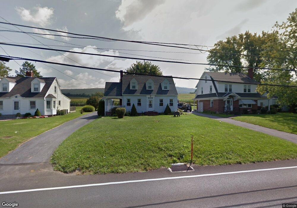
7522 Anthony Hwy Waynesboro, PA 17268
Estimated Value: $174,529 - $268,000
--
Bed
--
Bath
1,320
Sq Ft
$163/Sq Ft
Est. Value
About This Home
This home is located at 7522 Anthony Hwy, Waynesboro, PA 17268 and is currently estimated at $215,382, approximately $163 per square foot. 7522 Anthony Hwy is a home located in Franklin County with nearby schools including Waynesboro Area Senior High School, Providence School - Pigeon Hill Building, and CITY LIGHT SCHOOL.
Ownership History
Date
Name
Owned For
Owner Type
Purchase Details
Closed on
Mar 27, 2018
Sold by
Kauffman Beverly and Estate Of Dirtch Sr
Bought by
Pearson Amanda M and Pearson Robert R
Current Estimated Value
Home Financials for this Owner
Home Financials are based on the most recent Mortgage that was taken out on this home.
Original Mortgage
$84,000
Outstanding Balance
$72,138
Interest Rate
4.38%
Mortgage Type
New Conventional
Estimated Equity
$143,244
Create a Home Valuation Report for This Property
The Home Valuation Report is an in-depth analysis detailing your home's value as well as a comparison with similar homes in the area
Home Values in the Area
Average Home Value in this Area
Purchase History
| Date | Buyer | Sale Price | Title Company |
|---|---|---|---|
| Pearson Amanda M | $105,000 | None Available |
Source: Public Records
Mortgage History
| Date | Status | Borrower | Loan Amount |
|---|---|---|---|
| Open | Pearson Amanda M | $84,000 |
Source: Public Records
Tax History Compared to Growth
Tax History
| Year | Tax Paid | Tax Assessment Tax Assessment Total Assessment is a certain percentage of the fair market value that is determined by local assessors to be the total taxable value of land and additions on the property. | Land | Improvement |
|---|---|---|---|---|
| 2025 | $2,265 | $15,520 | $650 | $14,870 |
| 2024 | $2,195 | $15,520 | $650 | $14,870 |
| 2023 | $2,134 | $15,520 | $650 | $14,870 |
| 2022 | $2,072 | $15,520 | $650 | $14,870 |
| 2021 | $2,010 | $15,520 | $650 | $14,870 |
| 2020 | $2,010 | $15,520 | $650 | $14,870 |
| 2019 | $1,964 | $15,520 | $650 | $14,870 |
| 2018 | $1,453 | $11,880 | $650 | $11,230 |
| 2017 | $1,420 | $11,880 | $650 | $11,230 |
| 2016 | $340 | $11,880 | $650 | $11,230 |
| 2015 | $317 | $11,880 | $650 | $11,230 |
| 2014 | $317 | $11,880 | $650 | $11,230 |
Source: Public Records
Map
Nearby Homes
- 7468 Anthony Hwy
- 5434 Manheim Rd
- 8620 Monns Gap Rd
- 6159 Orphanage Rd
- 8652 Mormon Church Rd
- 286 Verdier St
- 207 University Dr
- 111 Poplar St
- 6 S Main St
- 6456 Wayne Hwy
- 8655 Wayne Hwy
- 7205 Fairway Dr S
- 6158 Merion Dr
- 7130 St Annes Dr
- 7059 Duck Hook Ln
- 7136 Sandwich Ln
- 7060 Duck Hook Ln
- 7121 Sandwich Ln
- 6337 Medina Ridge Dr
- 6852 Lytham Ln
- 7508 Anthony Hwy
- 7534 Anthony Hwy
- 7544 Anthony Hwy
- 7560 Anthony Hwy
- 7574 Anthony Hwy
- 0 Anthony Hwy Unit FL9840816
- 0 Anthony Hwy Unit 1004910798
- 7575 Anthony Hwy
- 7626 Anthony Hwy
- 7432 Anthony Hwy
- 7628 Anthony Hwy
- 7640 Anthony Hwy
- 7652 Anthony Hwy
- 7662 Anthony Hwy
- 7670 Anthony Hwy
- 6440 Slabtown Rd
- 7978 Tomstown Rd
- 6472 Slabtown Rd
- 7680 Anthony Hwy
- 6518 Slabtown Rd