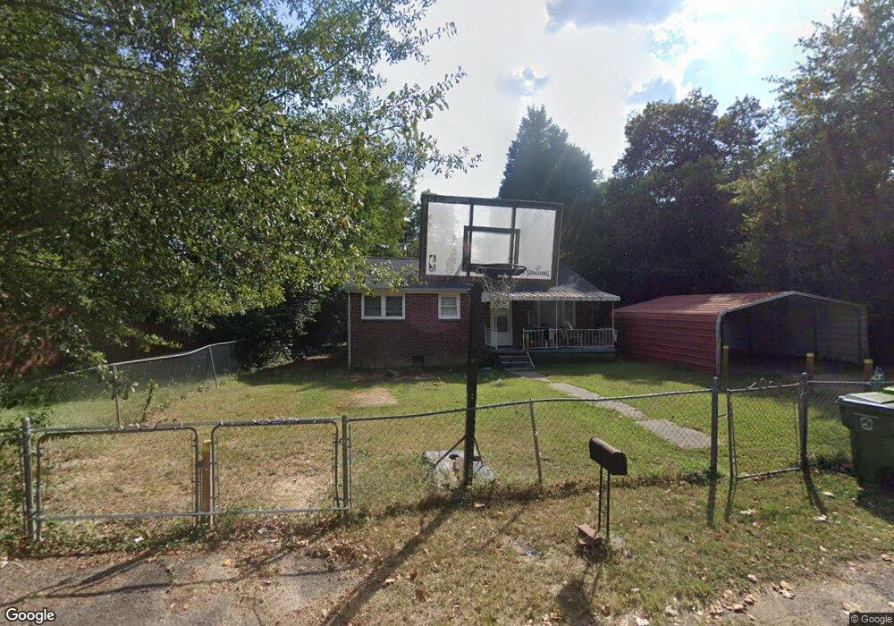
7524 Marie St Columbia, SC 29209
Southeast Columbia NeighborhoodEstimated Value: $84,000 - $137,000
2
Beds
1
Bath
945
Sq Ft
$124/Sq Ft
Est. Value
About This Home
This home is located at 7524 Marie St, Columbia, SC 29209 and is currently estimated at $117,063, approximately $123 per square foot. 7524 Marie St is a home located in Richland County with nearby schools including Mill Creek Elementary School, Hopkins Middle School, and Lower Richland High School.
Ownership History
Date
Name
Owned For
Owner Type
Purchase Details
Closed on
Feb 2, 2005
Sold by
Kachmarsky John and The Estates Of Stephen & Annel
Bought by
Irmo Properties Llc
Current Estimated Value
Home Financials for this Owner
Home Financials are based on the most recent Mortgage that was taken out on this home.
Original Mortgage
$33,000
Outstanding Balance
$16,740
Interest Rate
5.72%
Mortgage Type
Purchase Money Mortgage
Estimated Equity
$100,323
Create a Home Valuation Report for This Property
The Home Valuation Report is an in-depth analysis detailing your home's value as well as a comparison with similar homes in the area
Home Values in the Area
Average Home Value in this Area
Purchase History
| Date | Buyer | Sale Price | Title Company |
|---|---|---|---|
| Irmo Properties Llc | $33,000 | -- |
Source: Public Records
Mortgage History
| Date | Status | Borrower | Loan Amount |
|---|---|---|---|
| Open | Irmo Properties Llc | $33,000 |
Source: Public Records
Tax History Compared to Growth
Tax History
| Year | Tax Paid | Tax Assessment Tax Assessment Total Assessment is a certain percentage of the fair market value that is determined by local assessors to be the total taxable value of land and additions on the property. | Land | Improvement |
|---|---|---|---|---|
| 2024 | $1,787 | $55,300 | $0 | $0 |
| 2023 | $1,787 | $1,924 | $0 | $0 |
| 2022 | $1,639 | $48,100 | $7,300 | $40,800 |
| 2021 | $1,621 | $2,890 | $0 | $0 |
| 2020 | $1,629 | $2,890 | $0 | $0 |
| 2019 | $1,598 | $2,890 | $0 | $0 |
| 2018 | $1,400 | $2,510 | $0 | $0 |
| 2017 | $1,365 | $2,510 | $0 | $0 |
| 2016 | $1,344 | $2,510 | $0 | $0 |
| 2015 | $1,327 | $2,510 | $0 | $0 |
| 2014 | $1,304 | $41,800 | $0 | $0 |
| 2013 | -- | $2,510 | $0 | $0 |
Source: Public Records
Map
Nearby Homes
- 168 Ashewood Commons Dr
- 360 Council Loop
- 909 Eastmont Dr
- 842 Eastmont Dr
- 1527 Burnside Ave
- 797 Phipps Ln
- 349 Eastfair Dr
- 8025 Skylark Dr
- 113 Colonial Commons Ln
- 115 Colonial Commons Ln
- 2 Routhland Ct
- 101 Colonial Commons Ln
- 220 Wheat Farm Rd
- 208 Wheat Farm Rd
- 217 Wheat Farm Rd
- 213 Wheat Farm Rd
- 267 Blue Savannah St
- 26 Vendue Ct
- 263 Blue Savannah St
- 106 Colonial Commons Ln
- 7532 Marie St
- 7516 Marie St
- 7540 Marie St
- 7525 Marie St
- 7512 Marie St
- 7541 Marie St
- 7517 Marie St
- 7600 Marie St
- 720 Hazelwood Rd
- 7603 Marie St
- 7608 Marie St
- 7522 Stephen St
- 7530 Stephen St
- 7611 Marie St
- 7514 Stephen St
- 7538 Stephen St
- 7616 Marie St
- 7604 Stephen St
- NE/S Garners Ferry Rd
- 7625 Marie St