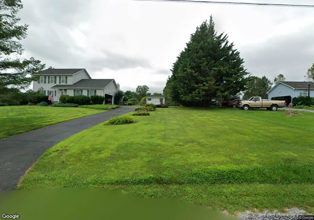
7527 Rock Jim Rd Stewartstown, PA 17363
Estimated Value: $364,000 - $383,000
3
Beds
3
Baths
1,720
Sq Ft
$218/Sq Ft
Est. Value
About This Home
This home is located at 7527 Rock Jim Rd, Stewartstown, PA 17363 and is currently estimated at $374,360, approximately $217 per square foot. 7527 Rock Jim Rd is a home located in York County with nearby schools including South Eastern Intermediate School, South Eastern Middle School, and Kennard-Dale High School.
Ownership History
Date
Name
Owned For
Owner Type
Purchase Details
Closed on
Jul 14, 2000
Sold by
Hinkle Gregory A and Foose Debra A
Bought by
Hannum David Keith and Hannum Wendy Ewing
Current Estimated Value
Home Financials for this Owner
Home Financials are based on the most recent Mortgage that was taken out on this home.
Original Mortgage
$120,000
Outstanding Balance
$42,788
Interest Rate
8.18%
Estimated Equity
$331,572
Purchase Details
Closed on
Apr 26, 1993
Bought by
Hinkle Gregory A
Create a Home Valuation Report for This Property
The Home Valuation Report is an in-depth analysis detailing your home's value as well as a comparison with similar homes in the area
Home Values in the Area
Average Home Value in this Area
Purchase History
| Date | Buyer | Sale Price | Title Company |
|---|---|---|---|
| Hannum David Keith | $150,000 | -- | |
| Hinkle Gregory A | $135,000 | -- |
Source: Public Records
Mortgage History
| Date | Status | Borrower | Loan Amount |
|---|---|---|---|
| Open | Hannum David Keith | $120,000 | |
| Closed | Hannum David Keith | $15,000 |
Source: Public Records
Tax History Compared to Growth
Tax History
| Year | Tax Paid | Tax Assessment Tax Assessment Total Assessment is a certain percentage of the fair market value that is determined by local assessors to be the total taxable value of land and additions on the property. | Land | Improvement |
|---|---|---|---|---|
| 2025 | $5,704 | $189,200 | $50,000 | $139,200 |
| 2024 | $5,676 | $189,200 | $50,000 | $139,200 |
| 2023 | $5,676 | $189,200 | $50,000 | $139,200 |
| 2022 | $5,676 | $189,200 | $50,000 | $139,200 |
| 2021 | $5,466 | $189,200 | $50,000 | $139,200 |
| 2020 | $5,466 | $189,200 | $50,000 | $139,200 |
| 2019 | $5,447 | $189,200 | $50,000 | $139,200 |
| 2018 | $5,447 | $189,200 | $50,000 | $139,200 |
| 2017 | $5,436 | $189,200 | $50,000 | $139,200 |
| 2016 | $0 | $189,200 | $50,000 | $139,200 |
| 2015 | -- | $189,200 | $50,000 | $139,200 |
| 2014 | -- | $189,200 | $50,000 | $139,200 |
Source: Public Records
Map
Nearby Homes
- 7923 Hickory Rd
- 14754 Lowe Rd
- 8292 Hickory Rd
- 15792 Cross Mill Rd
- 14639 Hyson School Rd
- 18010 Dave Anne Cir
- 18183 Piedmont Rd
- 545 Log House Rd Unit 116
- 210 Runningboard Rd
- 525 Log House Rd Unit 118
- 119 Edie Cir
- 515 Log House Rd Unit 119
- 200 Patterson Dr Unit 52
- 180 Patterson Dr Unit 50
- 170 Patterson Dr Unit 49
- 4389 Hess Rd
- 10 Black Oak Ct
- 160 Patterson Dr Unit 48
- 13503 Fishel Rd
- 140 Lantern Ln
- 7465 Rock Jim Rd
- 7561 Rock Jim Rd
- 7427 Rock Jim Rd
- 7431 Rock Jim Rd
- 7591 Rock Jim Rd
- 7415 Rock Jim Rd
- 7641 Rock Jim Rd
- 7530 Rock Jim Rd
- 7528 Rock Jim Rd
- 5878 Marys Cir
- 5870 Marys Cir
- 5900 Marys Cir
- 5881 Marys Cir
- 5932 Marys Cir
- 5917 Marys Cir
- 5943 Marys Cir
- 5980 Marys Cir
- 5975 Marys Cir
- 6014 Marys Cir
- 6500 Mccleary Rd