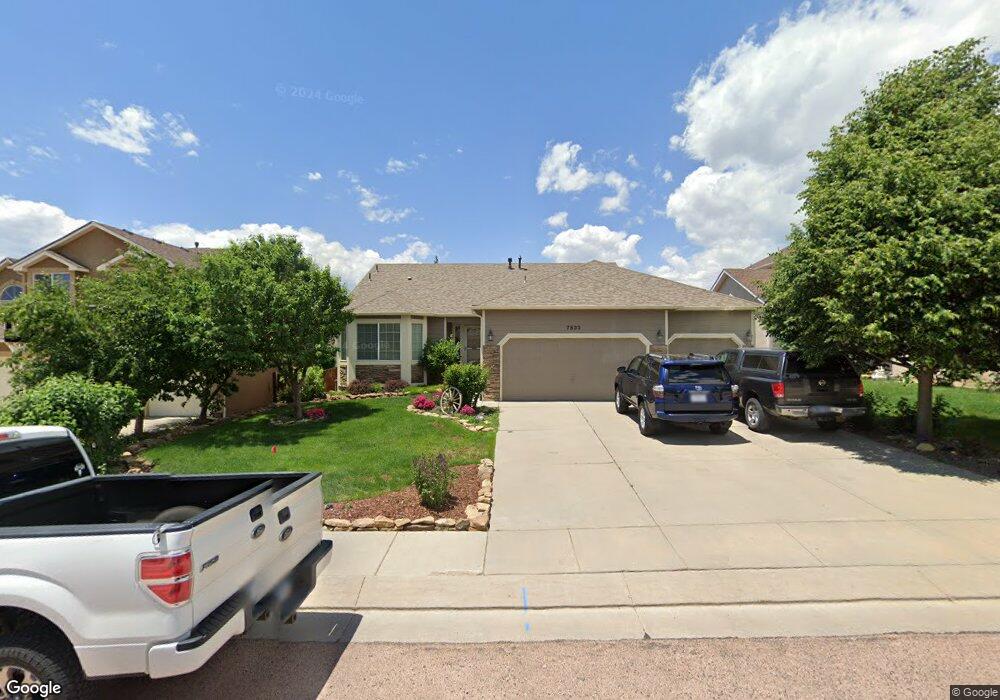
7533 Campstool Dr Colorado Springs, CO 80922
Estimated Value: $487,765 - $559,000
4
Beds
4
Baths
1,434
Sq Ft
$361/Sq Ft
Est. Value
About This Home
This home is located at 7533 Campstool Dr, Colorado Springs, CO 80922 and is currently estimated at $517,441, approximately $360 per square foot. 7533 Campstool Dr is a home located in El Paso County with nearby schools including Springs Ranch Elementary School, Horizon Middle School, and Sand Creek High School.
Ownership History
Date
Name
Owned For
Owner Type
Purchase Details
Closed on
May 31, 2006
Sold by
Campbell Homes Llc
Bought by
Gillespie Jeffrey D and Gillespie Kathleen A
Current Estimated Value
Home Financials for this Owner
Home Financials are based on the most recent Mortgage that was taken out on this home.
Original Mortgage
$321,542
Outstanding Balance
$189,146
Interest Rate
6.58%
Mortgage Type
VA
Estimated Equity
$328,295
Create a Home Valuation Report for This Property
The Home Valuation Report is an in-depth analysis detailing your home's value as well as a comparison with similar homes in the area
Home Values in the Area
Average Home Value in this Area
Purchase History
| Date | Buyer | Sale Price | Title Company |
|---|---|---|---|
| Gillespie Jeffrey D | $314,775 | Fahtco |
Source: Public Records
Mortgage History
| Date | Status | Borrower | Loan Amount |
|---|---|---|---|
| Open | Gillespie Jeffrey D | $321,542 |
Source: Public Records
Tax History Compared to Growth
Tax History
| Year | Tax Paid | Tax Assessment Tax Assessment Total Assessment is a certain percentage of the fair market value that is determined by local assessors to be the total taxable value of land and additions on the property. | Land | Improvement |
|---|---|---|---|---|
| 2025 | $2,170 | $35,130 | -- | -- |
| 2024 | $1,592 | $34,790 | $4,620 | $30,170 |
| 2023 | $1,592 | $34,790 | $4,620 | $30,170 |
| 2022 | $1,333 | $26,450 | $4,170 | $22,280 |
| 2021 | $1,388 | $27,210 | $4,290 | $22,920 |
| 2020 | $1,181 | $24,160 | $3,580 | $20,580 |
| 2019 | $1,171 | $24,160 | $3,580 | $20,580 |
| 2018 | $946 | $20,710 | $3,020 | $17,690 |
| 2017 | $1,326 | $20,710 | $3,020 | $17,690 |
| 2016 | $1,488 | $22,930 | $2,950 | $19,980 |
| 2015 | $1,490 | $22,930 | $2,950 | $19,980 |
| 2014 | $1,518 | $22,930 | $2,790 | $20,140 |
Source: Public Records
Map
Nearby Homes
- 4013 Pronghorn Meadows Cir
- 4144 Poplar Brook Dr
- 3707 Reindeer Cir
- Trinity Plan at Windermere - 3500 Series
- 3944 Ryedale Way
- 4029 Ryedale Way
- 3880 Happy Jack Dr
- 3617 Vineyard Cir
- 3850 Springs Ranch Dr
- 4013 Patterdale Place
- 3863 Vineyard Cir
- 4126 Fellsland Dr
- 4307 Addax Ct
- 7350 Axis Point
- 4148 Heathmoor Dr
- 7307 Axis Point
- 7215 Amber Ridge Dr
- 4404 Poplar Brook Dr
- 7117 Saddle Up Dr
- 4325 Crow Creek Dr
- 7541 Campstool Dr
- 7525 Campstool Dr
- 3845 Pronghorn Meadows Cir
- 3869 Pronghorn Meadows Cir
- 7549 Campstool Dr
- 7517 Campstool Dr
- 3833 Pronghorn Meadows Cir
- 3881 Pronghorn Meadows Cir
- 7534 Campstool Dr
- 7526 Campstool Dr
- 7557 Campstool Dr
- 7542 Campstool Dr
- 7509 Campstool Dr
- 3893 Pronghorn Meadows Cir
- 3809 Pronghorn Meadows Cir
- 7518 Campstool Dr
- 7550 Campstool Dr
- 7510 Campstool Dr
- 7501 Campstool Dr
- 3905 Pronghorn Meadows Cir