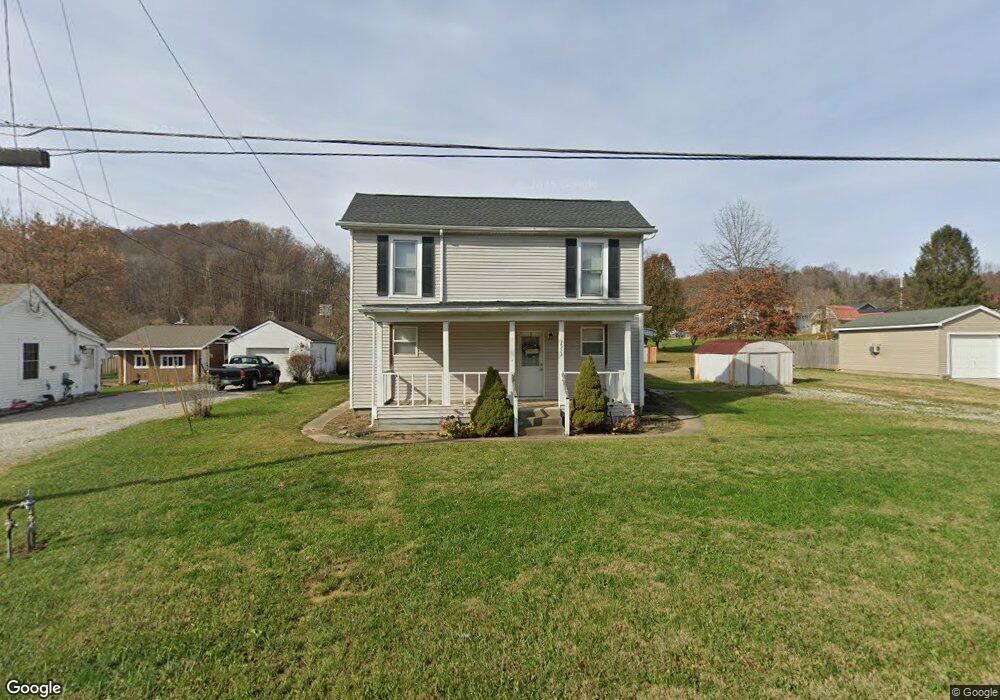
7533 N State Route 139 Lucasville, OH 45648
Estimated Value: $77,000 - $181,000
4
Beds
2
Baths
1,320
Sq Ft
$100/Sq Ft
Est. Value
About This Home
This home is located at 7533 N State Route 139, Lucasville, OH 45648 and is currently estimated at $131,520, approximately $99 per square foot. 7533 N State Route 139 is a home located in Scioto County with nearby schools including Valley Elementary School, Valley Middle School, and Valley High School.
Ownership History
Date
Name
Owned For
Owner Type
Purchase Details
Closed on
Sep 16, 2015
Sold by
Lilly Devan
Bought by
Howard Marcus
Current Estimated Value
Purchase Details
Closed on
May 8, 2013
Sold by
Wells Fargo Bank Na As Trustee For F
Bought by
Lilly Devan N and Lilly
Purchase Details
Closed on
Nov 27, 2012
Sold by
Donini Marty V
Bought by
Wells Fargo Bank Na and First Franklin Mortgage Loan Trust 2006-
Purchase Details
Closed on
Oct 27, 2005
Bought by
Stepp Gary + Erika J and Stepp S
Purchase Details
Closed on
Sep 16, 2005
Sold by
Gaines Harrison D + Karen
Bought by
Midfirst Bank
Purchase Details
Closed on
Jun 19, 1998
Sold by
Buckle Walter L + Erma L
Bought by
Gaines Harrison D + Karen
Create a Home Valuation Report for This Property
The Home Valuation Report is an in-depth analysis detailing your home's value as well as a comparison with similar homes in the area
Home Values in the Area
Average Home Value in this Area
Purchase History
| Date | Buyer | Sale Price | Title Company |
|---|---|---|---|
| Howard Marcus | -- | -- | |
| Lilly Devan N | -- | -- | |
| Wells Fargo Bank Na | $30,000 | Manley Deas Kochalski Llc | |
| Wells Fargo Bank | $30,000 | -- | |
| Stepp Gary + Erika J | $50,000 | -- | |
| Midfirst Bank | $32,000 | -- | |
| Gaines Harrison D + Karen | $51,000 | -- |
Source: Public Records
Tax History Compared to Growth
Tax History
| Year | Tax Paid | Tax Assessment Tax Assessment Total Assessment is a certain percentage of the fair market value that is determined by local assessors to be the total taxable value of land and additions on the property. | Land | Improvement |
|---|---|---|---|---|
| 2024 | $1,104 | $23,810 | $4,820 | $18,990 |
| 2023 | $1,583 | $23,810 | $4,820 | $18,990 |
| 2022 | $1,698 | $23,810 | $4,820 | $18,990 |
| 2021 | $1,243 | $19,320 | $4,240 | $15,080 |
| 2020 | $1,235 | $19,320 | $4,240 | $15,080 |
| 2019 | $859 | $17,560 | $3,850 | $13,710 |
| 2018 | $920 | $17,560 | $3,850 | $13,710 |
| 2017 | $804 | $17,560 | $3,850 | $13,710 |
| 2016 | $840 | $15,810 | $3,100 | $12,710 |
| 2015 | $761 | $15,810 | $3,100 | $12,710 |
| 2013 | $662 | $15,810 | $3,100 | $12,710 |
Source: Public Records
Map
Nearby Homes
- 7948 State Route 139
- 7080 Ohio 139
- 7042 Ohio 139
- 8499 Ohio 139
- 296 Clay Dr
- 640 Rases Mountain Dr
- 311 Diane St
- 0-5A Rice Rd
- 0-5B Rice Rd
- 0-5 Rice Rd
- 0-2C Rice Rd
- 0-2B Rice Rd
- 0-2A Rice Rd
- 436 High St
- 373 Piketon Rd
- 1987 Swauger Valley Rd
- Lot 9 Hearthstone Dr
- 0 Hearthstone Dr
- 224 Breckenridge Dr
- 1720 Swauger Valley Rd
- 7537 N State Route 139
- 7517 Ohio 139
- 7517 N State Route 139
- 7563 N State Route 139
- 36 Clark St Unit LONG
- 36 Clark St
- 51 Smith Perry Rd
- 7567 N State Route 139
- 45 Smith Perry Rd
- 73 Smith Perry Rd
- 7579 N State Route 139
- 7530 N State Route 139
- 58 Clark St
- 7526 N State Route 139
- 89 Smith Perry Rd
- 33 Clark St
- 7589 N State Route 139
- 48 Smith Perry Rd
- 48 Smith Perry Rd
- 7603 N State Route 139