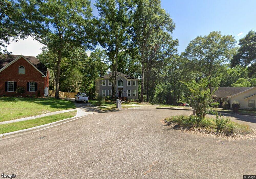
7535 Brockton Ct Mobile, AL 36695
Second Creek NeighborhoodEstimated Value: $345,405 - $407,000
4
Beds
3
Baths
3,028
Sq Ft
$125/Sq Ft
Est. Value
About This Home
This home is located at 7535 Brockton Ct, Mobile, AL 36695 and is currently estimated at $378,851, approximately $125 per square foot. 7535 Brockton Ct is a home located in Mobile County with nearby schools including O'rourke Elementary School, Burns Middle School, and WP Davidson High School.
Ownership History
Date
Name
Owned For
Owner Type
Purchase Details
Closed on
Mar 22, 2024
Sold by
Gillis Living Trust
Bought by
Gillis William E and Gillis Stephanie M
Current Estimated Value
Purchase Details
Closed on
Feb 25, 2009
Sold by
Gillis William E and Gillis Stephanie M
Bought by
Gillis William E and Gillis Stephanie M
Home Financials for this Owner
Home Financials are based on the most recent Mortgage that was taken out on this home.
Original Mortgage
$234,000
Interest Rate
5.29%
Mortgage Type
Unknown
Purchase Details
Closed on
Feb 20, 2008
Sold by
Gillis William E and Gillis Stephanie M
Bought by
Gillis William E and Gillis Stephanie M
Create a Home Valuation Report for This Property
The Home Valuation Report is an in-depth analysis detailing your home's value as well as a comparison with similar homes in the area
Home Values in the Area
Average Home Value in this Area
Purchase History
| Date | Buyer | Sale Price | Title Company |
|---|---|---|---|
| Gillis William E | $299,500 | None Listed On Document | |
| Gillis William E | -- | None Available | |
| Gillis William E | $234,500 | None Available | |
| Gillis William E | -- | None Available |
Source: Public Records
Mortgage History
| Date | Status | Borrower | Loan Amount |
|---|---|---|---|
| Previous Owner | Gillis William E | $234,000 |
Source: Public Records
Tax History
| Year | Tax Paid | Tax Assessment Tax Assessment Total Assessment is a certain percentage of the fair market value that is determined by local assessors to be the total taxable value of land and additions on the property. | Land | Improvement |
|---|---|---|---|---|
| 2025 | $1,517 | $32,440 | $4,950 | $27,490 |
| 2024 | $1,517 | $31,370 | $4,500 | $26,870 |
| 2023 | $1,465 | $29,930 | $6,000 | $23,930 |
| 2022 | $1,402 | $30,270 | $6,000 | $24,270 |
| 2021 | $1,434 | $30,940 | $6,000 | $24,940 |
| 2020 | $1,450 | $31,280 | $6,000 | $25,280 |
| 2019 | $1,421 | $30,680 | $6,000 | $24,680 |
| 2018 | $1,437 | $31,000 | $0 | $0 |
| 2017 | $1,437 | $31,000 | $0 | $0 |
| 2016 | $1,481 | $31,920 | $0 | $0 |
| 2013 | $1,400 | $29,440 | $0 | $0 |
Source: Public Records
Map
Nearby Homes
- 1542 Stone Hedge Dr W
- 1337 Carson Rd W
- 1291 Carson Rd W
- 7693 Pembroke Cir
- 1265 Hanover Ct
- 1171 Newbury Ln E
- 7271 Carson Rd S
- 1484 Pebble Creek Dr
- 1361 Dellwyn Ct
- 1645 Ashmoor Dr E
- 1735 Ashmoor Dr W
- 7485 Creekwood Dr
- 7328 Janita Dr
- 7671 Creekwood Dr
- 1130 Jonathan Ct
- 8621 Grelot Rd
- 1263 Smithfield Rd E
- 7190 Bradshaw Ct
- 1000 Choctaw Bluff Rd
- 1930 Bradshire Dr
- 7515 Brockton Ct
- 7545 Brockton Ct
- 7480 Brockton Ln W
- 7550 Brockton Ct
- 7505 Brockton Ct
- 7530 Brockton Ct
- 7490 Brockton Ln W
- 7520 Brockton Ct
- 7510 Brockton Ct
- 7492 Brockton Ln W
- 7485 Brockton Ln W
- 1471 Stone Hedge Dr
- 7500 Brockton Ct
- 7480 Brockton Ct
- 1451 Stone Hedge Dr
- 7491 Brockton Ln W
- 7494 Brockton Ln W
- 7475 Brockton Ln N
- 7521 Quency Dr
- 7541 Quency Dr