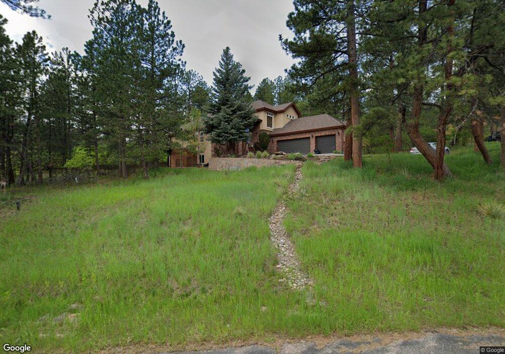
7535 Engineers Ct Larkspur, CO 80118
Estimated Value: $836,558 - $1,062,000
3
Beds
3
Baths
2,535
Sq Ft
$379/Sq Ft
Est. Value
About This Home
This home is located at 7535 Engineers Ct, Larkspur, CO 80118 and is currently estimated at $961,390, approximately $379 per square foot. 7535 Engineers Ct is a home located in Douglas County with nearby schools including Larkspur Elementary School, Castle Rock Middle School, and Castle View High School.
Ownership History
Date
Name
Owned For
Owner Type
Purchase Details
Closed on
Jan 18, 2000
Sold by
Briarwood Investment Group Inc
Bought by
Erickson Glen T
Current Estimated Value
Purchase Details
Closed on
Nov 25, 1996
Sold by
Briarwood Inv Group Inc
Bought by
Tanzanite Custom Builders Inc
Purchase Details
Closed on
Nov 13, 1996
Sold by
Hanfco Inc
Bought by
Briarwood Investment Group Inc
Purchase Details
Closed on
Mar 28, 1991
Sold by
Briarwood Inv Group Inc
Bought by
Hanfco Inc Dba & Mountain Region Inc
Purchase Details
Closed on
Sep 21, 1990
Sold by
Rassilyer Ronald Lee
Bought by
Briarwood Inv Group Inc
Purchase Details
Closed on
May 16, 1990
Sold by
Briarwood Inv Group Inc
Bought by
Rassilyer Ronald Lee
Purchase Details
Closed on
Jun 15, 1973
Sold by
Mountain States Land Co
Bought by
Arville Elder B and Arville John
Create a Home Valuation Report for This Property
The Home Valuation Report is an in-depth analysis detailing your home's value as well as a comparison with similar homes in the area
Home Values in the Area
Average Home Value in this Area
Purchase History
| Date | Buyer | Sale Price | Title Company |
|---|---|---|---|
| Erickson Glen T | $80,000 | Title Services | |
| Briarwood Group Inc | -- | Title Services | |
| Tanzanite Custom Builders Inc | $63,000 | -- | |
| Briarwood Investment Group Inc | -- | -- | |
| Hanfco Inc Dba & Mountain Region Inc | $12,500 | -- | |
| Briarwood Inv Group Inc | -- | -- | |
| Rassilyer Ronald Lee | $17,500 | -- | |
| Arville Elder B | $11,700 | -- |
Source: Public Records
Tax History Compared to Growth
Tax History
| Year | Tax Paid | Tax Assessment Tax Assessment Total Assessment is a certain percentage of the fair market value that is determined by local assessors to be the total taxable value of land and additions on the property. | Land | Improvement |
|---|---|---|---|---|
| 2024 | $5,577 | $60,910 | $12,480 | $48,430 |
| 2023 | $5,633 | $60,910 | $12,480 | $48,430 |
| 2022 | $4,205 | $44,390 | $8,530 | $35,860 |
| 2021 | $4,352 | $44,390 | $8,530 | $35,860 |
| 2020 | $3,979 | $41,420 | $7,440 | $33,980 |
| 2019 | $3,992 | $41,420 | $7,440 | $33,980 |
| 2018 | $3,525 | $35,930 | $6,820 | $29,110 |
| 2017 | $3,313 | $35,930 | $6,820 | $29,110 |
| 2016 | $3,395 | $36,210 | $6,530 | $29,680 |
| 2015 | $3,320 | $36,210 | $6,530 | $29,680 |
| 2014 | $2,906 | $29,720 | $4,700 | $25,020 |
Source: Public Records
Map
Nearby Homes
- 0 E Cherry Creek Rd Unit 2541327
- 0 E Cherry Creek Rd Unit REC1786246
- 929 Tenderfoot Dr
- 670 Independence Dr
- 7737 Taylor Cir
- 691 Cumberland Rd
- 773 Copper Fox Place
- 950 Tenderfoot Dr
- 7596 Rollins Dr
- 720 Copper Fox Place
- 682 Copper Fox Place
- 1600 Independence Dr
- 1600 Independence Dr Unit 50
- 533 Tenderfoot Dr
- 7317 Fremont Place
- 1038 Tenderfoot Dr
- 648 Copper Fox Place Unit 5
- 665 Copper Fox Place
- 7076 Boreas Rd
- 7994 Monarch Rd
- 7526 Cameron Dr Unit 3
- 7526 Cameron Dr
- 7511 Engineers Ct
- 7546 Cameron Dr
- 7524 Engineers Ct
- 802 Independence Dr
- 870 Cottonwood Ln
- 7510 Cameron Dr
- 7485 Engineers Ct
- 770 Independence Dr
- 861 Cottonwood Ln
- 7496 Cameron Dr
- 7521 Cameron Dr
- 7473 Engineers Ct
- 890 Cottonwood Ln
- 7480 Engineers Ct
- 879 Cottonwood Ln
- 697 Tenderfoot Dr
- 882 Independence Dr
- 673 Tenderfoot Dr