Estimated Value: $169,926 - $254,000
--
Bed
2
Baths
1,968
Sq Ft
$102/Sq Ft
Est. Value
About This Home
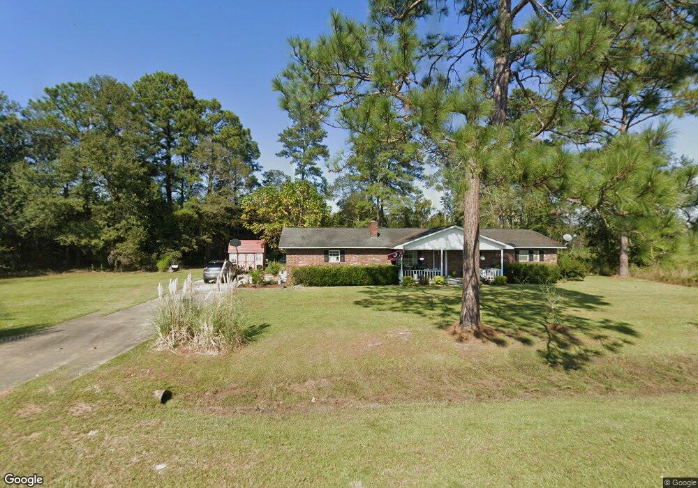
This home is located at 7536 Tank Rd, Odum, GA 31555 and is currently estimated at $200,732, approximately $101 per square foot. 7536 Tank Rd is a home located in Wayne County with nearby schools including Odum Elementary School, Martha Puckett Middle School, and Wayne County High School.
Ownership History
Date
Name
Owned For
Owner Type
Purchase Details
Closed on
Jan 20, 2017
Sold by
Lane Christi B
Bought by
Lane Carl D
Current Estimated Value
Purchase Details
Closed on
Jul 1, 2000
Sold by
Lane Carl D
Bought by
Lane Carl D and Lane Christi B
Purchase Details
Closed on
Jun 1, 1973
Purchase Details
Closed on
Jan 1, 1972
Create a Home Valuation Report for This Property
The Home Valuation Report is an in-depth analysis detailing your home's value as well as a comparison with similar homes in the area
Home Values in the Area
Average Home Value in this Area
Purchase History
| Date | Buyer | Sale Price | Title Company |
|---|---|---|---|
| Lane Carl D | -- | -- | |
| Lane Carl D | -- | -- | |
| -- | $73,000 | -- | |
| -- | -- | -- | |
| -- | -- | -- |
Source: Public Records
Tax History Compared to Growth
Tax History
| Year | Tax Paid | Tax Assessment Tax Assessment Total Assessment is a certain percentage of the fair market value that is determined by local assessors to be the total taxable value of land and additions on the property. | Land | Improvement |
|---|---|---|---|---|
| 2024 | $1,322 | $54,915 | $792 | $54,123 |
| 2023 | $740 | $48,195 | $792 | $47,403 |
| 2022 | $1,064 | $38,786 | $792 | $37,994 |
| 2021 | $896 | $31,569 | $792 | $30,777 |
| 2020 | $1,014 | $34,077 | $3,300 | $30,777 |
| 2019 | $1,045 | $34,077 | $3,300 | $30,777 |
| 2018 | $1,045 | $34,077 | $3,300 | $30,777 |
| 2017 | $899 | $34,077 | $3,300 | $30,777 |
| 2016 | $870 | $34,077 | $3,300 | $30,777 |
| 2014 | $1,008 | $38,583 | $3,300 | $35,283 |
| 2013 | -- | $38,582 | $3,300 | $35,282 |
Source: Public Records
Map
Nearby Homes
- Lot 00 Moss Landing
- Lots 26+ Moss Landing
- Lot 21 Moss Landing
- 10 Beards Bluff Rd
- 000 Beards Bluff Rd
- 0 N Church St
- 0 Tract 3 Hwy 341 & Bennett Mill Pond Rd Unit 1656129
- 0 Tract 6 Hwy 341 & Bennett Mill Rd Unit 1656128
- 0 Bennett Mill Pond Rd
- 21 AC Hwy 341
- 468 Lake Lannell Rd
- 468 Lake Lanell Rd
- 10.00 AC Hwy 341 Odum Hwy
- TRACT 2 Bennett Mill Pond Rd
- Tract 4 Bennett Mill Pond Rd
- Tract 3 Bennett Mill Pond Rd
- TRACT 1 Bennett Mill Pond Rd
- 858 Hoke Ogden Rd
- 796 Lud Oquinn Rd
- 10.00 AC Highway 341
- 7667 Tank Rd
- 7390 Tank Rd
- 7721 Tank Rd
- 2277 Beards Bluff Rd
- 2085 Beards Bluff Rd
- 2070 Beards Bluff Rd
- 0 Bonham Rd Unit 18846
- 0 Bonham Rd Unit 145278
- 0 Bonham Rd Unit 1636341
- 0 Bonham Rd Unit 10092067
- 6926 Tank Rd
- 6923 Tank Rd
- 7979 Tank Rd
- 1140 Winn Rd
- 6875 Tank Rd
- 101 Maisie St
- 101 Maisie Dr
- 6760 Tank Rd
- 1037 N Church St
- 1021 N Church St