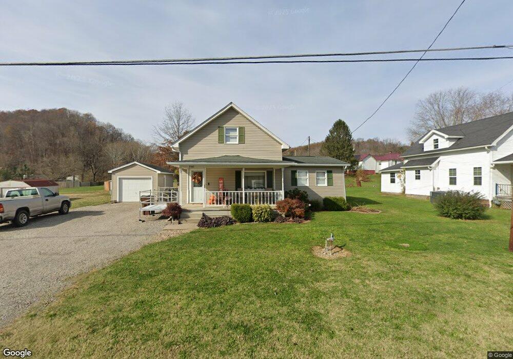
7537 N State Route 139 Lucasville, OH 45648
Estimated Value: $84,000 - $171,000
3
Beds
2
Baths
1,294
Sq Ft
$109/Sq Ft
Est. Value
About This Home
This home is located at 7537 N State Route 139, Lucasville, OH 45648 and is currently estimated at $141,116, approximately $109 per square foot. 7537 N State Route 139 is a home located in Scioto County with nearby schools including Valley Elementary School, Valley Middle School, and Valley High School.
Ownership History
Date
Name
Owned For
Owner Type
Purchase Details
Closed on
Jun 2, 2014
Sold by
Seth A Seth A and Deatley Sara L
Bought by
Strickland Richard L and Strickland Monica J
Current Estimated Value
Purchase Details
Closed on
May 5, 2008
Sold by
Scott Scott and Duncan Jennifer
Bought by
Deatley Seth A and Deatley Sara L
Purchase Details
Closed on
Jan 16, 2003
Bought by
Duncan Scott + Jennifer J
Purchase Details
Closed on
Dec 13, 2000
Sold by
Percell Harold + Dottie J
Bought by
Scott Ryan A + Elizabeth
Purchase Details
Closed on
Feb 21, 1997
Sold by
Holdren Robert F Jr + Apr
Bought by
Percell Harold + Dottie J
Create a Home Valuation Report for This Property
The Home Valuation Report is an in-depth analysis detailing your home's value as well as a comparison with similar homes in the area
Home Values in the Area
Average Home Value in this Area
Purchase History
| Date | Buyer | Sale Price | Title Company |
|---|---|---|---|
| Strickland Richard L | $87,500 | -- | |
| Deatley Seth A | -- | -- | |
| Deatley Seth A | -- | -- | |
| Duncan Scott + Jennifer J | $75,000 | -- | |
| Scott Ryan A + Elizabeth | $68,000 | -- | |
| Percell Harold + Dottie J | $10,800 | -- |
Source: Public Records
Tax History Compared to Growth
Tax History
| Year | Tax Paid | Tax Assessment Tax Assessment Total Assessment is a certain percentage of the fair market value that is determined by local assessors to be the total taxable value of land and additions on the property. | Land | Improvement |
|---|---|---|---|---|
| 2024 | $1,673 | $37,120 | $5,100 | $32,020 |
| 2023 | $1,673 | $37,120 | $5,100 | $32,020 |
| 2022 | $1,669 | $37,120 | $5,100 | $32,020 |
| 2021 | $1,545 | $33,810 | $4,660 | $29,150 |
| 2020 | $1,520 | $33,810 | $4,660 | $29,150 |
| 2019 | $1,488 | $30,720 | $4,220 | $26,500 |
| 2018 | $1,471 | $30,720 | $4,220 | $26,500 |
| 2017 | $1,395 | $30,720 | $4,220 | $26,500 |
| 2016 | $1,375 | $30,260 | $4,220 | $26,040 |
| 2015 | $1,375 | $30,260 | $4,220 | $26,040 |
| 2013 | $1,223 | $30,260 | $4,220 | $26,040 |
Source: Public Records
Map
Nearby Homes
- 7948 State Route 139
- 7080 Ohio 139
- 7042 Ohio 139
- 8499 Ohio 139
- 296 Clay Dr
- 640 Rases Mountain Dr
- 311 Diane St
- 0-5A Rice Rd
- 0-5B Rice Rd
- 0-5 Rice Rd
- 0-2C Rice Rd
- 0-2B Rice Rd
- 0-2A Rice Rd
- 436 High St
- 373 Piketon Rd
- 1987 Swauger Valley Rd
- Lot 9 Hearthstone Dr
- 0 Hearthstone Dr
- 224 Breckenridge Dr
- 1720 Swauger Valley Rd
- 7563 N State Route 139
- 7533 N State Route 139
- 7567 N State Route 139
- 51 Smith Perry Rd
- 45 Smith Perry Rd
- 7579 N State Route 139
- 7517 Ohio 139
- 7517 N State Route 139
- 73 Smith Perry Rd
- 7589 N State Route 139
- 36 Clark St Unit LONG
- 36 Clark St
- 7530 N State Route 139
- 48 Smith Perry Rd
- 48 Smith Perry Rd
- 89 Smith Perry Rd
- 7603 N State Route 139
- 44 Smith Perry Rd
- 58 Clark St
- 7526 N State Route 139