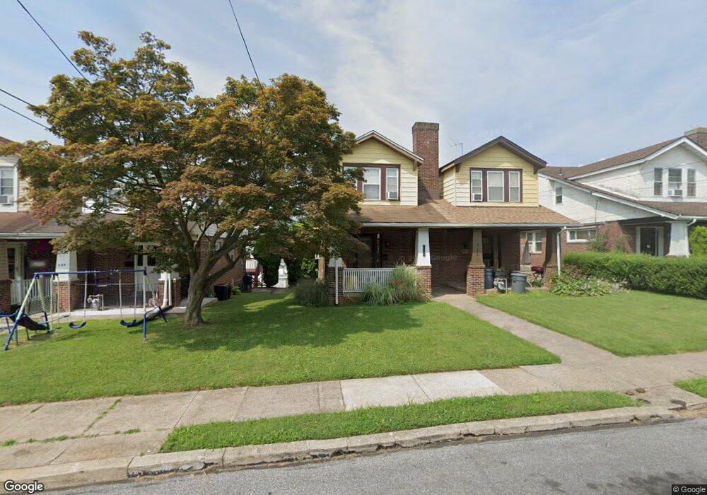
754 Bullock Ave Lansdowne, PA 19050
Estimated Value: $194,000 - $263,000
3
Beds
1
Bath
1,346
Sq Ft
$170/Sq Ft
Est. Value
About This Home
This home is located at 754 Bullock Ave, Lansdowne, PA 19050 and is currently estimated at $228,761, approximately $169 per square foot. 754 Bullock Ave is a home located in Delaware County with nearby schools including Evans Elementary School, Penn Wood Middle School, and Penn Wood High School - Cypress Street Campus.
Ownership History
Date
Name
Owned For
Owner Type
Purchase Details
Closed on
Jul 21, 2018
Sold by
Mayo Michael and Mayo Eileen
Bought by
Mayo Eileen and Mayo Kevin
Current Estimated Value
Home Financials for this Owner
Home Financials are based on the most recent Mortgage that was taken out on this home.
Original Mortgage
$45,000
Outstanding Balance
$14,861
Interest Rate
4.5%
Mortgage Type
Purchase Money Mortgage
Estimated Equity
$213,900
Purchase Details
Closed on
May 1, 1986
Sold by
Hall Walter J and Hall Janet
Bought by
Mayo Michael and Mayo Eileen
Create a Home Valuation Report for This Property
The Home Valuation Report is an in-depth analysis detailing your home's value as well as a comparison with similar homes in the area
Home Values in the Area
Average Home Value in this Area
Purchase History
| Date | Buyer | Sale Price | Title Company |
|---|---|---|---|
| Mayo Eileen | -- | None Available | |
| Mayo Michael | $43,000 | -- |
Source: Public Records
Mortgage History
| Date | Status | Borrower | Loan Amount |
|---|---|---|---|
| Open | Mayo Eileen | $45,000 |
Source: Public Records
Tax History Compared to Growth
Tax History
| Year | Tax Paid | Tax Assessment Tax Assessment Total Assessment is a certain percentage of the fair market value that is determined by local assessors to be the total taxable value of land and additions on the property. | Land | Improvement |
|---|---|---|---|---|
| 2025 | $4,477 | $104,840 | $32,890 | $71,950 |
| 2024 | $4,477 | $104,840 | $32,890 | $71,950 |
| 2023 | $4,066 | $104,840 | $32,890 | $71,950 |
| 2022 | $3,877 | $104,840 | $32,890 | $71,950 |
| 2021 | $5,863 | $104,840 | $32,890 | $71,950 |
| 2020 | $3,916 | $62,700 | $18,980 | $43,720 |
| 2019 | $3,847 | $62,700 | $18,980 | $43,720 |
| 2018 | $3,793 | $62,700 | $0 | $0 |
| 2017 | $3,714 | $62,700 | $0 | $0 |
| 2016 | $344 | $62,700 | $0 | $0 |
| 2015 | $351 | $62,700 | $0 | $0 |
| 2014 | $344 | $62,700 | $0 | $0 |
Source: Public Records
Map
Nearby Homes
- 800 Bullock Ave
- 740 Church Ln
- 722 Yeadon Ave
- 711 Yeadon Ave Unit 1
- 808 Serrill Ave
- 825 Laurel Rd
- 813 Arbor Rd
- 702 Cedar Ave
- 908 Yeadon Ave
- 921 Serrill Ave
- 939 Serrill Ave
- 923 Bell Ave
- 1016 Whitby Ave
- 530 Orchard Ave
- 1049 Yeadon Ave
- 536 Cypress St
- 503 Bonsall Ave
- 6535 Windsor St
- 435 Bonsall Ave
- 6718 Cobbs Creek Pkwy
- 752 Bullock Ave
- 756 Bullock Ave
- 750 Bullock Ave
- 758 Bullock Ave
- 748 Bullock Ave
- 760 Bullock Ave
- 762 Bullock Ave
- 751 Yeadon Ave
- 746 Bullock Ave
- 753 Yeadon Ave
- 755 Yeadon Ave
- 749 Yeadon Ave
- 757 Yeadon Ave
- 747 Yeadon Ave
- 744 Bullock Ave
- 759 Yeadon Ave
- 745 Yeadon Ave
- 761 Yeadon Ave
- 742 Bullock Ave
- 749 Bullock Ave