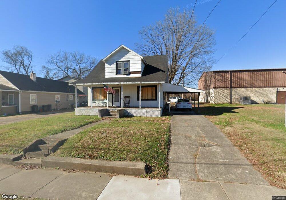
754 High St Coal Grove, OH 45638
Estimated Value: $63,000 - $134,000
3
Beds
1
Bath
1,092
Sq Ft
$84/Sq Ft
Est. Value
About This Home
This home is located at 754 High St, Coal Grove, OH 45638 and is currently estimated at $91,759, approximately $84 per square foot. 754 High St is a home located in Lawrence County with nearby schools including Dawson-Bryant Elementary School, Dawson-Bryant Middle School, and Dawson-Bryant High School.
Ownership History
Date
Name
Owned For
Owner Type
Purchase Details
Closed on
Jan 4, 2007
Sold by
Thompson Glenn E
Bought by
Thompson Brent E
Current Estimated Value
Purchase Details
Closed on
Sep 18, 2003
Sold by
Thompson Glenn E and Thompson Caro
Bought by
Thompson Glenn E
Purchase Details
Closed on
Jun 11, 2001
Sold by
Thompson Perry E Rem
Bought by
Sloan, Mary Life Est.
Purchase Details
Closed on
Mar 31, 1995
Sold by
Sloan Mary
Bought by
Thompson Perry E Rem
Create a Home Valuation Report for This Property
The Home Valuation Report is an in-depth analysis detailing your home's value as well as a comparison with similar homes in the area
Home Values in the Area
Average Home Value in this Area
Purchase History
| Date | Buyer | Sale Price | Title Company |
|---|---|---|---|
| Thompson Brent E | -- | Attorney | |
| Thompson Glenn E | $10,000 | -- | |
| Sloan, Mary Life Est. | -- | -- | |
| Thompson Perry E Rem | -- | -- |
Source: Public Records
Tax History Compared to Growth
Tax History
| Year | Tax Paid | Tax Assessment Tax Assessment Total Assessment is a certain percentage of the fair market value that is determined by local assessors to be the total taxable value of land and additions on the property. | Land | Improvement |
|---|---|---|---|---|
| 2024 | -- | $19,760 | $2,960 | $16,800 |
| 2023 | $689 | $19,760 | $2,960 | $16,800 |
| 2022 | $692 | $19,760 | $2,960 | $16,800 |
| 2021 | $474 | $15,580 | $2,470 | $13,110 |
| 2020 | $575 | $15,580 | $2,470 | $13,110 |
| 2019 | $574 | $15,580 | $2,470 | $13,110 |
| 2018 | $536 | $14,160 | $2,240 | $11,920 |
| 2017 | $535 | $14,160 | $2,240 | $11,920 |
| 2016 | $501 | $14,160 | $2,240 | $11,920 |
| 2015 | $556 | $14,900 | $2,240 | $12,660 |
| 2014 | $520 | $14,900 | $2,240 | $12,660 |
| 2013 | $520 | $14,900 | $2,240 | $12,660 |
Source: Public Records
Map
Nearby Homes
- 125 Center St
- 514 Lane St
- 519 Lane St
- 805 1/2 High St
- 204 Dutey Dr
- 135 Lane St
- 309 High St
- 309 High St Unit LAO-5
- 119 Remy St
- 103 Carrico Dr
- 3107 S 4th St
- 342 Township Road 296
- 156 Township Road 181
- 317 Ashtabula St
- 0 Central & Mlk
- 2721 S 8th St
- 2726 S 9th St
- 2088 State Route 243
- 321 Wyanoke St
- 2626 S 11th St