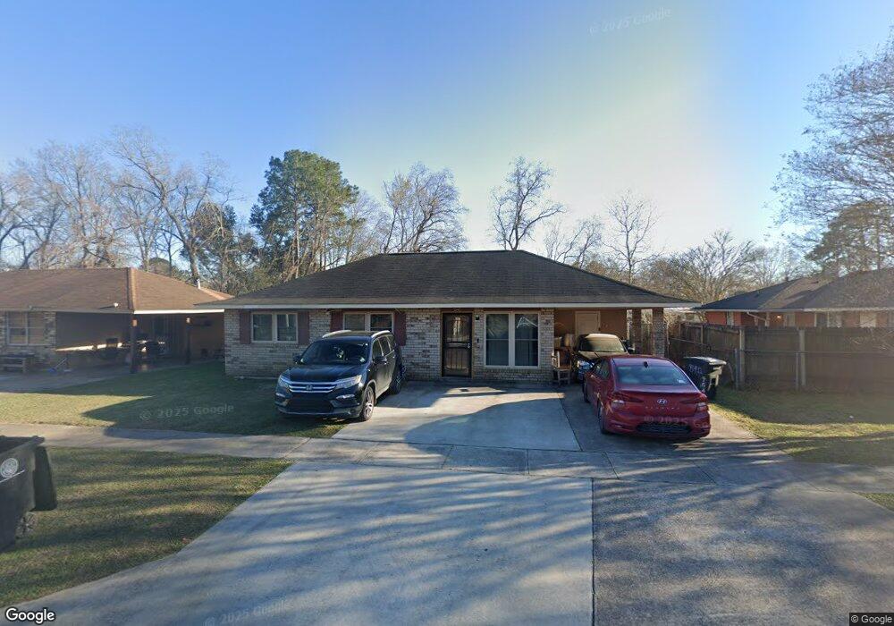
7542 Percy Ave Baton Rouge, LA 70812
Merrydale NeighborhoodEstimated Value: $96,000 - $144,000
3
Beds
2
Baths
1,511
Sq Ft
$84/Sq Ft
Est. Value
About This Home
This home is located at 7542 Percy Ave, Baton Rouge, LA 70812 and is currently estimated at $126,449, approximately $83 per square foot. 7542 Percy Ave is a home located in East Baton Rouge Parish with nearby schools including Merrydale Elementary School, Glen Oaks Senior High School, and Celerity Lanier Charter School.
Ownership History
Date
Name
Owned For
Owner Type
Purchase Details
Closed on
Jun 25, 2001
Sold by
Collins Robert C and Collins Caroline A
Bought by
Collins Robert C
Current Estimated Value
Purchase Details
Closed on
May 21, 1999
Sold by
Victor L Nealond Nealond James V
Bought by
Collins Robert C and Collins Caroline A
Home Financials for this Owner
Home Financials are based on the most recent Mortgage that was taken out on this home.
Original Mortgage
$58,487
Interest Rate
6.94%
Create a Home Valuation Report for This Property
The Home Valuation Report is an in-depth analysis detailing your home's value as well as a comparison with similar homes in the area
Home Values in the Area
Average Home Value in this Area
Purchase History
| Date | Buyer | Sale Price | Title Company |
|---|---|---|---|
| Collins Robert C | -- | -- | |
| Collins Robert C | $59,000 | -- |
Source: Public Records
Mortgage History
| Date | Status | Borrower | Loan Amount |
|---|---|---|---|
| Previous Owner | Collins Robert C | $58,487 |
Source: Public Records
Tax History Compared to Growth
Tax History
| Year | Tax Paid | Tax Assessment Tax Assessment Total Assessment is a certain percentage of the fair market value that is determined by local assessors to be the total taxable value of land and additions on the property. | Land | Improvement |
|---|---|---|---|---|
| 2024 | $618 | $11,870 | $660 | $11,210 |
| 2023 | $620 | $7,870 | $660 | $7,210 |
| 2022 | $1,104 | $7,870 | $660 | $7,210 |
| 2021 | $1,086 | $7,870 | $660 | $7,210 |
| 2020 | $1,098 | $7,870 | $660 | $7,210 |
| 2019 | $1,033 | $7,150 | $600 | $6,550 |
| 2018 | $1,022 | $7,150 | $600 | $6,550 |
| 2017 | $1,022 | $7,150 | $600 | $6,550 |
| 2016 | $32 | $4,858 | $600 | $4,258 |
| 2015 | $32 | $6,950 | $600 | $6,350 |
| 2014 | $32 | $6,950 | $600 | $6,350 |
| 2013 | -- | $6,950 | $600 | $6,350 |
Source: Public Records
Map
Nearby Homes
- 5723 Hartford Ave
- 7819 Greenwell St
- 5726 Matthews St
- 7655 Hanks Dr
- 5540 Lanier Dr
- 5911 Benson Dr
- 7341 Whitney Dr
- 5965 Denova St
- 6032 Matthews St
- 5837 Denova St
- 7264 Hanks Dr
- 6022 E Fairlane Ct
- 6155 Pontotoc St
- 5854 Wright Dr
- 5233 Satinwood Dr
- 6612 Merrydale Ave
- 6634 Fern Dr
- 6868 Oak Glen Dr
- 4314 Lanier Dr
- 6411 Landis Dr
- 7564 Percy Ave
- 5460 Beth Ann Dr
- 7606 Percy Ave
- 7539 Phebus Dr
- 7571 Phebus Dr
- 7571 Phebus Dr
- 5436 Beth Ann Dr
- 7601 Phebus Dr
- 7545 Percy Ave
- 7618 Percy Ave
- 5439 Beth Ann Dr
- 7561 Percy Ave
- 7613 Phebus Dr
- 5445 Beth Ann Dr
- 7603 Percy Ave
- 5457 Beth Ann Dr
- 5423 Beth Ann Dr
- 7622 Percy Ave
- 5515 Beth Ann Dr
- 5529 Beth Ann Dr