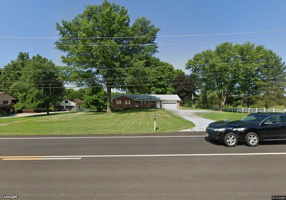
7544 Liberty Rd N Powell, OH 43065
Liberty Township NeighborhoodEstimated Value: $405,000 - $586,000
3
Beds
3
Baths
1,512
Sq Ft
$327/Sq Ft
Est. Value
About This Home
This home is located at 7544 Liberty Rd N, Powell, OH 43065 and is currently estimated at $493,999, approximately $326 per square foot. 7544 Liberty Rd N is a home located in Delaware County with nearby schools including Wyandot Run Elementary School, Olentangy Liberty Middle School, and Olentangy Liberty High School.
Ownership History
Date
Name
Owned For
Owner Type
Purchase Details
Closed on
Aug 2, 2024
Sold by
Mills Patricia A
Bought by
Patricia A Mills 2000 Trust and Mills
Current Estimated Value
Purchase Details
Closed on
Jul 6, 2000
Sold by
Extenkamper Jack L
Bought by
Mills Robert D and Mills Patricia A
Home Financials for this Owner
Home Financials are based on the most recent Mortgage that was taken out on this home.
Original Mortgage
$145,000
Interest Rate
8.35%
Mortgage Type
New Conventional
Create a Home Valuation Report for This Property
The Home Valuation Report is an in-depth analysis detailing your home's value as well as a comparison with similar homes in the area
Home Values in the Area
Average Home Value in this Area
Purchase History
| Date | Buyer | Sale Price | Title Company |
|---|---|---|---|
| Patricia A Mills 2000 Trust | -- | None Listed On Document | |
| Mills Robert D | $214,000 | -- |
Source: Public Records
Mortgage History
| Date | Status | Borrower | Loan Amount |
|---|---|---|---|
| Previous Owner | Mills Robert D | $145,000 |
Source: Public Records
Tax History Compared to Growth
Tax History
| Year | Tax Paid | Tax Assessment Tax Assessment Total Assessment is a certain percentage of the fair market value that is determined by local assessors to be the total taxable value of land and additions on the property. | Land | Improvement |
|---|---|---|---|---|
| 2024 | $5,737 | $119,210 | $45,850 | $73,360 |
| 2023 | $5,793 | $119,210 | $45,850 | $73,360 |
| 2022 | $6,061 | $100,030 | $41,090 | $58,940 |
| 2021 | $6,098 | $100,030 | $41,090 | $58,940 |
| 2020 | $6,127 | $100,030 | $41,090 | $58,940 |
| 2019 | $4,940 | $85,470 | $34,230 | $51,240 |
| 2018 | $4,963 | $85,470 | $34,230 | $51,240 |
| 2017 | $4,734 | $81,910 | $25,940 | $55,970 |
| 2016 | $5,037 | $81,910 | $25,940 | $55,970 |
| 2015 | $4,556 | $81,910 | $25,940 | $55,970 |
| 2014 | $4,619 | $81,910 | $25,940 | $55,970 |
| 2013 | $5,290 | $81,910 | $25,940 | $55,970 |
Source: Public Records
Map
Nearby Homes
- 0 Home Rd Unit 224041180
- 2377 Home Rd
- 7495 Bridlespur Ln
- 2596 Hackney Ct
- Lexington Plan at Carriage Farms
- Overbrooke Plan at Carriage Farms
- Gainsway Plan at Carriage Farms
- Clayborne Plan at Carriage Farms
- Edisto Plan at Carriage Farms
- Callie Plan at Carriage Farms
- Carmen Plan at Carriage Farms
- 3150 Rutherford Rd
- 3296 Home Rd
- 3402 Winding Woods Dr
- 46 Watson Way
- 3143 Rossmore Cir
- 8021 Hillingdon Dr
- 3717 Hickory Field Ln
- 7030 Kinsale Ln
- 8347 Dunnbury Cir
- 7560 Liberty Rd N
- 7580 Liberty Rd N
- 7533 Liberty Rd N
- 7428 Liberty Reserve Place
- 2505 Wildcat Run Ct
- 7549 Liberty Rd N
- 2548 Dauer Ct
- 7636 Liberty Rd N
- 7424 Martelli Way
- 7541 Liberty Rd N
- 2524 Dauer Ct
- 2549 Dauer Ct
- 7537 Liberty Rd N
- 7545 Liberty Rd N
- 2470 Wildcat Run Ct
- 7674 Liberty Rd N
- 2533 Dauer Ct
- 2507 Dauer Ct
- 2460 Dauer Ct
- 2434 Wildcat Run Ct