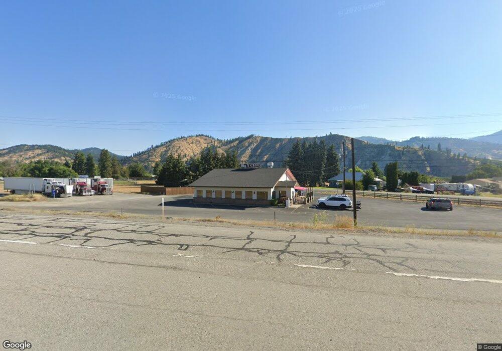
7546 Saunders Rd Peshastin, WA 98847
--
Bed
--
Bath
2,404
Sq Ft
1.98
Acres
About This Home
This home is located at 7546 Saunders Rd, Peshastin, WA 98847. 7546 Saunders Rd is a home located in Chelan County with nearby schools including Cascade High School.
Ownership History
Date
Name
Owned For
Owner Type
Purchase Details
Closed on
Oct 13, 2021
Sold by
Derby Ddd Ii Llc
Bought by
Darlington Daniel
Home Financials for this Owner
Home Financials are based on the most recent Mortgage that was taken out on this home.
Original Mortgage
$50,000
Interest Rate
2.7%
Mortgage Type
Credit Line Revolving
Purchase Details
Closed on
Oct 16, 2015
Sold by
Bristow James and Bristow Elisabeta
Bought by
Derby Ddd Ii Llc
Purchase Details
Closed on
Jun 28, 2007
Sold by
Rayfield Helen G and Yonaka Helen G
Bought by
Bristow James and Bristow Elisabeta
Home Financials for this Owner
Home Financials are based on the most recent Mortgage that was taken out on this home.
Original Mortgage
$600,000
Interest Rate
6.21%
Mortgage Type
Commercial
Create a Home Valuation Report for This Property
The Home Valuation Report is an in-depth analysis detailing your home's value as well as a comparison with similar homes in the area
Home Values in the Area
Average Home Value in this Area
Purchase History
| Date | Buyer | Sale Price | Title Company |
|---|---|---|---|
| Darlington Daniel | -- | None Available | |
| Derby Ddd Ii Llc | -- | None Available | |
| Bristow James | $550,000 | Landamerica Transnation Titl |
Source: Public Records
Mortgage History
| Date | Status | Borrower | Loan Amount |
|---|---|---|---|
| Previous Owner | Derby Ddd Ii Llc | $50,000 | |
| Previous Owner | Bristow James | $600,000 |
Source: Public Records
Tax History Compared to Growth
Tax History
| Year | Tax Paid | Tax Assessment Tax Assessment Total Assessment is a certain percentage of the fair market value that is determined by local assessors to be the total taxable value of land and additions on the property. | Land | Improvement |
|---|---|---|---|---|
| 2021 | $4,632 | $484,537 | $260,053 | $224,484 |
| 2020 | $5,156 | $484,996 | $260,053 | $224,943 |
| 2019 | $5,531 | $493,575 | $260,053 | $233,522 |
| 2018 | $6,094 | $517,751 | $260,053 | $257,698 |
| 2017 | $6,097 | $530,224 | $260,053 | $270,171 |
| 2016 | $4,289 | $563,064 | $260,053 | $303,011 |
| 2015 | $4,289 | $571,888 | $260,053 | $311,835 |
| 2013 | $4,289 | $443,160 | $260,053 | $183,107 |
Source: Public Records
Map
Nearby Homes
- 9291 Pakascwa Rd
- 7569 Us Hwy 97
- 8829 Josephine Ave
- 0 Rollercoaster Rd
- 8010 Green Rd
- 0 Larson Rd Unit NWM2357970
- 8348 Main St Unit 6
- 0 Ludwig Hill Rd Unit NWM2316428
- 80 Still Ln
- 102 Still Ln
- 122 Still Ln
- 0 Olalla Canyon Rd Unit NWM2413511
- 138 Trestle View Ln
- 951 Willems Rd
- 10801 Us Hwy 2
- 9615 North Rd
- 9377 Lone Pine Orchards Rd
- 9753 Nibbelink Rd
- 7905 Mountain Home Rd
- 5721 Mountain Lane Rd
- 7546 Saunders Rd
- 9252 Saunders Rd
- 7577 Saunders Rd
- 7592 Saunders Rd
- 7503 Saunders Rd
- 7545 Saunders Rd
- 9264 Foster Rd
- 7433 Noland Rd
- 7433 Noland Rd
- 39 Amas Place
- 9252 Foster Rd
- 9211 Otis Rd
- 7636 Saunders Rd
- 36 Ama Place
- 9214 Otis Rd
- 9205 Foster Rd
- 7564 Otis Rd
- 9291 Deadman Hill Rd
- 9206 Us Highway 2
- 9491 Noland Rd
