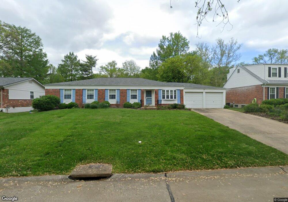
755 Gascogne Dr Saint Louis, MO 63141
Estimated Value: $383,314 - $459,000
4
Beds
2
Baths
2,114
Sq Ft
$202/Sq Ft
Est. Value
About This Home
This home is located at 755 Gascogne Dr, Saint Louis, MO 63141 and is currently estimated at $428,079, approximately $202 per square foot. 755 Gascogne Dr is a home located in St. Louis County with nearby schools including Bellerive Elementary School, Parkway Northeast Middle School, and Parkway North High School.
Ownership History
Date
Name
Owned For
Owner Type
Purchase Details
Closed on
May 10, 2024
Sold by
Robert G Schultz G and Robert Suzanne M
Bought by
Suzanne M Schultz Declaration Of Trust and Schultz
Current Estimated Value
Purchase Details
Closed on
Nov 24, 2014
Sold by
Schultz Robert G and Schultz Suzanne M
Bought by
Schultz Robert G and Schultz Suzanne M
Create a Home Valuation Report for This Property
The Home Valuation Report is an in-depth analysis detailing your home's value as well as a comparison with similar homes in the area
Home Values in the Area
Average Home Value in this Area
Purchase History
| Date | Buyer | Sale Price | Title Company |
|---|---|---|---|
| Suzanne M Schultz Declaration Of Trust | -- | None Listed On Document | |
| Schultz Robert G | -- | None Available | |
| Schultz Robert G | -- | None Available |
Source: Public Records
Tax History Compared to Growth
Tax History
| Year | Tax Paid | Tax Assessment Tax Assessment Total Assessment is a certain percentage of the fair market value that is determined by local assessors to be the total taxable value of land and additions on the property. | Land | Improvement |
|---|---|---|---|---|
| 2025 | $4,023 | $65,380 | $31,120 | $34,260 |
| 2024 | $4,023 | $59,360 | $19,460 | $39,900 |
| 2023 | $3,862 | $59,360 | $19,460 | $39,900 |
| 2022 | $3,952 | $55,370 | $23,350 | $32,020 |
| 2021 | $3,929 | $55,370 | $23,350 | $32,020 |
| 2020 | $3,486 | $47,080 | $17,330 | $29,750 |
| 2019 | $3,412 | $47,080 | $17,330 | $29,750 |
| 2018 | $3,647 | $46,720 | $17,330 | $29,390 |
| 2017 | $3,541 | $46,720 | $17,330 | $29,390 |
| 2016 | $3,029 | $38,340 | $14,480 | $23,860 |
| 2015 | $3,174 | $38,340 | $14,480 | $23,860 |
| 2014 | $2,832 | $36,790 | $10,740 | $26,050 |
Source: Public Records
Map
Nearby Homes
- 809 Aramis Dr
- 770 Montmartre Dr
- 13232 Dartagnan Ct
- 29 Muirfield Ln
- 12910 Chaumont Ct
- 815 Ariege Dr
- 12932 Nimes Dr
- 12936 Bellerive Estates Dr
- 1121 Matador Dr Unit 1
- 1163 Mill Crossing Dr Unit 103
- 12914 Nimes Dr
- 857 Coalport Dr
- 13209 Matador Dr Unit 3
- 13314 Wood Chapel Dr
- 12923 Somerton Ridge Dr
- 12897 Nimes Dr
- 925 Maison Ladue Dr
- 13417 Forestlac Dr
- 13101 Mill Crossing Ct Unit 306
- 13101 Mill Crossing Ct Unit 302
- 759 Gascogne Dr
- 749 Gascogne Dr
- 773 Gascogne Dr
- 758 Aramis Dr
- 752 Aramis Dr
- 741 Gascogne Dr
- 750 Gascogne Dr
- 756 Gascogne Dr
- 746 Aramis Dr
- 781 Gascogne Dr
- 764 Aramis Dr
- 736 Gascogne Dr
- 760 Gascogne Dr
- 738 Aramis Dr
- 733 Gascogne Dr
- 766 Gascogne Dr
- 772 Gascogne Dr
- 787 Gascogne Dr
- 770 Aramis Dr
- 730 Aramis Dr