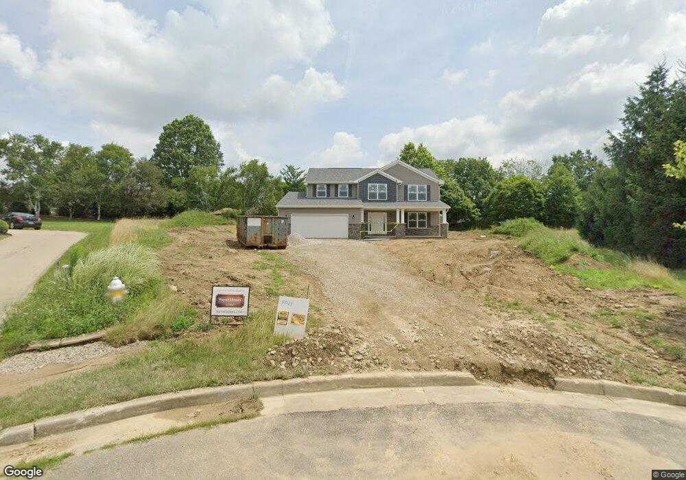
755 Locust Ln Mansfield, OH 44907
Estimated Value: $285,000 - $442,000
3
Beds
3
Baths
2,898
Sq Ft
$128/Sq Ft
Est. Value
About This Home
This home is located at 755 Locust Ln, Mansfield, OH 44907 and is currently estimated at $371,014, approximately $128 per square foot. 755 Locust Ln is a home with nearby schools including Mansfield Christian School, Discovery School, and Mansfield Seventh-day Adventist School.
Ownership History
Date
Name
Owned For
Owner Type
Purchase Details
Closed on
Nov 10, 2018
Sold by
Weaver Jason
Bought by
Weaver Jason and Weaver Kelly
Current Estimated Value
Home Financials for this Owner
Home Financials are based on the most recent Mortgage that was taken out on this home.
Original Mortgage
$220,000
Interest Rate
4.7%
Mortgage Type
New Conventional
Purchase Details
Closed on
Aug 31, 2018
Sold by
Trumpower Scott G and Trumpower Luann J
Bought by
Weaver Jason
Purchase Details
Closed on
Aug 6, 2003
Sold by
West Park Development Inc
Bought by
Trumpower Scott G and Trumpower Luann J
Purchase Details
Closed on
Nov 20, 1991
Bought by
Cee Bee Inc
Create a Home Valuation Report for This Property
The Home Valuation Report is an in-depth analysis detailing your home's value as well as a comparison with similar homes in the area
Home Values in the Area
Average Home Value in this Area
Purchase History
| Date | Buyer | Sale Price | Title Company |
|---|---|---|---|
| Weaver Jason | -- | Mckineley Title Agency Inc | |
| Weaver Jason | $29,000 | Chicago Title | |
| Trumpower Scott G | $25,000 | -- | |
| Cee Bee Inc | -- | -- |
Source: Public Records
Mortgage History
| Date | Status | Borrower | Loan Amount |
|---|---|---|---|
| Closed | Weaver Jason | $220,000 |
Source: Public Records
Tax History Compared to Growth
Tax History
| Year | Tax Paid | Tax Assessment Tax Assessment Total Assessment is a certain percentage of the fair market value that is determined by local assessors to be the total taxable value of land and additions on the property. | Land | Improvement |
|---|---|---|---|---|
| 2024 | $5,203 | $108,670 | $11,210 | $97,460 |
| 2023 | $5,203 | $108,670 | $11,210 | $97,460 |
| 2022 | $4,533 | $79,350 | $9,350 | $70,000 |
| 2021 | $4,565 | $79,350 | $9,350 | $70,000 |
| 2020 | $4,668 | $79,350 | $9,350 | $70,000 |
| 2019 | $488 | $7,480 | $7,480 | $0 |
| 2018 | $481 | $7,480 | $7,480 | $0 |
| 2017 | $469 | $7,480 | $7,480 | $0 |
| 2016 | $469 | $7,260 | $7,260 | $0 |
| 2015 | $448 | $7,260 | $7,260 | $0 |
| 2014 | $442 | $7,260 | $7,260 | $0 |
| 2012 | $174 | $7,480 | $7,480 | $0 |
Source: Public Records
Map
Nearby Homes
- 1163 Woodland Rd
- 654 Courtwright Blvd
- 240 Whippoorwill Ln Unit 240
- 0 U S Highway 42
- 1009 Woodhill Rd
- 501 Clifton Blvd
- 589 Andover Rd
- 476 Glendale Blvd
- 1201 W Cook Rd
- 1156 Briarwood Rd
- 646 Kennedy Dr
- 1332 Springbrook Dr
- 818 Red Oak Trail
- 823 1 2 Red Oak Trail
- 0 George Ave
- 823 1/2 Red Oak Trail
- 710 Cloverleaf Ct
- 1690 Riva Ridge Dr Unit 1690
- 1696 Riva Ridge Dr
- 655 Woodhill Rd
- 750 Locust Ln
- 1844 Cunning Dr Unit 2
- 765 Locust Ln
- 725 Glendale Blvd
- 1846 Cunning Dr Unit 1
- 1846 Cunning Dr
- 715 Glendale Blvd
- 1855 Chapelwood Blvd
- 1863 Chapelwood Blvd
- 1845 Chapelwood Blvd Unit 7
- 1850 Cunning Dr
- 0 Locust Ln
- 745 Glendale Blvd
- 745 Glendale Blvd
- 0 Cunning Dr
- 730 Glendale Blvd
- 1849 Cunning Dr Unit 1849
- 1835 Chapelwood Blvd
- 718 Glendale Blvd
- 1851 Cunning Dr Unit 1851