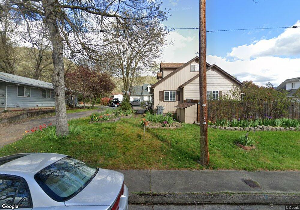
755 NE 12th St Grants Pass, OR 97526
Estimated Value: $307,000 - $332,080
3
Beds
2
Baths
1,358
Sq Ft
$235/Sq Ft
Est. Value
About This Home
This home is located at 755 NE 12th St, Grants Pass, OR 97526 and is currently estimated at $319,540, approximately $235 per square foot. 755 NE 12th St is a home located in Josephine County with nearby schools including Lincoln Elementary School, North Middle School, and Grants Pass High School.
Ownership History
Date
Name
Owned For
Owner Type
Purchase Details
Closed on
Oct 17, 2024
Sold by
Cousland Katy M
Bought by
Katy Marie Cousland Revocable Trust and Cousland
Current Estimated Value
Purchase Details
Closed on
Dec 14, 2011
Sold by
Ryan James H and Ryan Anita L
Bought by
Cousland Katy M
Home Financials for this Owner
Home Financials are based on the most recent Mortgage that was taken out on this home.
Original Mortgage
$100,388
Interest Rate
3.94%
Mortgage Type
FHA
Create a Home Valuation Report for This Property
The Home Valuation Report is an in-depth analysis detailing your home's value as well as a comparison with similar homes in the area
Home Values in the Area
Average Home Value in this Area
Purchase History
| Date | Buyer | Sale Price | Title Company |
|---|---|---|---|
| Katy Marie Cousland Revocable Trust | -- | None Listed On Document | |
| Cousland Katy M | $103,000 | First American |
Source: Public Records
Mortgage History
| Date | Status | Borrower | Loan Amount |
|---|---|---|---|
| Previous Owner | Cousland Katy M | $100,388 |
Source: Public Records
Tax History Compared to Growth
Tax History
| Year | Tax Paid | Tax Assessment Tax Assessment Total Assessment is a certain percentage of the fair market value that is determined by local assessors to be the total taxable value of land and additions on the property. | Land | Improvement |
|---|---|---|---|---|
| 2025 | $1,999 | $153,950 | -- | -- |
| 2024 | $1,999 | $149,470 | -- | -- |
| 2023 | $1,941 | $145,120 | $0 | $0 |
| 2022 | $1,892 | $140,900 | -- | -- |
| 2021 | $1,777 | $136,800 | $0 | $0 |
| 2020 | $1,726 | $132,820 | $0 | $0 |
| 2019 | $1,676 | $128,960 | $0 | $0 |
| 2018 | $1,706 | $125,210 | $0 | $0 |
| 2017 | $1,693 | $121,570 | $0 | $0 |
| 2016 | $1,488 | $118,030 | $0 | $0 |
| 2015 | $1,440 | $114,600 | $0 | $0 |
| 2014 | $1,400 | $111,270 | $0 | $0 |
Source: Public Records
Map
Nearby Homes
- 909 NE 11th St
- 946 NE 12th St
- 918 NE 10th St
- 431 NE Silverwood Place
- 419 NE Silverwood Place
- 425 NE Silverwood Place
- 418 NE 11th St
- 1051 NE Pepperwood Dr
- 409 NE Royal Dr
- 1405 NE Laura Ct
- 1117 NE Memorial Dr
- 715 NE A St
- 702 NE A St
- 811 NE Clyde Place
- 811 NE Clyde Place Unit 116 C
- 1752 NE Foothill Blvd
- 2060 NE Fairview Ave
- 219 NE Outlook Ave
- 1448 NE Jennifer Way
- 1345 NE 9th St
- 753 NE 12th St
- 761 NE 12th St
- 1215 NE Dudley Dr
- 749 NE 12th St
- 751 NE 12th St
- 1216 NE Dudley Dr
- 781 NE 12th St
- 1221 NE Dudley Dr
- 745 NE 12th St
- 1216 Adele Dr
- 760 NE 12th St
- 1220 Adele Dr
- 1220 NE Dudley Dr
- 772 NE 12th St
- 754 NE 12th St
- 806 NE Beacon Dr
- 741 NE 12th St
- 787 NE 12th St
- 780 NE 12th St
- 814 NE Beacon Dr