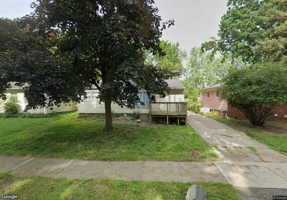
755 Scottwood St Unit Bldg-Unit Pontiac, MI 48340
Estimated Value: $89,000 - $143,000
3
Beds
1
Bath
900
Sq Ft
$138/Sq Ft
Est. Value
About This Home
This home is located at 755 Scottwood St Unit Bldg-Unit, Pontiac, MI 48340 and is currently estimated at $124,233, approximately $138 per square foot. 755 Scottwood St Unit Bldg-Unit is a home located in Oakland County with nearby schools including Herrington Elementary School, Pontiac Middle School, and Pontiac High School.
Ownership History
Date
Name
Owned For
Owner Type
Purchase Details
Closed on
Apr 27, 2018
Sold by
Regnas Properties Llc
Bought by
Holly Nest Llc
Current Estimated Value
Purchase Details
Closed on
Jan 31, 2016
Sold by
Sanger Mark
Bought by
Regnas Properties Llc
Purchase Details
Closed on
Oct 23, 2015
Sold by
The Bank Of New York Mellon
Bought by
Sanger Mark
Purchase Details
Closed on
Jul 14, 2015
Sold by
Sapelak Gary
Bought by
The Bank Of New York Mellon and The Bank Of New York
Purchase Details
Closed on
Aug 12, 1996
Sold by
Davis George E
Bought by
Sapelak Gary
Home Financials for this Owner
Home Financials are based on the most recent Mortgage that was taken out on this home.
Original Mortgage
$48,500
Interest Rate
8.18%
Create a Home Valuation Report for This Property
The Home Valuation Report is an in-depth analysis detailing your home's value as well as a comparison with similar homes in the area
Home Values in the Area
Average Home Value in this Area
Purchase History
| Date | Buyer | Sale Price | Title Company |
|---|---|---|---|
| Holly Nest Llc | -- | Ata National Title Group Llc | |
| Regnas Properties Llc | -- | Attorney | |
| Sanger Mark | $20,500 | Parks Title | |
| The Bank Of New York Mellon | $18,456 | Attorney | |
| Sapelak Gary | $50,000 | -- |
Source: Public Records
Mortgage History
| Date | Status | Borrower | Loan Amount |
|---|---|---|---|
| Previous Owner | Sapelak Gary | $48,500 |
Source: Public Records
Tax History Compared to Growth
Tax History
| Year | Tax Paid | Tax Assessment Tax Assessment Total Assessment is a certain percentage of the fair market value that is determined by local assessors to be the total taxable value of land and additions on the property. | Land | Improvement |
|---|---|---|---|---|
| 2024 | $1,457 | $42,040 | $0 | $0 |
| 2023 | $1,389 | $38,890 | $0 | $0 |
| 2022 | $1,403 | $33,540 | $0 | $0 |
| 2021 | $1,361 | $29,460 | $0 | $0 |
| 2020 | $1,262 | $26,730 | $0 | $0 |
| 2019 | $1,321 | $22,570 | $0 | $0 |
| 2018 | $1,105 | $19,750 | $0 | $0 |
| 2017 | $1,260 | $18,650 | $0 | $0 |
| 2016 | $973 | $16,500 | $0 | $0 |
| 2015 | -- | $14,920 | $0 | $0 |
| 2014 | -- | $14,440 | $0 | $0 |
| 2011 | -- | $26,230 | $0 | $0 |
Source: Public Records
Map
Nearby Homes
- 790 Parkwood Ave
- 821 Robinwood St
- 785 Kenilworth Ave
- 715 Kenilworth Ave
- 644 Brady Ln
- 770 Cameron Ave
- 802 Cameron Ave
- 790 Cameron Ave
- 608 Brady Ln
- 602 Brady Ln
- 597 Brady Ln
- 591 Brady Ln
- 667 Raskob St
- 663 Lenox Ave
- 457 Cameron Ave
- 808 Kettering Ave
- Fairfiled Plan at Fairview Village
- Enclave II Plan at Fairview Village
- Enclave Plan at Fairview Village
- Carlyle Plan at Fairview Village
- 751 Scottwood St
- 761 Scottwood St
- 765 Scottwood St
- 754 Parkwood Ave
- 750 Parkwood Ave
- 741 Scottwood St
- 771 Scottwood St
- 764 Parkwood Ave
- 760 Scottwood St
- 740 Parkwood Ave
- 770 Parkwood Ave
- 764 Scottwood St
- 735 Scottwood St
- 775 Scottwood St
- 750 Scottwood St
- 740 Scottwood St
- 734 Parkwood Ave
- 774 Parkwood Ave
- 774 Scottwood St