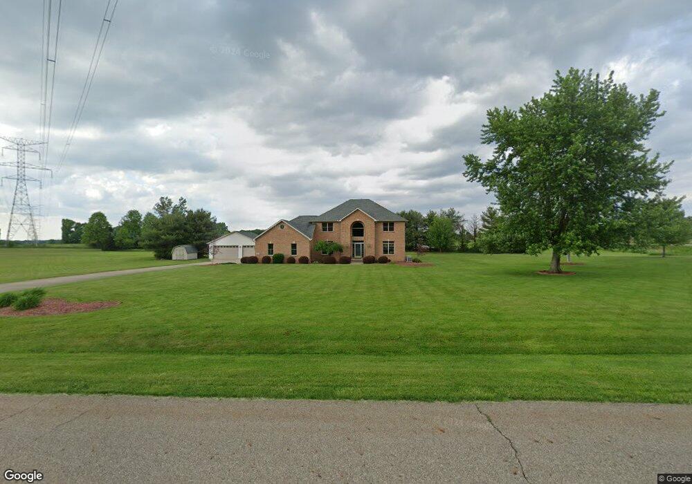
7550 Meadowood Dr Canfield, OH 44406
Estimated Value: $470,246 - $591,000
3
Beds
3
Baths
2,397
Sq Ft
$229/Sq Ft
Est. Value
About This Home
This home is located at 7550 Meadowood Dr, Canfield, OH 44406 and is currently estimated at $547,812, approximately $228 per square foot. 7550 Meadowood Dr is a home located in Mahoning County with nearby schools including Canfield Village Middle School and Canfield High School.
Ownership History
Date
Name
Owned For
Owner Type
Purchase Details
Closed on
Dec 16, 2005
Sold by
Federal Home Loan Mortgage Corporation
Bought by
Hanrahan Richard A and Hanrahan Christine A
Current Estimated Value
Home Financials for this Owner
Home Financials are based on the most recent Mortgage that was taken out on this home.
Original Mortgage
$111,400
Interest Rate
6.34%
Mortgage Type
Fannie Mae Freddie Mac
Purchase Details
Closed on
Nov 4, 2005
Sold by
Rosati Gerald A and Rosati Julia C
Bought by
Federal Home Loan Mortgage Corporation and Abn Amro Mtg Group Inc
Home Financials for this Owner
Home Financials are based on the most recent Mortgage that was taken out on this home.
Original Mortgage
$111,400
Interest Rate
6.34%
Mortgage Type
Fannie Mae Freddie Mac
Purchase Details
Closed on
Mar 7, 1990
Bought by
P F S H Associates
Create a Home Valuation Report for This Property
The Home Valuation Report is an in-depth analysis detailing your home's value as well as a comparison with similar homes in the area
Home Values in the Area
Average Home Value in this Area
Purchase History
| Date | Buyer | Sale Price | Title Company |
|---|---|---|---|
| Hanrahan Richard A | -- | None Available | |
| Federal Home Loan Mortgage Corporation | $250,000 | None Available | |
| P F S H Associates | -- | -- |
Source: Public Records
Mortgage History
| Date | Status | Borrower | Loan Amount |
|---|---|---|---|
| Previous Owner | Hanrahan Richard A | $111,400 |
Source: Public Records
Tax History Compared to Growth
Tax History
| Year | Tax Paid | Tax Assessment Tax Assessment Total Assessment is a certain percentage of the fair market value that is determined by local assessors to be the total taxable value of land and additions on the property. | Land | Improvement |
|---|---|---|---|---|
| 2024 | $5,399 | $132,360 | $17,500 | $114,860 |
| 2023 | $4,944 | $132,360 | $17,500 | $114,860 |
| 2022 | $5,286 | $105,300 | $17,500 | $87,800 |
| 2021 | $5,121 | $105,300 | $17,500 | $87,800 |
| 2020 | $5,143 | $105,300 | $17,500 | $87,800 |
| 2019 | $4,878 | $90,060 | $17,500 | $72,560 |
| 2018 | $4,739 | $90,060 | $17,500 | $72,560 |
| 2017 | $4,776 | $90,060 | $17,500 | $72,560 |
| 2016 | $4,815 | $87,190 | $17,500 | $69,690 |
| 2015 | $4,709 | $87,190 | $17,500 | $69,690 |
| 2014 | $4,728 | $87,190 | $17,500 | $69,690 |
| 2013 | $4,556 | $87,190 | $17,500 | $69,690 |
Source: Public Records
Map
Nearby Homes
- 8000 Briarwood Ct Unit 22
- 8015 Briarwood Ct Unit 6
- 7850 Meadowood Dr
- 8020 Briarwood Ct
- 8475 Youngstown - Salem Rd
- 8075 Meadowood Dr
- 8131 Leffingwell Rd
- 8068 Maplevale Dr
- 6695 Leffingwell Rd
- 6605 Covington Cove
- 7518 Youngstown Salem Rd
- 6020 (LOT #39) Century Blvd
- 18 Hunters Woods Blvd Unit C
- 7120 (LOT #32) S Palmyra Rd
- 6080 (LOT 44) Century Blvd
- 6090 Century Blvd
- 6135 (LOT #65) Century Blvd
- 6025 (LOT #54) Century Blvd
- 6120 Century Blvd
- 7060 (LOT #29) S Palmyra Rd
- 8524 Youngstown Salem Rd
- 7575 Meadowood Dr
- 8400 Youngstown Salem Rd
- 7600 Meadowood Dr
- 7625 Meadowood Dr
- 7650 Meadowood Dr
- 7725 Meadowood Dr
- 7717 Lydia Ln
- 7765 Lydia Ln Unit 1
- 7665 Lydia Ln
- 7700 Meadowood Dr
- 8556 Youngstown Salem Rd
- 7795 Lydia Ln Unit 1
- 7795 Lydia Ln
- 7655 Lydia Ln
- 7760 Lydia Ln
- 8575 Youngstown Salem Rd
- 7775 Meadowood Dr
- 7780 Lydia Ln Unit 1
- 7780 Lydia Ln