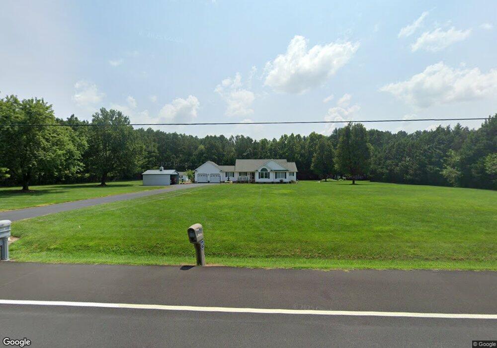
7553 Harmony Rd Preston, MD 21655
Estimated Value: $370,009 - $443,000
Studio
2
Baths
1,731
Sq Ft
$237/Sq Ft
Est. Value
About This Home
This home is located at 7553 Harmony Rd, Preston, MD 21655 and is currently estimated at $410,502, approximately $237 per square foot. 7553 Harmony Rd is a home located in Caroline County with nearby schools including Preston Elementary School, Colonel Richardson Middle School, and Colonel Richardson High School.
Ownership History
Date
Name
Owned For
Owner Type
Purchase Details
Closed on
Aug 12, 1997
Sold by
Mowbray Thomas H and Mowbray Deborah A
Bought by
Dolby Gary D and Dolby Janet M
Current Estimated Value
Purchase Details
Closed on
Nov 18, 1993
Sold by
Little Joseph W and Little Barbara J
Bought by
Mowbray Thomas H and Mowbray Deborah A
Home Financials for this Owner
Home Financials are based on the most recent Mortgage that was taken out on this home.
Original Mortgage
$20,000
Interest Rate
7.12%
Create a Home Valuation Report for This Property
The Home Valuation Report is an in-depth analysis detailing your home's value as well as a comparison with similar homes in the area
Home Values in the Area
Average Home Value in this Area
Purchase History
| Date | Buyer | Sale Price | Title Company |
|---|---|---|---|
| Dolby Gary D | $26,000 | -- | |
| Mowbray Thomas H | $25,000 | -- |
Source: Public Records
Mortgage History
| Date | Status | Borrower | Loan Amount |
|---|---|---|---|
| Previous Owner | Mowbray Thomas H | $20,000 | |
| Closed | Dolby Gary D | -- |
Source: Public Records
Tax History Compared to Growth
Tax History
| Year | Tax Paid | Tax Assessment Tax Assessment Total Assessment is a certain percentage of the fair market value that is determined by local assessors to be the total taxable value of land and additions on the property. | Land | Improvement |
|---|---|---|---|---|
| 2025 | $3,316 | $304,500 | $69,500 | $235,000 |
| 2024 | $3,159 | $288,633 | $0 | $0 |
| 2023 | $3,009 | $272,767 | $0 | $0 |
| 2022 | $2,865 | $256,900 | $69,500 | $187,400 |
| 2021 | $2,678 | $248,300 | $0 | $0 |
| 2020 | $2,678 | $239,700 | $0 | $0 |
| 2019 | $2,584 | $231,100 | $63,500 | $167,600 |
| 2018 | $2,550 | $228,033 | $0 | $0 |
| 2017 | $2,517 | $224,967 | $0 | $0 |
| 2016 | -- | $221,900 | $0 | $0 |
| 2015 | $2,282 | $221,900 | $0 | $0 |
| 2014 | $2,282 | $221,900 | $0 | $0 |
Source: Public Records
Map
Nearby Homes
- 24383 Robins Creek Rd
- 8548 Dogwood Blossom Ln
- 7904 Clark Rd
- 24749 Woods Dr
- 24899 Woods Dr
- 7929 Laurel Ln
- 24800 Pealiquor Rd
- 6401 Laurel Grove Rd
- 23296 Wilder Way
- 0 Laurel Ln
- 0 Asbury Dr
- 24324 Asbury Dr
- 24276 Asbury Dr
- 8578 Tuckahoe Rd
- 33293 Matthewstown Rd
- 0 Shore Highway-404 Unit MDCM2004050
- 25749 Herring Ln
- 1111 Trice Meadows Cir
- 1302 Trice Meadows Cir
- 25699 Auction Rd
- 7558 American Corner Rd
- 7560 Harmony Rd
- 7552 Harmony Rd
- 7549 Harmony Rd
- 7573 Harmony Rd
- 7530 Harmony Rd
- 7620 2 Johns Rd
- 7489 Harmony Rd
- 7644 2 Johns Rd
- 7522 American Corner Rd
- 7508 Harmony Rd
- 7660 2 Johns Rd
- 7471 Harmony Rd
- 7670 Sarabee Dr
- 7670 2 Johns Rd
- 7680 2 Johns Rd
- 7480 Harmony Rd
- 7459 Harmony Rd
- 7696 2 Johns Rd
- 7465 Harmony Rd
