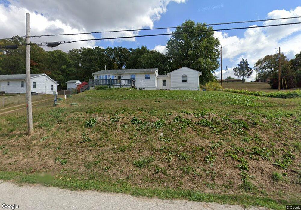
7554 Us Highway 61/67 Barnhart, MO 63012
Estimated Value: $163,000 - $205,000
4
Beds
--
Bath
936
Sq Ft
$186/Sq Ft
Est. Value
About This Home
This home is located at 7554 Us Highway 61/67, Barnhart, MO 63012 and is currently estimated at $174,259, approximately $186 per square foot. 7554 Us Highway 61/67 is a home located in Jefferson County with nearby schools including Windsor High School and St. Joseph Catholic School.
Ownership History
Date
Name
Owned For
Owner Type
Purchase Details
Closed on
Sep 30, 2010
Sold by
Hearst Emmet and Hearst Donna Rose
Bought by
Limesand Craig M and Limesand Mackenzie L
Current Estimated Value
Home Financials for this Owner
Home Financials are based on the most recent Mortgage that was taken out on this home.
Original Mortgage
$75,050
Outstanding Balance
$569
Interest Rate
4.42%
Mortgage Type
New Conventional
Estimated Equity
$173,690
Create a Home Valuation Report for This Property
The Home Valuation Report is an in-depth analysis detailing your home's value as well as a comparison with similar homes in the area
Home Values in the Area
Average Home Value in this Area
Purchase History
| Date | Buyer | Sale Price | Title Company |
|---|---|---|---|
| Limesand Craig M | -- | Investors Title Company |
Source: Public Records
Mortgage History
| Date | Status | Borrower | Loan Amount |
|---|---|---|---|
| Open | Limesand Craig M | $75,050 |
Source: Public Records
Tax History Compared to Growth
Tax History
| Year | Tax Paid | Tax Assessment Tax Assessment Total Assessment is a certain percentage of the fair market value that is determined by local assessors to be the total taxable value of land and additions on the property. | Land | Improvement |
|---|---|---|---|---|
| 2025 | $1,071 | $15,100 | $1,900 | $13,200 |
| 2024 | $1,071 | $14,000 | $1,900 | $12,100 |
| 2023 | $1,071 | $14,000 | $1,900 | $12,100 |
| 2022 | $1,064 | $14,000 | $1,900 | $12,100 |
| 2021 | $1,064 | $14,000 | $1,900 | $12,100 |
| 2020 | $975 | $12,600 | $1,700 | $10,900 |
| 2019 | $978 | $12,600 | $1,700 | $10,900 |
| 2018 | $966 | $12,600 | $1,700 | $10,900 |
| 2017 | $931 | $12,600 | $1,700 | $10,900 |
| 2016 | $778 | $11,300 | $1,700 | $9,600 |
| 2015 | $777 | $11,300 | $1,700 | $9,600 |
| 2013 | -- | $10,300 | $1,600 | $8,700 |
Source: Public Records
Map
Nearby Homes
- 1670 Clover Ct
- 1022 Graystone Park
- 7255 Meriwether Ct
- 1728 Fairfax Dr
- 7098 Ridge Dr
- 7062 Tuckahoe Ct
- 7056 Albermarle Ct
- 7009 Albermarle Ct
- 7013 Wayles Dr
- 2030 Engle Ridge Rd
- 7075 Metropolitan Blvd
- 900 Bluff Rd
- 2090 Birchwood Dr
- 2000 Lot 10 Crossroads Rd
- 2000 Lot 9 Crossroads Rd
- 2000 Lot 8 Crossroads Rd
- 2000 Lot 7 Crossroads Rd
- 2000 Lot 6 Crossroads Rd
- 2000 Lot 5 Crossroads Rd
- 2000 Lot 4 Crossroads Rd
- 7550 Us Highway 61 67
- 7596 Us Hwy 61
- 7594 U S 61
- 7594 Us Highway 61/67
- 7594 Us Highway 61 67
- 7585 Us Highway 61/67
- 7598 Us Highway 61/67
- 1415 Wild Rose Dr
- 1406 Mulberry Hill Rd
- 0 Wild Rose Unit 17045294
- 1404 Mulberry Hill Rd
- 7596 Us Highway 61/67
- 1451 Stoneridge Ct
- 1400 Wild Rose Dr
- 1390 Mulberry Hill Rd
- 1458 Stoneridge Ct
- 7600 Us Highway 61 67
- 1471 Stoneridge Ct
- 7495 Engleport Rd
- 1470 Stoneridge Ct