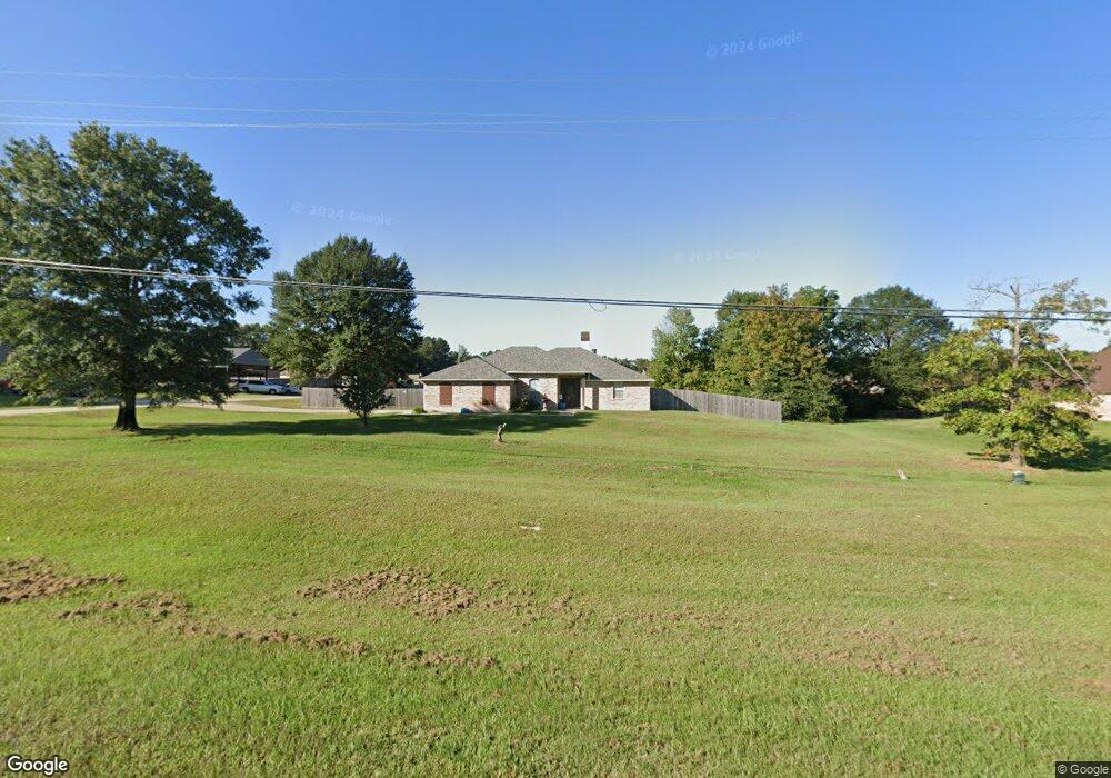
7555 Highway 1 Shreveport, LA 71107
Estimated Value: $241,000 - $254,000
3
Beds
2
Baths
1,669
Sq Ft
$149/Sq Ft
Est. Value
About This Home
This home is located at 7555 Highway 1, Shreveport, LA 71107 and is currently estimated at $248,854, approximately $149 per square foot. 7555 Highway 1 is a home located in Caddo Parish with nearby schools including Mooringsport Elementary School, Judson Fundamental Elementary School, and Fairfield Magnet School.
Ownership History
Date
Name
Owned For
Owner Type
Purchase Details
Closed on
Aug 23, 2007
Sold by
E & Development Inc
Bought by
Fletcher Amy K
Current Estimated Value
Home Financials for this Owner
Home Financials are based on the most recent Mortgage that was taken out on this home.
Original Mortgage
$143,910
Outstanding Balance
$91,256
Interest Rate
6.69%
Mortgage Type
Unknown
Estimated Equity
$157,598
Create a Home Valuation Report for This Property
The Home Valuation Report is an in-depth analysis detailing your home's value as well as a comparison with similar homes in the area
Home Values in the Area
Average Home Value in this Area
Purchase History
| Date | Buyer | Sale Price | Title Company |
|---|---|---|---|
| Fletcher Amy K | $159,900 | None Available |
Source: Public Records
Mortgage History
| Date | Status | Borrower | Loan Amount |
|---|---|---|---|
| Open | Fletcher Amy K | $143,910 |
Source: Public Records
Tax History Compared to Growth
Tax History
| Year | Tax Paid | Tax Assessment Tax Assessment Total Assessment is a certain percentage of the fair market value that is determined by local assessors to be the total taxable value of land and additions on the property. | Land | Improvement |
|---|---|---|---|---|
| 2024 | $2,773 | $17,523 | $4,190 | $13,333 |
| 2023 | $2,635 | $16,203 | $3,990 | $12,213 |
| 2022 | $2,635 | $16,203 | $3,990 | $12,213 |
| 2021 | $2,637 | $16,203 | $3,990 | $12,213 |
| 2020 | $2,637 | $16,203 | $3,990 | $12,213 |
| 2019 | $2,580 | $15,971 | $3,990 | $11,981 |
| 2018 | $1,310 | $15,971 | $3,990 | $11,981 |
| 2017 | $2,548 | $15,971 | $3,990 | $11,981 |
| 2015 | $1,383 | $16,320 | $3,990 | $12,330 |
| 2014 | $1,391 | $16,320 | $3,990 | $12,330 |
| 2013 | -- | $16,320 | $3,990 | $12,330 |
Source: Public Records
Map
Nearby Homes
- 6964 Emerald Bay Loop
- 6980 Regatta Dr
- 00 Highway 1
- 0 Morrow Rd
- 6186 Pine Tree Loop
- 6948 N Colony Dr
- 5589 Grace Ann Ln
- 0 Mirkwood Unit 97 20698306
- 0 Mirkwood Unit 96 20698300
- 0 Mirkwood Unit 94 20698275
- 5577 Crystal Dr
- 29 W Henderson Gin Rd
- 7478 Henderson Gin Rd
- 6845 Highway 1
- 009 Castle Dale Loop
- 2257 Soda Lake Cir
- 8050 Highway 1
- 4820 Bogey Ln
- 8340 Old Mooringsport Rd
- 7415 Henderson Gin Rd
- 7565 Highway 1
- 7545 Highway 1
- 7035 Emerald Bay Loop
- 7029 Emerald Bay Loop
- 7025 Emerald Bay Loop
- 6885 Emerald Bay Loop
- 7575 Highway 1
- 6889 Emerald Bay Loop
- 7021 Emerald Bay Loop
- 7535 Highway 1
- 7017 Emerald Bay Loop
- 6893 Emerald Bay Loop
- 7012 Emerald Bay Loop
- 7585 Highway 1
- 7013 Emerald Bay Loop
- 7515 Highway 1
- 6914 Emerald Bay Loop
- 6910 Emerald Bay Loop
- 6897 Emerald Bay Loop
- 6901 Emerald Bay Loop