Estimated Value: $316,000 - $417,000
2
Beds
2
Baths
1,202
Sq Ft
$295/Sq Ft
Est. Value
About This Home
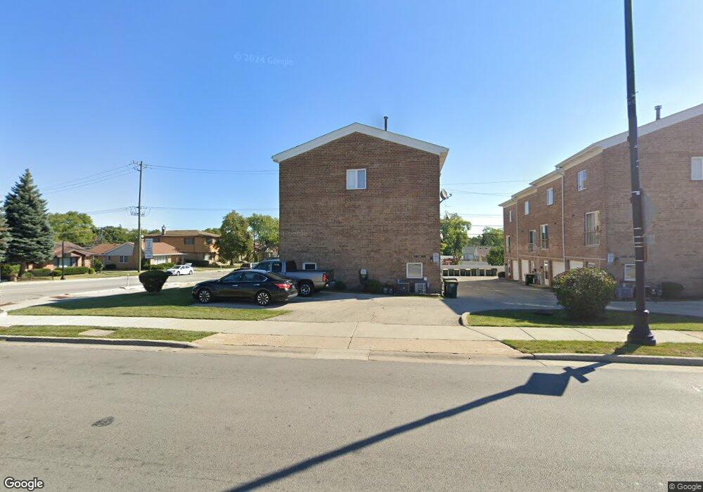
This home is located at 7557 N Waukegan Rd, Niles, IL 60714 and is currently estimated at $354,553, approximately $294 per square foot. 7557 N Waukegan Rd is a home located in Cook County with nearby schools including Clarence E Culver School, Niles West High School, and Logos Christian Academy.
Ownership History
Date
Name
Owned For
Owner Type
Purchase Details
Closed on
Jul 21, 2006
Sold by
Gahbauer Martin A
Bought by
Paungsombat Chatchai and Sirirak Patcharin
Current Estimated Value
Home Financials for this Owner
Home Financials are based on the most recent Mortgage that was taken out on this home.
Original Mortgage
$249,475
Outstanding Balance
$156,895
Interest Rate
7.75%
Mortgage Type
Unknown
Estimated Equity
$197,658
Create a Home Valuation Report for This Property
The Home Valuation Report is an in-depth analysis detailing your home's value as well as a comparison with similar homes in the area
Home Values in the Area
Average Home Value in this Area
Purchase History
| Date | Buyer | Sale Price | Title Company |
|---|---|---|---|
| Paungsombat Chatchai | $293,500 | Multiple |
Source: Public Records
Mortgage History
| Date | Status | Borrower | Loan Amount |
|---|---|---|---|
| Open | Paungsombat Chatchai | $249,475 |
Source: Public Records
Tax History Compared to Growth
Tax History
| Year | Tax Paid | Tax Assessment Tax Assessment Total Assessment is a certain percentage of the fair market value that is determined by local assessors to be the total taxable value of land and additions on the property. | Land | Improvement |
|---|---|---|---|---|
| 2024 | $5,967 | $29,000 | $4,500 | $24,500 |
| 2023 | $5,571 | $29,000 | $4,500 | $24,500 |
| 2022 | $5,571 | $29,000 | $4,500 | $24,500 |
| 2021 | $5,097 | $20,567 | $1,089 | $19,478 |
| 2020 | $4,830 | $20,567 | $1,089 | $19,478 |
| 2019 | $4,831 | $22,853 | $1,089 | $21,764 |
| 2018 | $5,159 | $22,116 | $946 | $21,170 |
| 2017 | $5,278 | $22,116 | $946 | $21,170 |
| 2016 | $4,982 | $22,116 | $946 | $21,170 |
| 2015 | $4,305 | $20,574 | $802 | $19,772 |
| 2014 | $4,183 | $20,574 | $802 | $19,772 |
| 2013 | $4,105 | $20,574 | $802 | $19,772 |
Source: Public Records
Map
Nearby Homes
- 7554 N Waukegan Rd
- 7450 N Waukegan Rd Unit 206
- 7421 N Oconto Ave
- 7753 N Nordica Ave
- 6882 W Touhy Ave Unit D
- 7021 W Touhy Ave Unit 509B
- 7021 W Touhy Ave Unit 207B
- 7091 W Touhy Ave Unit 209
- 7091 W Touhy Ave Unit 505
- 7221 N Octavia Ave
- 7448 W Jonquil Terrace
- 7232 W Oakton St
- 6914 W Oakton Ct
- 6600 W Wood River Dr Unit B201B
- 240 E Sibley St
- 7458 W Touhy Ave
- 7875 N Caldwell Ave Unit 302
- 8049 N Osceola Ave
- 6964 W Cleveland St
- 8206 N Octavia Ave
- 7559 N Waukegan Rd
- 7561 N Waukegan Rd
- 7551 N Waukegan Rd
- 7563 N Waukegan Rd
- 7029 W Howard St
- 7029 W Howard St
- 7553 N Waukegan Rd
- 7555 N Waukegan Rd
- 7549 N Waukegan Rd
- 7025 W Howard St
- 1145 Hadowridge
- 1219
- 1516 Old
- 119 Yngstn-Wrn
- 7036 W Howard St
- 7030 W Howard St
- 7042 W Howard St
- 7026 W Birchwood Ave
- 7019 W Howard St
- 7024 W Howard St