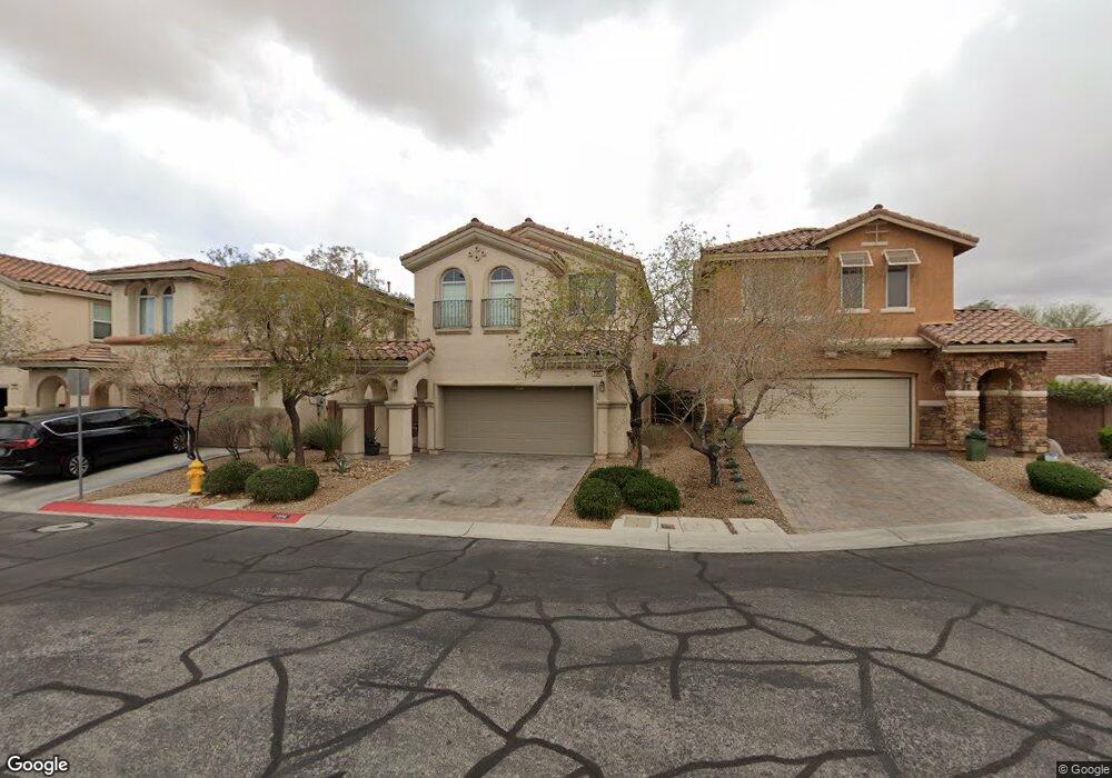
7559 Dobroyd Dr Las Vegas, NV 89179
Mountains Edge NeighborhoodEstimated Value: $427,000 - $457,000
3
Beds
3
Baths
1,775
Sq Ft
$251/Sq Ft
Est. Value
About This Home
This home is located at 7559 Dobroyd Dr, Las Vegas, NV 89179 and is currently estimated at $445,111, approximately $250 per square foot. 7559 Dobroyd Dr is a home located in Clark County with nearby schools including Jones Blackhurst Elementary School, Desert Oasis High School, and Doral Academy Cactus.
Ownership History
Date
Name
Owned For
Owner Type
Purchase Details
Closed on
Sep 21, 2012
Sold by
Smith Thomas G and Schamp Nicole E
Bought by
Smith Ii Thomas G and Smith Nicole Elizabeth
Current Estimated Value
Home Financials for this Owner
Home Financials are based on the most recent Mortgage that was taken out on this home.
Original Mortgage
$218,221
Outstanding Balance
$152,275
Interest Rate
3.75%
Mortgage Type
FHA
Estimated Equity
$292,836
Purchase Details
Closed on
Sep 30, 2008
Sold by
Beazer Homes Holdings Corp
Bought by
Smith Ii Thomas G and Schamp Nicole E
Home Financials for this Owner
Home Financials are based on the most recent Mortgage that was taken out on this home.
Original Mortgage
$235,932
Interest Rate
6.39%
Mortgage Type
FHA
Create a Home Valuation Report for This Property
The Home Valuation Report is an in-depth analysis detailing your home's value as well as a comparison with similar homes in the area
Home Values in the Area
Average Home Value in this Area
Purchase History
| Date | Buyer | Sale Price | Title Company |
|---|---|---|---|
| Smith Ii Thomas G | -- | None Available | |
| Smith Ii Thomas G | $239,636 | First American Title Centra |
Source: Public Records
Mortgage History
| Date | Status | Borrower | Loan Amount |
|---|---|---|---|
| Open | Smith Ii Thomas G | $218,221 | |
| Closed | Smith Ii Thomas G | $235,932 |
Source: Public Records
Tax History Compared to Growth
Tax History
| Year | Tax Paid | Tax Assessment Tax Assessment Total Assessment is a certain percentage of the fair market value that is determined by local assessors to be the total taxable value of land and additions on the property. | Land | Improvement |
|---|---|---|---|---|
| 2025 | $2,131 | $117,866 | $36,750 | $81,116 |
| 2024 | $2,070 | $117,866 | $36,750 | $81,116 |
| 2023 | $1,584 | $109,277 | $33,250 | $76,027 |
| 2022 | $2,273 | $97,461 | $28,000 | $69,461 |
| 2021 | $2,046 | $91,972 | $26,250 | $65,722 |
| 2020 | $1,891 | $90,176 | $25,200 | $64,976 |
| 2019 | $1,773 | $86,247 | $22,400 | $63,847 |
| 2018 | $1,691 | $79,297 | $18,200 | $61,097 |
| 2017 | $2,197 | $74,899 | $16,800 | $58,099 |
| 2016 | $1,584 | $68,145 | $14,350 | $53,795 |
| 2015 | $1,580 | $55,429 | $11,900 | $43,529 |
| 2014 | $1,531 | $50,646 | $5,600 | $45,046 |
Source: Public Records
Map
Nearby Homes
- 11068 Hunting Hawk Rd
- 7635 Tierra Montanosa Ave
- 11002 Elk Sands Rd
- 7562 Morisset Ave
- 7612 Kit Carson Ave
- 7622 Kit Carson Ave
- 7725 Canyon Diablo Rd
- 7440 Earnshaw Ave
- 10856 Casco Bay St
- 7428 Alamo Ranch Ave
- 7357 Palo Real Ct
- 0 W Erie Ave
- 7761 Sagamore Bay Ct
- 7286 Caballo Range Ave
- 7722 Sagamore Bay Ct
- 7497 Dequon Bay Ct
- 10795 Yarmouth Bay Ct
- 10751 Centerville Bay Ct
- 10739 Centerville Bay Ct
- 11238 Meadow Cove St
- 7553 Dobroyd Dr
- 7565 Dobroyd Dr
- 7547 Dobroyd Dr
- 7571 Dobroyd Dr
- 7541 Dobroyd Dr
- 11107 Carlin Farms St
- 7535 Dobroyd Dr
- 7558 Dobroyd Dr
- 7564 Dobroyd Dr
- 7552 Dobroyd Dr
- 7570 Dobroyd Dr
- 7546 Dobroyd Dr
- 7529 Dobroyd Dr
- 7574 Dobroyd Dr
- 11092 Hunting Hawk Rd
- 7540 Dobroyd Dr
- 11115 Carlin Farms St
- 11084 Hunting Hawk Rd
- 7534 Dobroyd Dr
- 7523 Dobroyd Dr