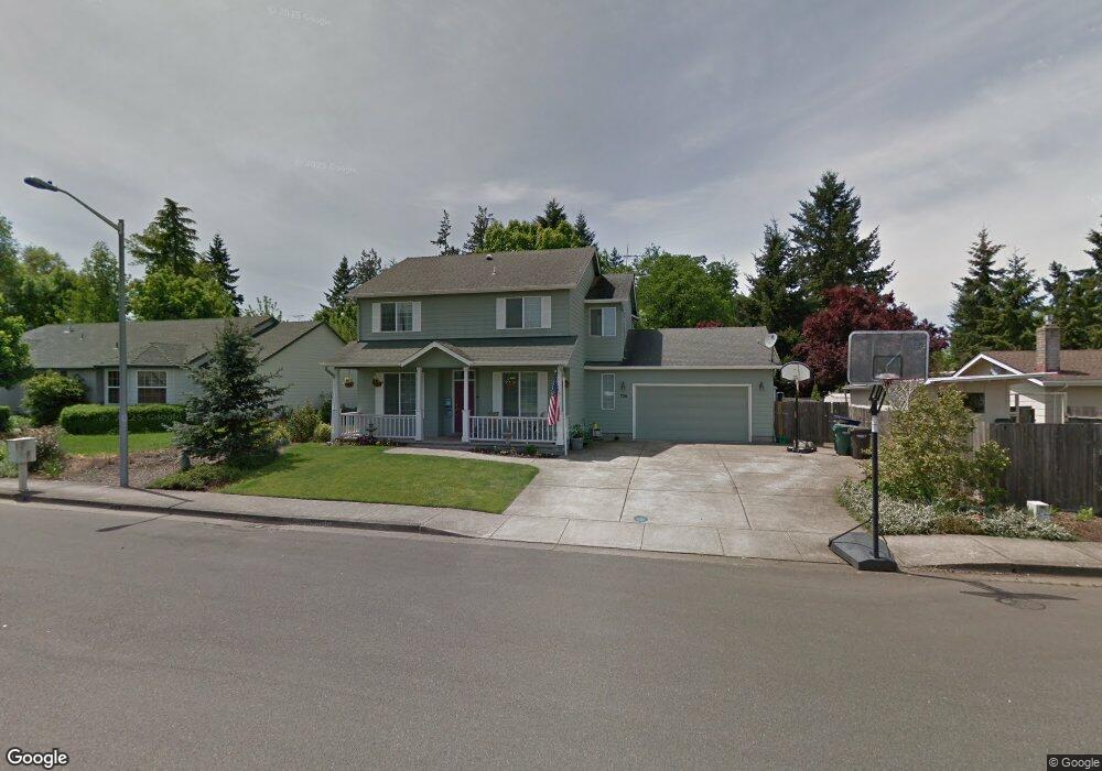
756 Kayla Way N Monmouth, OR 97361
Estimated Value: $509,269 - $537,000
4
Beds
3
Baths
2,045
Sq Ft
$256/Sq Ft
Est. Value
About This Home
This home is located at 756 Kayla Way N, Monmouth, OR 97361 and is currently estimated at $524,317, approximately $256 per square foot. 756 Kayla Way N is a home located in Polk County with nearby schools including Monmouth Elementary School, Talmadge Middle School, and Central High School.
Ownership History
Date
Name
Owned For
Owner Type
Purchase Details
Closed on
Aug 29, 2007
Sold by
Conley Timothy M and Conley Melissa J
Bought by
Rech Anthony Dean and Rech Nancy Lynn
Current Estimated Value
Home Financials for this Owner
Home Financials are based on the most recent Mortgage that was taken out on this home.
Original Mortgage
$220,000
Outstanding Balance
$140,498
Interest Rate
6.74%
Mortgage Type
Purchase Money Mortgage
Estimated Equity
$383,819
Create a Home Valuation Report for This Property
The Home Valuation Report is an in-depth analysis detailing your home's value as well as a comparison with similar homes in the area
Home Values in the Area
Average Home Value in this Area
Purchase History
| Date | Buyer | Sale Price | Title Company |
|---|---|---|---|
| Rech Anthony Dean | $280,000 | Amerititle |
Source: Public Records
Mortgage History
| Date | Status | Borrower | Loan Amount |
|---|---|---|---|
| Open | Rech Anthony Dean | $220,000 |
Source: Public Records
Tax History Compared to Growth
Tax History
| Year | Tax Paid | Tax Assessment Tax Assessment Total Assessment is a certain percentage of the fair market value that is determined by local assessors to be the total taxable value of land and additions on the property. | Land | Improvement |
|---|---|---|---|---|
| 2025 | $4,397 | $265,040 | $53,880 | $211,160 |
| 2024 | $4,397 | $257,330 | $52,310 | $205,020 |
| 2023 | $4,578 | $249,840 | $50,790 | $199,050 |
| 2022 | $4,122 | $242,570 | $49,310 | $193,260 |
| 2021 | $4,075 | $235,510 | $47,870 | $187,640 |
| 2020 | $3,914 | $228,660 | $46,480 | $182,180 |
| 2019 | $3,799 | $222,000 | $45,120 | $176,880 |
| 2018 | $3,669 | $215,540 | $43,810 | $171,730 |
| 2017 | $3,649 | $209,270 | $42,540 | $166,730 |
| 2016 | $3,726 | $203,180 | $41,300 | $161,880 |
| 2015 | $3,563 | $197,270 | $40,090 | $157,180 |
| 2014 | $3,469 | $191,530 | $38,920 | $152,610 |
Source: Public Records
Map
Nearby Homes
- 751 Catron St N
- 0 Catron St N
- 1329 Price Ln E
- 141 S 17th St Unit 61 St
- 141 S 17th St Unit 70 St
- 141 17th (#7) St S Unit 7
- 858 Main St E
- 101 Edwards Rd S Unit 10-B Rd S
- 151 Edwards (#46) Rd S Unit 46
- 151 S Edwards (151) Rd
- 184 Willow Way E
- 235 Edwards (#104) Rd S Unit 104
- 9650 Hoffman Rd
- Lot 1600 S 16th St
- 309 Atwater St S
- 277 Edwards Rd S
- 277 Edwards Rd S Unit 133
- 191 Catron St S
- 348 Main St E
- 355 Jacobson Ct S
- 748 Kayla Way N
- 1033 Olive Way E
- 763 Caroline Way N
- 733 Caroline Way N
- 793 Caroline Way N
- 1163 Lori Ln E
- 787 Kayla Way N
- 703 Caroline Way N
- 1181 Lori Ln E
- 799 Kayla Way N
- 1160 Mickey Ln E
- 698 Kayla Way N
- 1198 Lori Ln E
- 1030 Olive Way E
- 1000 Olive Way E
- 762 Caroline Way N
- 1188 Mickey Ln E
- 792 Caroline Way N
- 1209 Lori Ln E
- 1210 Lori Ln E