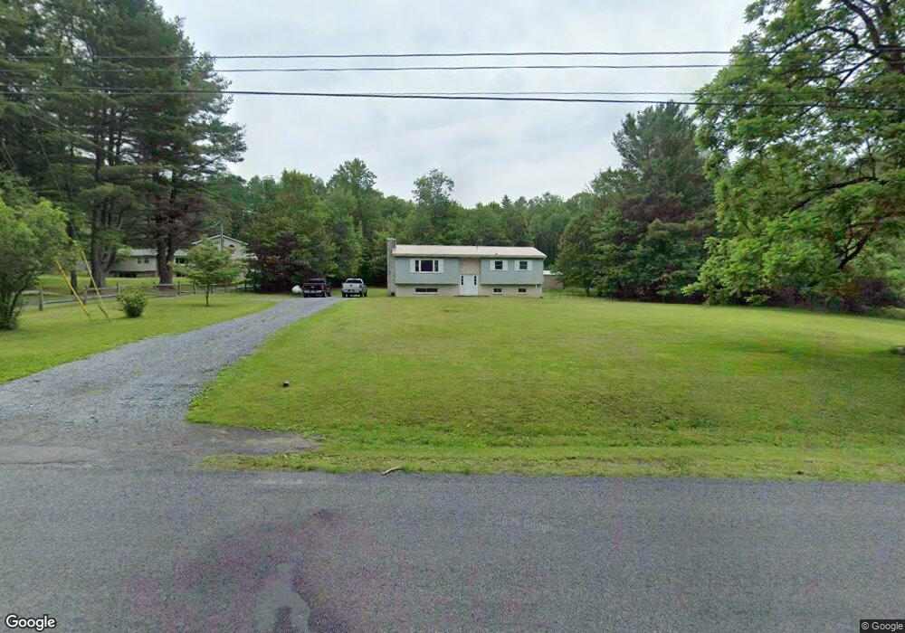
756 Spruce Rd Clarence, PA 16829
Snow Shoe NeighborhoodEstimated Value: $205,000 - $242,000
3
Beds
2
Baths
1,822
Sq Ft
$125/Sq Ft
Est. Value
About This Home
This home is located at 756 Spruce Rd, Clarence, PA 16829 and is currently estimated at $227,568, approximately $124 per square foot. 756 Spruce Rd is a home located in Centre County with nearby schools including Bald Eagle Area Junior/Senior High School.
Ownership History
Date
Name
Owned For
Owner Type
Purchase Details
Closed on
Sep 20, 2016
Sold by
Fye Scott A and Fye Billie Jo
Bought by
Fye Scott A
Current Estimated Value
Home Financials for this Owner
Home Financials are based on the most recent Mortgage that was taken out on this home.
Original Mortgage
$113,500
Outstanding Balance
$52,480
Interest Rate
3.43%
Mortgage Type
New Conventional
Estimated Equity
$175,088
Purchase Details
Closed on
May 28, 1997
Bought by
Fye Scott A and Billie Jo
Create a Home Valuation Report for This Property
The Home Valuation Report is an in-depth analysis detailing your home's value as well as a comparison with similar homes in the area
Home Values in the Area
Average Home Value in this Area
Purchase History
| Date | Buyer | Sale Price | Title Company |
|---|---|---|---|
| Fye Scott A | -- | None Available | |
| Fye Scott A | $75,000 | -- |
Source: Public Records
Mortgage History
| Date | Status | Borrower | Loan Amount |
|---|---|---|---|
| Open | Fye Scott A | $113,500 |
Source: Public Records
Tax History Compared to Growth
Tax History
| Year | Tax Paid | Tax Assessment Tax Assessment Total Assessment is a certain percentage of the fair market value that is determined by local assessors to be the total taxable value of land and additions on the property. | Land | Improvement |
|---|---|---|---|---|
| 2025 | $2,804 | $38,515 | $5,280 | $33,235 |
| 2024 | $2,843 | $38,515 | $5,280 | $33,235 |
| 2023 | $2,843 | $38,515 | $5,280 | $33,235 |
| 2022 | $2,766 | $38,515 | $5,280 | $33,235 |
| 2021 | $2,720 | $38,515 | $5,280 | $33,235 |
| 2020 | $2,720 | $38,515 | $5,280 | $33,235 |
| 2019 | $1,826 | $38,515 | $5,280 | $33,235 |
| 2018 | $2,604 | $38,515 | $5,280 | $33,235 |
| 2017 | $2,456 | $38,515 | $5,280 | $33,235 |
| 2016 | -- | $38,515 | $5,280 | $33,235 |
| 2015 | -- | $38,515 | $5,280 | $33,235 |
| 2014 | -- | $38,515 | $5,280 | $33,235 |
Source: Public Records
Map
Nearby Homes
- 103 Spruce Rd
- 203 Gorton Rd
- 569 Elm Rd
- 1532 Clarence Rd
- 529 Lucas Ridge Rd
- 1176 Clarence Rd
- 0 Moshannon Ave
- 1503 Gorton Rd
- 145 Meadow Dr
- Viehdorfer Road Lot Unit WP001
- 0 Viehdorfer Rd
- 3402 Tunnel Rd
- 293 Snow Shoe Mountain Forest Rd
- 170 Blackberry Rd
- 186 Little Wolf Rd
- 1437 Cooper Ave
- 1178 Cooper Ave
- 111 Fireside Rd
- 0 Pine Glen Rd
- 814 Market St